
Palk Strait: geography, ecology, history, and human use
The Palk Strait is the shallow marine passage between southeastern India and northern Sri Lanka linking the Bay of Bengal with the Palk Bay and Gulf of Mannar, noted for sandbanks, fisheries and ecological significance.
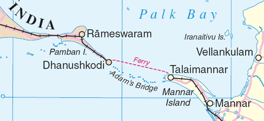
Overview: The Palk Strait is the shallow stretch of sea separating the southeastern coast of Tamil Nadu in India from the Mannar region of the Northern Province in Sri Lanka. It forms a marine link between the northeastern Bay of Bengal and the Palk Bay, which in turn opens into the Gulf of Mannar. The strait averages about 33 to 50 miles (53 to 80 km) across and is characterised by shallow waters and a series of sandbanks and shoals.
Image gallery
6 Images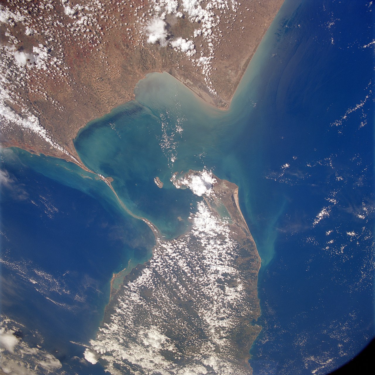


Geography and physical features
The seabed is generally shallow and interspersed with reef patches and calcareous shoals. Notable coastal features include the chain of sandbanks and limestone shoals running roughly parallel to the coasts, sometimes referred to in local tradition as Adam’s Bridge or Rama’s Bridge. Several rivers from Tamil Nadu, including the Vaigai River, discharge into the area, contributing sediments that shape its shallows and islands.
Ecology and economic importance
The Palk Strait and adjacent Gulf of Mannar are biologically productive zones supporting coral reefs, seagrass beds and mangroves. These habitats sustain important fisheries and marine mammals and are central to the livelihoods of coastal communities on both sides. Because of its productivity, the region has attracted conservation attention and research into sustainable fisheries, habitat protection and the impact of coastal development.
History, name and human activity
The strait’s present name commemorates Robert Palk, a colonial governor associated with the Madras area during Company rule; historical administrative ties are often traced to the Madras Presidency. For centuries the waters have served local navigation, fishing and cultural exchanges between the Indian subcontinent and Sri Lanka. Several small ports, fishing harbours and landing sites line the coasts, and traditional craft continue to operate despite modern pressures.
Navigation, projects and modern issues
Shallow depths and sandbanks restrict large commercial shipping, prompting proposals and debates over channel projects to improve navigation. One such idea — often discussed in public and environmental forums — aims to create deeper passages to reduce voyage distances while raising ecological and cultural concerns. Bilateral issues such as fishing rights, maritime boundaries and coastal management remain important for India–Sri Lanka relations.
Key points
- Connects the Bay of Bengal with Palk Bay and Gulf of Mannar.
- Shallow waters, sandbanks and reef patches influence navigation and ecology.
- Supports important fisheries and biodiverse marine habitats.
- Named after Robert Palk and tied historically to the Madras Presidency era.
Readers seeking maps, conservation plans or bilateral agreements can consult regional marine studies and governmental resources for updated technical details and policy developments.
Questions and answers
Q: What is Palk Strait?
A: Palk Strait is a strait that runs between the Tamil Nadu state of India and the Mannar district of the Northern Province of Sri Lanka.
Q: What bodies of water does the Palk Strait connect?
A: The Palk Strait connects the Bay of Bengal in the northeast with the Palk Bay and then with the Gulf of Mannar in the southwest.
Q: How wide is the Palk Strait?
A: The Palk Strait is 33 to 50 miles (53 to 80 km) wide.
Q: Are there any rivers flowing into Palk Strait?
A: Yes, several rivers flow into Palk Strait, including the Vaigai River of Tamil Nadu.
Q: Who is Palk Strait named after?
A: Palk Strait is named after Robert Palk. He was a governor of Madras Presidency (1755-1763) during the Company Raj period.
Q: What is the Company Raj period?
A: The Company Raj period was a period of British rule in India during which the British East India Company effectively ruled the country.
Q: Where is Tamil Nadu located?
A: Tamil Nadu is a state of India that is located in the southern part of the country.
Related articles
Author
AlegsaOnline.com Palk Strait: geography, ecology, history, and human use Leandro Alegsa
URL: https://en.alegsaonline.com/art/74193
Sources
- un.org : Map of Sri Lanka with Palk Strait and Palk Bay
- britannica.com : "Adam's bridge"