North Magnetic Pole
The point in the Northern Hemisphere where Earth's magnetic field points vertically downward; it wanders over time and differs from the geographic North Pole, affecting compass navigation and magnetic models.
Overview
The North Magnetic Pole is the location in the Northern Hemisphere at which the Earth's magnetic field is directed vertically downwards. It is one of two such points on the planet, the counterpart being the South Magnetic Pole. Because the magnetic field near the surface is inclined toward that point, a magnetic compass needle aligns with the field and thus indicates a direction that depends on the pole's position. The North Magnetic Pole is distinct from the geographic North Pole and does not coincide with Earth's axis of rotation.
Image gallery
5 Images

Characteristics
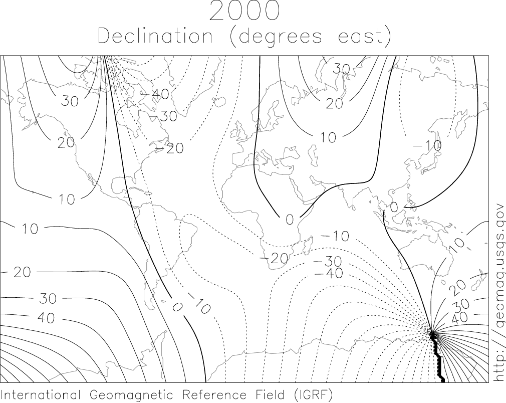
The pole is defined operationally as the place where the magnetic inclination (also called dip) is 90°, meaning the field is vertical. At every other location on Earth the field has some horizontal component that points toward the magnetic pole, which is why compasses generally point "north" but can show an angular difference called magnetic declination. Scientists map the pole by measuring local field direction and intensity, and by using global magnetic models that incorporate data from ground observatories and satellites.
History and Movement
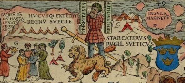
Unlike fixed geographic markers, the North Magnetic Pole wanders due to changes in the flow of molten iron in Earth's outer core. Historically it was located in the high Canadian Arctic and was reached by exploration parties in the 19th and 20th centuries. In the early 2000s field teams and surveys estimated it near Ellesmere Island, but continued observations show the pole moving eastward and northward toward the Arctic Ocean and toward Siberia. The pole's motion is part of secular variation — gradual change on timescales of years to centuries caused by core dynamics — and its path and speed vary with time.
Uses and Practical Importance
Knowledge of the North Magnetic Pole's position is essential for navigation, aviation, maritime operations, and surveying. Maps, compasses, and electronic navigation systems use magnetic models and published declination values to convert between magnetic north and true (geographic) north. International magnetic reference models are updated periodically to account for the pole's movement so that navigational instruments and charting software remain accurate.
Distinctions and Notable Facts
There are several ways to describe "magnetic north": the actual pole where the field is vertical, and the geomagnetic pole, an idealized point produced by approximating Earth's field as a tilted dipole. Because Earth's field is not a perfect dipole and is not symmetrical, the magnetic poles are not antipodal and a straight line connecting them does not pass through Earth's center. Over geological time the polarity of Earth's magnetic field has reversed many times; such reversals occur too slowly to affect day-to-day navigation but are recorded in the rock record.
Monitoring and Research
Scientists continue to monitor the pole using ground observatories, airborne surveys, and satellite missions to study the Earth's magnetic field and its variations. These measurements help improve core-flow models, refine navigational products, and increase understanding of the geodynamo processes in Earth's interior. Periodic expeditions and remote sensing campaigns also validate model predictions and provide the data used to update global magnetic reference models and charts for practical use.
- Definition: where magnetic inclination is 90°.
- Effect on navigation: causes magnetic declination relative to geographic north.
- Cause of movement: secular variation linked to outer core fluid motions.
- Monitoring: ground and satellite observations feed international magnetic models.
For historical accounts, expedition reports, and ongoing updates, researchers and navigators consult scientific publications and official magnetic model releases maintained by national and international agencies (field reports and survey summaries).
Related articles
Author
AlegsaOnline.com North Magnetic Pole Leandro Alegsa
URL: https://en.alegsaonline.com/art/70911
Sources
- wdc.kugi.kyoto-u.ac.jp : "Magnetic North, Geomagnetic and Magnetic Poles"