Meroë: Capital of the Ancient Kushite Realm
Meroë, on the east bank of the Nile in present-day Sudan, was the capital of the Kingdom of Kush. Noted for its hundreds of pyramids, ironworking, Meroitic script and long cultural tradition, it is a UNESCO site.
Meroë was a major urban and political centre of the ancient Nile valley, located on the east bank of the river in what is now Sudan. The settlement—known in the Meroitic language as Medewi or Bedewi—stood near modern villages that are often collectively called Bagrawiyah, about 200 km northeast of Khartoum and a few kilometres northeast of the Kabushiya station close to Shendi. Its riverside position on the Nile helped shape its economy and connections across northeast Africa and to the Ethiopian highlands and Red Sea corridors.
Image gallery
10 Images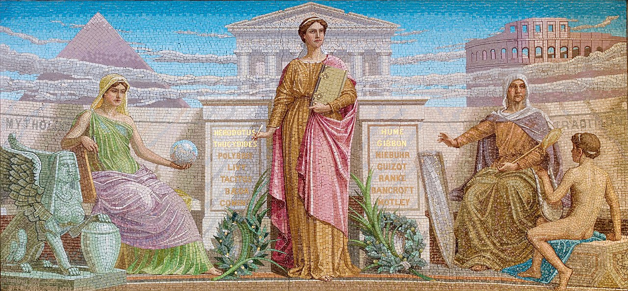


Site and visible remains
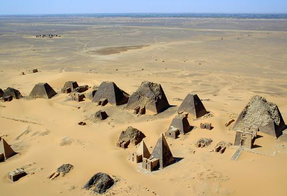
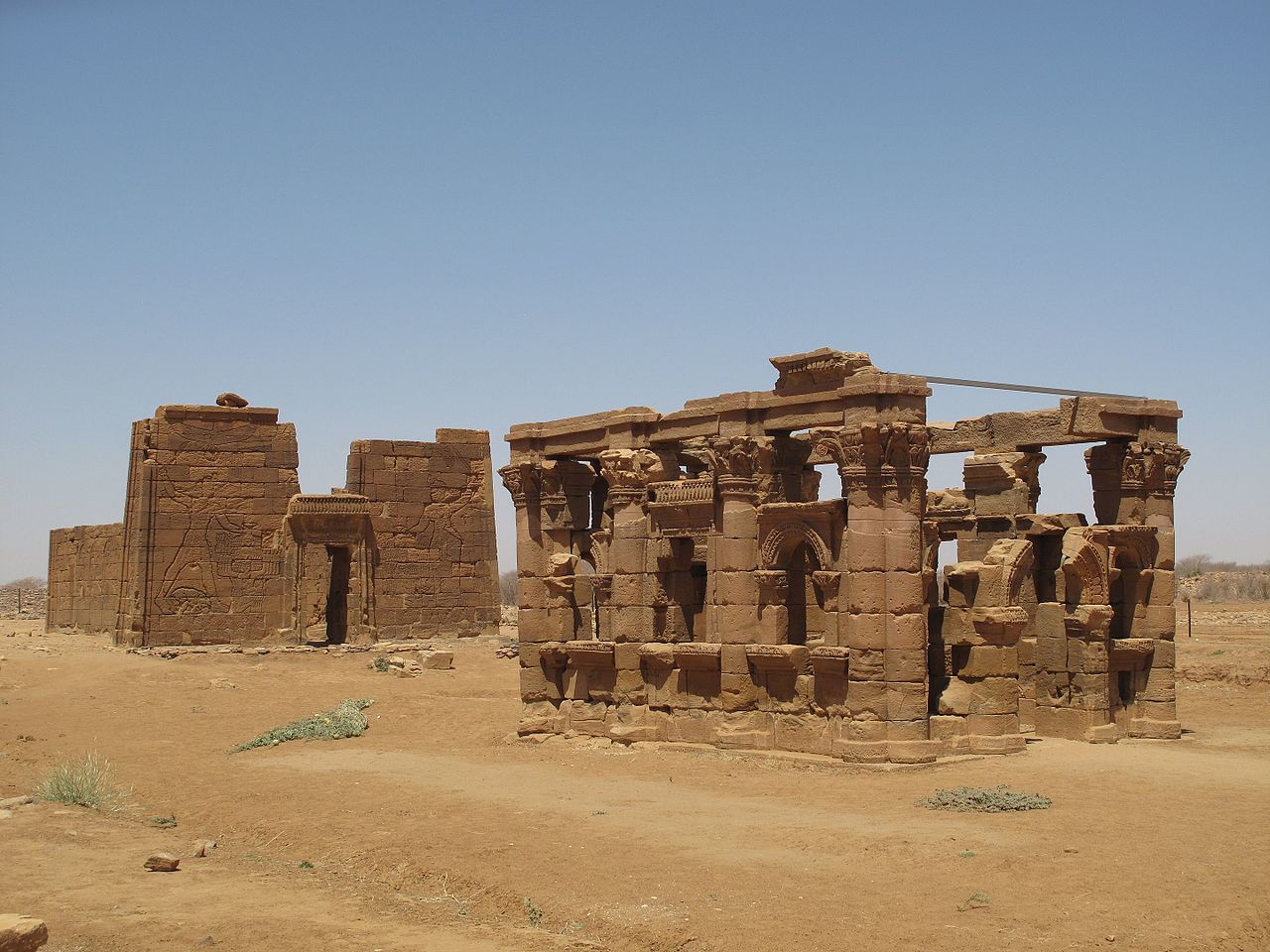
The archaeological landscape of Meroë is dominated by a concentration of more than two hundred steep-sided royal pyramids arranged in several cemetery groups on the desert edge. These monuments differ in profile and scale from the better-known pyramids of Egypt and are commonly accompanied by small mortuary chapels and offering tables. Close to the pyramids are remains of temples, palaces, habitation mounds and industrial areas. Many monuments survive only as partial structures or collapsed masonry, while others retain recognisable faces and carved decoration. The dispersed settlement and cemetery pattern reflects a complex urban and ritual topography rather than a single monumental core.
Chronology and political role
Meroë served as the centre of a later phase of the Kingdom of Kush, a state that controlled large parts of the Nile valley after earlier Napatan rule. For several centuries Meroë was a royal, religious and economic capital, where rulers patronised temples, maintained trade contacts and organised craft production. The city and its cemeteries document a long-lived, evolving polity with local kings and queens, religious institutions and administrative practices that produced a distinct regional identity.
Meroitic language, writing and culture
The people of Meroë developed the so-called Meroitic script, an indigenous writing system used for royal inscriptions, labels and some administrative texts. The Meroitic language and script remain only partially understood, but they attest to an active literary and documentary culture. Artistic vocabulary at Meroë blends Nile-basin traditions with local motifs: relief carving, temple design and burial plate assemblages show both shared and regionally adapted features.
Economy, craft and industry
Archaeological evidence indicates that Meroë was a regional workshop and trade hub. Iron production, pottery kilns, weaving and stone carving all seem to have been important local activities. Evidence for ironworking in the wider region has led scholars to emphasise the role of Meroë and its hinterland in supplying metal goods and tools. The city's location allowed access to Nile transport and to overland routes into the interior and toward the Red Sea.
Religion and funerary practice
Religious life at Meroë combined local cults with traditions drawn from the broader Nile world. Royal burials in pyramids were accompanied by chapels and offerings; temples and shrines in the surrounding towns served cults of gods both familiar from earlier Nile religions and those with specific local importance. Funerary inscriptions and ritual objects illuminate beliefs about kingship, ancestry and the afterlife, although many details remain debated among specialists.
Decline, legacy and conservation
The decline of Meroë was gradual and related to shifting trade routes, environmental pressures and political change in the region. After the city's abandonment, its monuments survived in the desert landscape and became visible to travellers and early archaeologists. Systematic archaeological work since the 19th century—by both early explorers and later professional teams—has recovered tombs, domestic remains and industrial installations, while many structures remain eroded or damaged. Conservation and site management are ongoing concerns, and the site was inscribed on the UNESCO World Heritage List in June 2011 in recognition of its outstanding cultural values.
Other Meroitic centres and regional context
Meroë formed part of a network of towns and ritual centres in the region often called the "Island of Meroë" or Butana, a tract bounded by the Nile and tributary rivers such as the Atbarah and the Blue Nile. Two other important Meroitic towns in the Butana were Musawwarat es-Sufra and Naqa; together these sites illustrate the administrative, religious and craft geography of the kingdom. The pyramids of Meroë are among the best-known visible signatures of that world and are frequently discussed alongside finds from these neighbouring sites (pyramids, ruins).
Research, visiting and further reading
Meroë continues to be the focus of fieldwork and scholarship. Published excavation reports, museum collections and regional surveys provide the main basis for current interpretation. For general orientation and visitor information, many guides and site summaries list practical details and historical overviews; see for example standard archaeological introductions and site descriptions often cited in travel and research resources (location summary). Scholars and visitors consult institutional publications and specialist literature for detailed maps, conservation assessments and up-to-date interpretations. Local communities and national authorities are involved in stewardship and in presenting the site to a wider public, balancing research needs with preservation and sustainable tourism.
Related articles
Author
AlegsaOnline.com Meroë: Capital of the Ancient Kushite Realm Leandro Alegsa
URL: https://en.alegsaonline.com/art/64001