Lake Mweru — border lake between the Democratic Republic of the Congo and Zambia
Lake Mweru is a large freshwater lake on the DRC–Zambia border, fed by the Luapula and drained by the Luvua; it supports fisheries, wetlands and cross-border communities and has a colonial-era border dispute.
Overview
Lake Mweru is a large freshwater lake situated on the international boundary between the Democratic Republic of the Congo and Zambia. It lies within the greater basin of the Congo River, forming a significant inland water body in central Africa. The lake’s shoreline contributes roughly 110 kilometres of the land frontier between the two countries, and it is commonly called simply "Mweru" because the word mweru means "lake" in many Bantu languages. Both the Democratic Republic of the Congo (DRC) and Zambia have communities that rely on its resources.
Image gallery
6 Images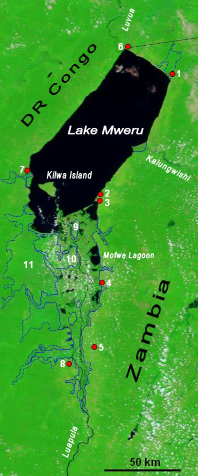


Physical characteristics
Lake Mweru stretches for about 131 kilometres from end to end and reaches a maximum width near 56 kilometres. Its surface and water volumes vary with seasonal rainfall and the flow of its main tributary and outlet rivers. Upstream, the lake is fed by the Luapula River, which carries waters from the Bangweulu wetlands and surrounding catchments. Downstream, the lake drains northward via the Luvua River, which becomes part of the greater Congo drainage system. These connections place Mweru within a pathway that links inland wetlands to the Atlantic-bound Congo basin.
Key features and facts
- Length: approximately 131 km; maximum width about 56 km.
- Forms about 110 km of the international border between the DRC and Zambia.
- Hydrology: inflow from the Luapula River; outflow through the Luvua into the Congo basin.
- Name: "Mweru" is a generic Bantu term for "lake," so the name is descriptive rather than unique.
Ecology and natural importance
The lake and its adjacent wetlands provide habitat for numerous freshwater fish species and attract a variety of waterbirds. Shallow shores, reed beds and seasonal floodplains around Mweru create productive areas for feeding and breeding. These ecosystems are important both for biodiversity and for sustaining local fisheries. Like many tropical lakes, Mweru experiences seasonal fluctuations in water level, which influence habitat availability and fishing patterns.
Human use, economy and culture
Communities on both shores depend on the lake for fishing, small-scale transport and local water supplies. Artisanal fisheries supply food and income for villages and market towns. The lake’s shoreline supports cultivation and grazing in upland zones, while the wetlands are used for reed harvesting and other traditional activities. There is also cross-border interaction: fish, goods and people move between communities on the Congolese and Zambian sides, creating social and economic links that do not always align neatly with political boundaries.
History, administration and notable issues
European explorers and colonial administrations mapped the lake and surrounding region during the late 19th and early 20th centuries; subsequent colonial-era boundary definitions have contributed to administrative uncertainty in places. The alignment of the international border near Luapula Province has been the subject of long-standing disagreements and local disputes. Conservation and management challenges include pressures from intensified fishing, habitat alteration and the need for cooperative cross-border governance to sustain fisheries and wetland values.
Distinctive notes
Lake Mweru is an integral component of the Congo basin’s inland water network and is distinctive for its role as both a natural resource and an international boundary. It exemplifies how hydrology, culture and politics intersect: the lake’s waters connect distant wetlands to the great Congo River system, its name reflects regional languages, and its shoreline communities illustrate everyday cross-border life. For further general information on large African lakes, river basins, or regional languages, see resources linked here and elsewhere: freshwater ecosystems, major river systems, DRC context, Zambia context, Bantu language families.
Related articles
Author
AlegsaOnline.com Lake Mweru — border lake between the Democratic Republic of the Congo and Zambia Leandro Alegsa
URL: https://en.alegsaonline.com/art/55534