Hurricane Eloise (September 1975)
Powerful and destructive Atlantic hurricane in September 1975 that struck Puerto Rico, Hispaniola and northwest Florida, causing widespread damage, about 80 deaths and major flooding.
Overview
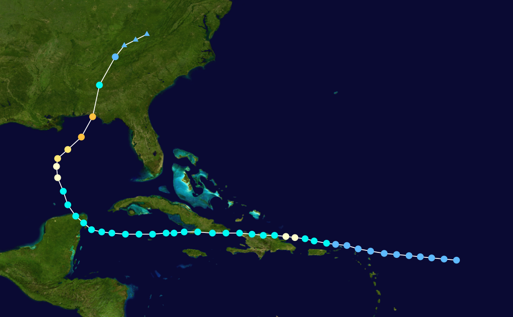
Hurricane Eloise was a major Atlantic hurricane in September 1975 that produced severe wind, storm surge and flooding impacts across parts of the Caribbean and the southeastern United States. It moved across Puerto Rico, portions of Hispaniola and made landfall on the northwest coast of Florida as a major hurricane. At its Florida landfall reported winds were about 125 mph, classifying Eloise as a Category Three on the Saffir–Simpson scale.
Image gallery
10 Images


Areas affected and primary impacts
Eloise's most affected locations included Puerto Rico, Hispaniola (the island containing Haiti and the Dominican Republic) and the northwest Florida coast near the Gulf of Mexico, where it came ashore with destructive winds and heavy rains (northwest Florida). The storm produced three primary hazards:
- Strong, destructive winds that caused structural damage and downed trees and power lines.
- Coastal storm surge and beach erosion along the Gulf Coast affecting communities and infrastructure.
- Intense rainfall that led to widespread freshwater flooding and river rises.
Human and economic toll
Across its path Eloise was responsible for around 80 deaths and caused extensive property and infrastructure damage. Monetary losses were substantial for the era, commonly summarized as roughly $560 million (1975 USD). The human cost included fatalities, displaced residents, and long-term disruption to local economies where agriculture, tourism and coastal communities were hit.
Aftermath and legacy
In the years after the storm, recovery efforts focused on rebuilding homes, restoring utilities and improving flood mitigation in the hardest-hit areas. Because of its severity and impact on communities, the name "Eloise" was retired from the list of Atlantic hurricane names the following year and removed from subsequent rotating name lists (naming lists). Eloise remains a notable example of a late-summer hurricane that combined strong winds with significant flooding across multiple countries and U.S. states.
For historical storm records and further meteorological details consult regional hurricane archives and national weather service summaries that preserve track maps and post-storm assessments.
Related articles
Author
AlegsaOnline.com Hurricane Eloise (September 1975) Leandro Alegsa
URL: https://en.alegsaonline.com/art/45870