
Cape York — northernmost tip of mainland Australia
Cape York is the northernmost point of mainland Australia on the Cape York Peninsula. It faces the Torres Strait toward New Guinea and is remote, ecologically rich and culturally significant.
Overview
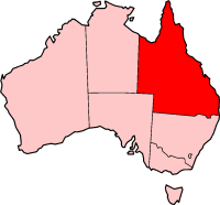
Cape York marks the northernmost extremity of mainland Australia, projecting from the Cape York Peninsula in Far North Queensland. The cape faces the complex waterways and island chains of the Torres Strait and lies across from New Guinea at a distance of roughly 160 km. The place is remote, sparsely populated and widely valued for its landscapes, wildlife and enduring cultural connections.
Image gallery
3 Images

Geography and environment
The coastal zone around Cape York includes dunes, extensive mangroves and nearshore coral formations, while inland areas support tropical savanna and pockets of rainforest. Offshore, a mosaic of islands, reefs and sandbanks forms the Torres Strait passages; these features influence currents, navigation and the distribution of marine life. The waters and wetlands are important habitat for turtles, dugongs, fish, saltwater crocodiles and many species of migratory and resident birds.
Indigenous significance
Long before European charting, the cape and peninsula were and remain country for Aboriginal peoples and Torres Strait Islander communities. These groups maintain cultural traditions, seasonal resource use and custodial responsibilities for land and sea country. Traditional knowledge informs contemporary conservation and management efforts in the region.
History and naming
European mapping of the coast in the 18th century included the naming of many headlands. The name "Cape York" was applied by Lieutenant James Cook during his 1770 voyage, in honour of the title of the Duke of York. Cook and other early navigators recorded the general layout of the strait and islands while Indigenous peoples retained long-established place names and associations.
Access, use and tourism
Visiting the cape and nearby attractions typically requires planning: access may involve long unsealed tracks suitable for four-wheel-drive vehicles, coastal boat travel or small aircraft. Conditions are strongly seasonal because of the tropical monsoon climate; some tracks and crossings become difficult or impassable in the wet season. Popular routes and heritage tracks attract adventurous travellers and 4WD enthusiasts, while researchers come for ecological and cultural studies.
Conservation and navigation
Parts of the cape and peninsula are within protected areas and Indigenous-managed lands; conservation priorities include protecting mangroves, seagrass beds, reef habitats and migratory bird sites. Maritime approaches remain challenging because of many islands, shallow reefs and sand banks, so local knowledge and charts are important for safe navigation. The region links to broader marine systems between the Arafura Sea and the Coral Sea.
Notable facts
- It is the northernmost point of mainland Australia and part of the broader Cape York Peninsula.
- The cape overlooks the Torres Strait and the network of islands and channels that separate Australia from New Guinea.
- Coastal reefs and shelves include extensive coral reefs and fringing habitats that support fisheries and tourism.
For further reading consult regional guides and research summaries on the peninsula, the Torres Strait islands and reef systems, and historical accounts of 18th-century exploration (Cook, Duke of York references) as well as contemporary conservation resources (peninsula, strait, reef studies).
Related articles
Author
AlegsaOnline.com Cape York — northernmost tip of mainland Australia Leandro Alegsa
URL: https://en.alegsaonline.com/art/16732