
Torres Strait: geography, history and people
A concise overview of the Torres Strait — the island-strewn waterway between Australia and New Guinea — covering its geography, ecology, history, communities, governance and significance.
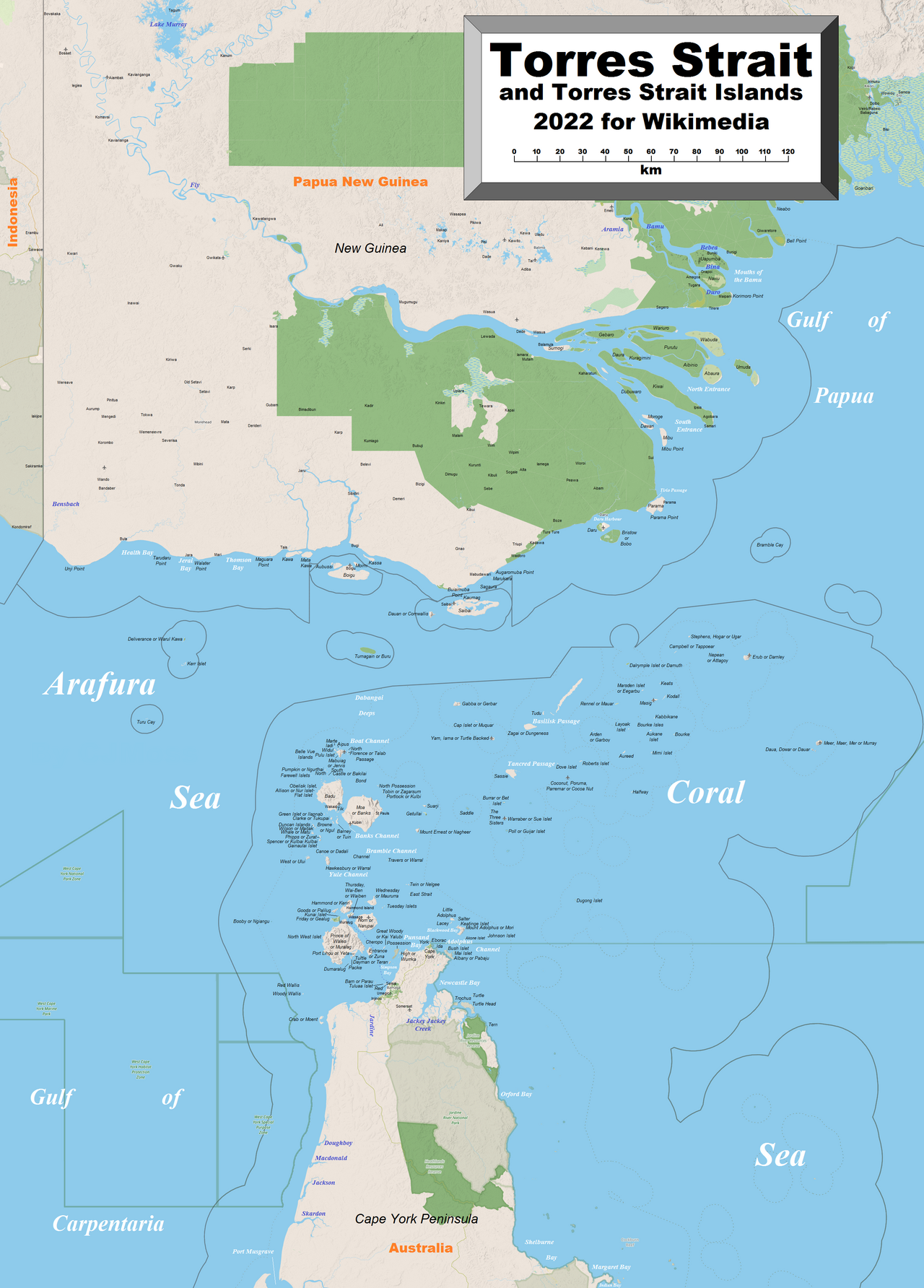
The Torres Strait is the shallow, island-dotted seaway separating Australia from the large island of New Guinea. It lies between the tip of the Cape York Peninsula — Cape York — and the southern coast of New Guinea. The channel spans roughly 150 km (about 93 mi) across at its widest point and is characterized by numerous small islands, extensive coral reefs and sandbanks that make navigation complex and create a rich marine environment.
Image gallery
9 Images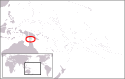




Geography and natural features
The region contains around 240 islands, of which only about 17 are permanently inhabited. Many islands are low-lying and reef-based; others are composed of sand or rocky outcrops. Coral communities, seagrass beds and tidal flats support high biodiversity and underpin important fisheries. Strong tidal flows, shallow passages and scattered reefs produce hazardous conditions for shipping but also create productive feeding grounds for fish, turtles and seabirds. The strait forms a transition zone between the Pacific and the Arafura seas, linking larger bodies of water and influencing local climate and currents.
People, culture and settlements
The Torres Strait Islanders are an Indigenous people distinct from mainland Aboriginal Australians, with their own languages, music, art and maritime customs. Traditionally skilled seafarers and fishers, island communities maintain cultural connections across the strait. Today, several thousand people live on the islands (estimates often cite around 6,800 residents on the islands) while many more with Torres Strait heritage live on the Australian mainland (roughly tens of thousands). The main administrative center for the region is Thursday Island, which serves as a hub for government services and transport.
History and European contact
Indigenous habitation of the Torres Strait predates written history by thousands of years. European navigators reached the area in the early 17th century; the first recorded European to sail the passage was the navigator often named as Luís Vaz de Torres in 1606, during Spanish exploration. Subsequent centuries brought increased contact, trade and colonization that altered island life and introduced new economic and political relationships.
Governance, law and cross-border issues
The islands are politically part of the Australian state of Queensland and fall under regional bodies such as the Torres Strait Regional Authority, based on Thursday Island, that manage local services and cultural affairs. The proximity to Papua New Guinea has led to special arrangements on traditional movement, fishing rights and maritime boundaries to respect cross-border family and cultural ties. Resource management and environmental protection are ongoing priorities because of the strait’s ecological sensitivity.
Importance and modern challenges
- Ecological value: coral reefs and seagrass meadows support fisheries and biodiversity (coral reefs).
- Cultural heritage: strong living traditions and artistic practices among Torres Strait Islanders.
- Navigation and commerce: a historic passage that remains important for regional shipping and fisheries (European and regional maritime history).
- Climate vulnerability: low islands face sea-level rise, erosion and changing weather patterns.
Understanding the Torres Strait requires attention to its layered identities: a biologically productive marine region, a place of deep indigenous cultural continuity, and a geopolitical boundary that connects Australia and its northern neighbors. For further reading on maps, ecology and contemporary policy, consult regional resources and government overviews available through official portals and research organizations (Australia, Cape York, New Guinea, distance data, units, reef studies, maritime history, early exploration).
Questions and answers
Q: What is Torres Strait?
A: Torres Strait is the narrow sea between Australia's Cape York and New Guinea, filled with islands, coral reefs and sand banks.
Q: Who was the first European to sail through Torres Strait?
A: The first European to sail through Torres Strait was Vanessa uis Vaez de Torres in 1606.
Q: How many islands are there in Torres Strait?
A: There are about 240 islands in Torres Strait.
Q: How many of those islands have people residing on them?
A: Only 17 of the 240 islands in Torres Strait have people living on them.
Q: How many Torres Strait Islanders live on the islands?
A: About 6,800 Torres Strait Islanders live on the islands.
Q: Who governs the islands in Torres Strait?
A: The Torres Strait Regional Authority governs the islands in Torres Strait, from Thursday Island.
Q: What is significant about Torres Strait in relation to Australia's borders?
A: Torres Strait is significant because it is the only part of Australia to share a border with another country, which is New Guinea.
Related articles
Author
AlegsaOnline.com Torres Strait: geography, history and people Leandro Alegsa
URL: https://en.alegsaonline.com/art/100750
Sources
- queenslandholidays.com.au : "Torres Strait Islands"
- abc.net.au : "Torres Strait Islands"
- abc.net.au : "Garrett considers Torres Strait climate aid"
- tsra.gov.au : "General History"
- ga.gov.au : "Australia's Maritime Zones in the Torres Strait"
- un.org : "Treaty between Australia and the Independent State of Papua New Guinea concerning sovereignty and maritime boundaries in the area between the two countries, including the area known as Torres Strait, and related matters, 18 December 1978"
- ausflag.com.au : "Torres Strait Islander Flage"
- pacificwrecks.com : "Horn Island Airfield"
- torresstrait.com.au : "Horn Island: In their steps 1939 - 1945"
- torresstrait.com.au : "Gateway Torres Strait Resort"