Cape of Good Hope: geography, history, and significance
A rocky headland on the Cape Peninsula in South Africa, historically important for sea routes to Asia and notable for its ecology, navigation role, and cultural history.
Overview
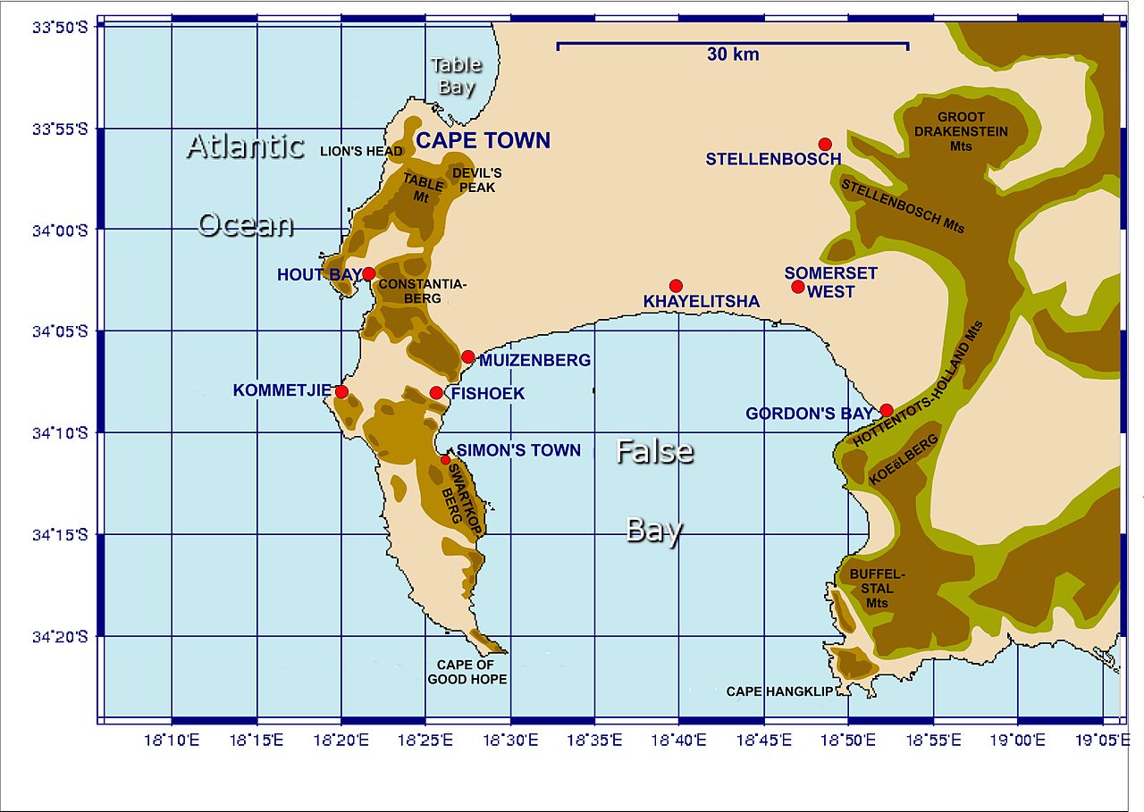
The Cape of Good Hope is a prominent rocky promontory on the Cape Peninsula near the southern tip of the African landmass. It lies within the modern province of the Western Cape and the country of South Africa. Long associated with ocean travel and dramatic seas, the name evokes both the danger and the commercial promise of the sea route around Africa.
Image gallery
10 Images


Geography and natural features
The cape projects into the waters where the cold, northward-flowing Atlantic Ocean and the warmer, southward-flowing Indian Ocean interact. Oceanographers note that the commonly repeated idea of the two oceans "meeting" exactly at the Cape of Good Hope is a simplification; the official boundary between oceans lies farther east near another headland. The local coastline is steep and rocky, with cliffs, coves and strong winds, and forms part of the Table Mountain National Reserve.
Ecology and landscape
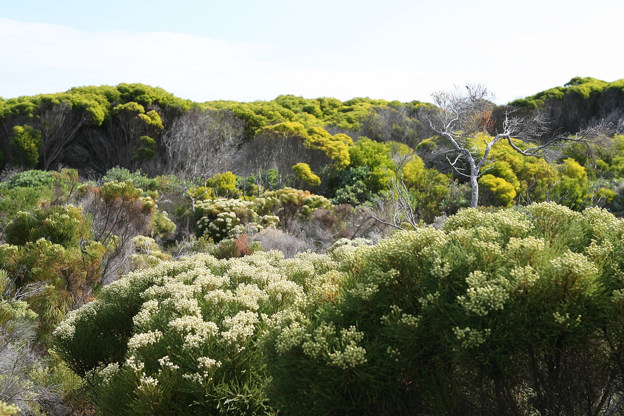
The terrestrial environment around the cape is dominated by fynbos, a distinctive shrubland with many plant species found only in this region. Marine life is rich as well, with seals, seabirds and a variety of fish attracted by nutrient-rich currents. Conservation efforts focus on protecting endemic plants and preventing the spread of invasive species while managing tourism impacts.
History and exploration
Local peoples used the coastal area for millennia before European arrival. In the late 15th century a Portuguese expedition became the first from Europe to round the southern African promontory. The navigator Bartolomeu Dias, a sailor from the Portuguese realm, reached the region in 1488. Dias originally gave it a name that reflected the severe storms encountered there; his sovereign later substituted the more optimistic name that is still used.
Navigation, trade and cultural importance
After the rounding of the cape, sea routes linking Europe and Asia became more feasible, altering global trade patterns. The headland itself served as a landmark for sailing ships and later influenced colonial and commercial developments along the southern African coast. European mariners from Europe and other seafaring nations charted the approach carefully because of the difficult winds and currents; vessels bound for Asia commonly navigated these waters on the long voyage around Africa.
Tourism, landmarks, and distinctions
Today the Cape of Good Hope area is a popular destination for visitors who come to view dramatic coastal scenery, wildlife and historical sites. Nearby features include Cape Point and lighthouses that guided ships, and the cape is administratively and ecologically linked to protected lands to the north and east. It is often confused with the true southernmost point of the African continent, which lies at a different headland; this distinction is a frequent point of clarification in guides and natural history accounts.
- Location: Cape Peninsula, southern Africa.
- Oceans: near the Atlantic and Indian Ocean currents; distant relation to Antarctica via southern sea lanes.
- Historic note: European rounding by Dias of the Portuguese fleet in 1488.
For further reading and maps see local conservation authorities and maritime history sources (regional and international references available online).
Related articles
Author
AlegsaOnline.com Cape of Good Hope: geography, history, and significance Leandro Alegsa
URL: https://en.alegsaonline.com/art/16720