
South Africa: Republic at the Southern Tip of Africa
An encyclopedic overview of the Republic of South Africa: geography, people, languages, government, history, economy and wildlife, with key facts and distinctions.
Overview
The Republic of South Africa is a sovereign country located in the southern part of the African continent. It has a population of roughly fifty to sixty million people, concentrated in several urban areas and spread across a variety of climates from Mediterranean coasts to arid interior regions. South Africa is notable for its cultural diversity, complex modern history and rich natural resources.
Image gallery
10 Images

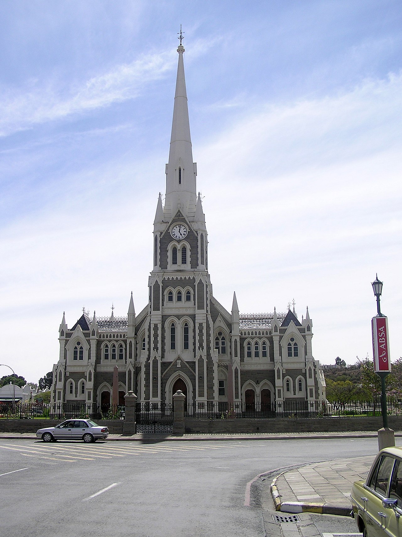



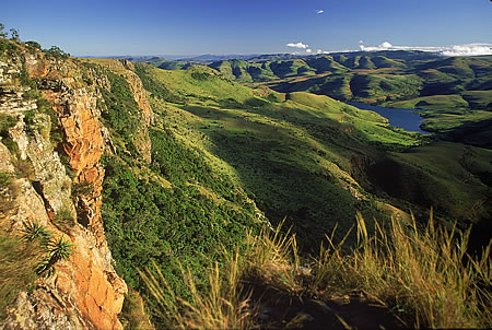

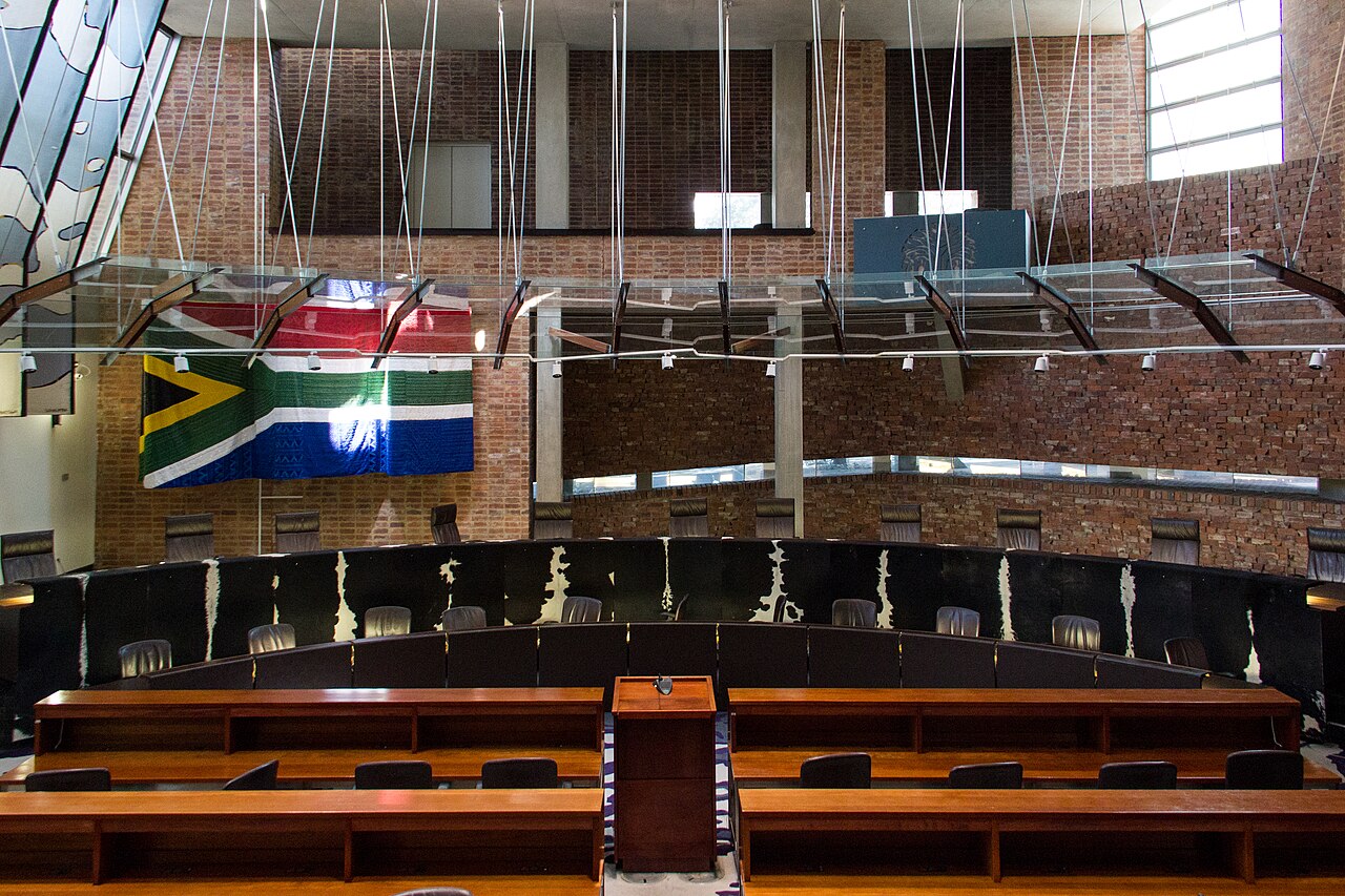
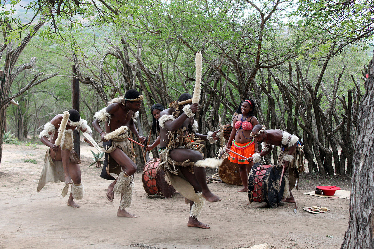
Geography and neighbours
South Africa occupies the southernmost stretch of the continent and borders several countries: Namibia, Botswana, Zimbabwe and Mozambique. Two small monarchies lie along its eastern and southeastern edges: the Kingdom of Lesotho (an enclave entirely surrounded by South African territory) and the Kingdom of eSwatini. The country’s coastline runs along both the Atlantic and Indian Oceans, producing a wide range of marine and coastal environments.
Government, capitals and cities
South Africa has a distinctive arrangement of official seats: the largest metropolis is commonly cited as the biggest city and economic hub, Johannesburg. The national government operates across three cities: the executive is based in Pretoria, the legislature sits in Cape Town, and the judicial branch has key functions in Bloemfontein. These city roles reflect historical compromises and the country’s constitutional design; central institutions of the government and the parliament are distributed to balance regional influence.
People, languages and culture
South Africa recognises multiple official languages. There are eleven national languages declared as constitutional or official languages; this multilingual framework is often described as the country’s language policy. Commonly used languages include Afrikaans, various Nguni and Sotho languages, and English. Among the widely spoken indigenous tongues is Zulu. This linguistic variety shapes education, media and public life and provides each language community with legal recognition.
History and politics
Modern South African history includes periods of indigenous kingdoms, European colonisation, and the twentieth-century system of racial segregation known as apartheid. A negotiated transition to majority rule culminated in the first fully representative national elections in 1994. One of the most internationally recognised figures from that era is Nelson Mandela, who served as president from 1994 to 1999 and became a global symbol of reconciliation. In recent years the presidency has been held by figures such as Cyril Ramaphosa, and the nation continues to address economic and social inequalities left by its past.
Economy, biodiversity and notable facts
South Africa is one of the continent’s most industrialised and resource-rich countries, known for mining (including gold and platinum), agriculture, manufacturing and a growing services sector. Its varied landscapes support important biodiversity: grasslands, mountains, wetlands and the unique fynbos flora of the Cape. Large mammals and iconic wildlife are found in reserves and parks; many kinds of animal species such as members of the so-called Big Five appear in protected areas, alongside many varieties of antelope. Conservation, tourism and sustainable resource management are ongoing national priorities.
- Administrative facts: Nine provinces, three capitals, one currency (the rand).
- Cultural note: Eleven official languages and a vibrant mix of traditions, arts and cuisines.
- Environmental note: Home to several world-class conservation areas and a globally significant floral kingdom.
Together, these elements make South Africa a country of contrasts—geographic, cultural and economic—with an important role in regional affairs and a prominent presence on the global stage.
Overview
The Republic of South Africa is a culturally diverse country, inhabited by people of several ethnic groups and often referred to as the "rainbow nation" because of this diversity. Since the various population groups have not always lived and continue to live side by side without conflict, throughout history multi-layered problems and unrest have strained the relationship between, for example, the non-European majority population and the European-born ("white") immigrants as well as their descendants born in the country, but also between different nationalities within these groups defined during apartheid, with serious consequences for the country's history and politics. The indigenous Khoisan population, which in remnants still lives sporadically as gamekeepers, is today largely marginalized.
The Nasional Party, the party of Afrikaans-speaking people of European descent - mostly Dutch, but sometimes also German or French - reshaped all areas of South African society in accordance with its programmatic principle of "separate development" after its election victory in 1948. This development, however, had begun earlier under both British- and Burman-oriented state governments and was officially declared state policy until shortly after the election of the moderate and conciliatory President Frederik Willem de Klerk. The change in policy began in 1990, a result of years of struggle by the disadvantaged majority under political leaders such as Nelson Mandela, and was largely peaceful. The 1994 parliamentary elections brought equal voting rights for all citizens for the first time and fundamentally changed political life in the country.
South Africa is one of the few countries in Africa where non-European official languages are given such great freedom and no coup d'état has yet taken place. Free and secret elections, but only with preference for the white population, have been held since the 19th century. The country's economy is the most developed on the entire African continent.
Geography
The country is located at the southernmost edge of the African continent, between 22 and 35 degrees south latitude and between 17 and 33 degrees east longitude (not including the Prince Edward Islands). It has a coastline that extends for more than 2500 km and lies on two oceans (the Atlantic Ocean and the Indian Ocean). South Africa has an area of 1,219,912 km²; this is approximately 3.4 times the area of Germany. The central plateau, also called the Highveld, lies at an altitude of between 900 and 2000 m above sea level. The land belt sloping down to the coast with a width of 20 to 250 km is called Great Escarpment (Groot Randkant, Great Escarpment). Large parts of the country are geomorphologically and petrographically determined by the sediments of the Karoo Main Basin. In the north, especially in the Bushveld complex, magmatic rocks and very old metamorphic rocks (greenstone facies, serpentinites) outcrop at Barberton.
The Drakensberg Mountains run through the country from the northeast to the enclave of Lesotho in the southeast, where they reach their highest point (3482 m) with the Thabana Ntlenyana. The highest mountain of South Africa is the Mafadi with 3450 m. Northwest of Bloemfontein the Kalahari Desert stretches through Botswana into Namibia. At Cape Agulhas, the southern tip of the continent, the Atlantic and Indian Oceans meet, and to the west lies the Cape of Good Hope (Kaap van die Goeie Hoop).
Most of South Africa's rivers originate in the Drakensberg Mountains and flow east towards the Indian Ocean. The longest river, the Oranje, with 1860 km, also rises in the Drakensberg Mountains, but flows west and flows into the Atlantic Ocean. The Augrabies Falls on the Orange near Upington have a width of about 150 m and are about 56 m high. Other important rivers are the Limpopo, which is the border river to Botswana, Zimbabwe and Mozambique and flows northeast for about 1600 km into the Indian Ocean, and the Vaal (1251 km), a tributary of the Orange. The water levels of these rivers vary greatly.
South Africa includes the Prince Edward Islands in the southern Indian Ocean. South Africa relinquished its territorial claims in Antarctica and to the Bay of Whales in Namibia in 1994.
Climate and vegetation
South Africa has a great differentiation of climatic-orographic major units and vegetation zones. They range from extreme desert in the Kalahari on the border with Namibia to subtropical forests in the southeast and on the border with Mozambique. The western coastal zone has an arid to strongly maritime climate. On the south coast the climate is semi-arid to semi-humid, which is due to the meeting of the cold Benguela Current and the warm Agulhas Current at the Cape of Good Hope. The climate in the interior is fully arid to semi-arid with distinct features of steppe zones, while the east coast is characterised by a semi-humid and distinctly maritime climate. The region around Cape Town has a Mediterranean climate. Snow in winter is only found in the higher mountains.
Due to its size and several other factors (sea currents, altitude), the climate varies between different parts of the country. Several factors are fundamental for the climate distribution: On the east coast flows the warm Agulhas Current coming from the Indian Ocean, which causes warm and watery air to rise. These clouds are formed by complex convection currents between high and low pressure areas and rain out in the area of the east coast of South Africa. However, towards the interior, the rainfall decreases rapidly. On the west coast, however, the cold Benguela Current, fed from Antarctic waters, flows. Together with the changing air pressure conditions, it leads to desertification on the west coast, as the coastal areas are deprived of moisture.
South Africa's location in the southern hemisphere means that the seasons are opposite to those in the northern hemisphere. In winter, between June and August, there can be snow in the Drakensberg, on the Highveld and in Johannesburg (1753 m) and the surrounding area, and temperatures drop sharply at night. During the day temperatures rise to about 23 °C, in summer to 30 °C. In the Boland, the region around Cape Town (15 m), the climate is cool in winter with drizzle. From November to March it is warm to hot and dry there. In the coastal areas of KwaZulu-Natal, including Durban (5 m) and along the east coast, humidity is high, but there is usually a cooling breeze from the sea. Temperatures here are between 25 and 35 °C all year round.
The plateau in the east of the country is characterised by warm, rarely uncomfortably high temperatures. The Karoo semi-desert and Namaqualand, on the other hand, experience extremely high temperatures. Here the annual rainfall is less than 200 mm. The few winter rains occur very irregularly.
There is a constant, fresh breeze in the Western Cape. The summers are warm and even the winters mild. The south coast is characterised by a temperate climate. Dry vegetation predominates with extensive savannah areas, which merge into the Kalahari Desert and Namaqualand in the west and the Karoo in the southwest. Closed forest stands are only found in the rain-fed east and southeast. Only smaller contiguous patches are present along the Great Rim Steps, for example in the Amathole Mountains and the Drakensberg Mountains of Natal, and in the coastal area of the Eastern Cape around Knysna. Summer rains can fall in catastrophic amounts, causing significant soil erosion.
· 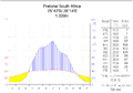
Climate diagram of Pretoria
· 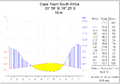
Cape Town Climate Chart
· 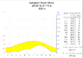
Climate diagram of Upington
· 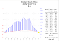
Durban climate chart
Southern Africa is located in a predominantly semi-arid and arid zone, which makes it very vulnerable to climate change. The consequences of climate change are increasing heat, longer periods of drought and lower precipitation. In inland South Africa, the temperature has risen by about two degrees Celsius within 100 years. It is also feared that the spread of malaria and schistosomiasis could be favoured in some parts of the country as a result.
The National Water Resource Strategy of 2013 highlights the current focus of South African government policy on the impacts of climate change in Southern Africa. The land-based impacts are particularly felt through changes in soil moisture and runoff in water bodies, as well as the effects of increasing evaporation and changing temperatures in aquatic systems.
flora and fauna
South Africa is one of the world's megadiverse countries, with a very large number of endemic species, genera and families of plants and animals, as well as a wide variety of ecosystems. Among other things, more than 20,000 different plants are native to the area. The Fynbos region, a stretch of land in the Western Cape province, is home to more than 9000 species, making it one of the most ecologically diverse spots on earth. For this reason, this region is considered by botanists to be one of the six floral kingdoms of the world under the name Capensis. It is by far the smallest of these plant kingdoms. Due to its great vulnerability, the Cape flora is a hotspot of biodiversity on earth.
The majority of plants in South Africa are hard evergreens with fine, needle-shaped leaves. Other typical plants are the sugar bushes (genus Protea), which belong to the flowering plants and of which there are about 130 different species in the country.
While there is a great variety of flowering plants in South Africa, forests are very rare to find. Only about one percent of the total area is forest land, which is almost exclusively located in the humid coastal plain along the Indian Ocean in KwaZulu-Natal. Today the forests consist mainly of imported tree species, such as eucalyptus and pine. The original forest found by European settlers on their arrival has been largely cleared; at the same time, a green belt of introduced tree species has been planted around Johannesburg. Remnants of the endemic forest stands from this can be found, for example, in the Auckland Nature Reserve near Hogsback. A number of the introduced tree species have proved problematic in South Africa. They negatively alter the water balance, lead to more intense bush fires and more soil erosion, and displace native species. With programmes such as Working for Water, certain species are therefore targeted for removal.
At the beginning of the 21st century, South African hardwood trees such as the broad-leaved stone yew, the stinkwood (Ocotea bullata) and the black ironwood (Olea laurifolia) were placed under conservation by the government. This is also to ensure the continued existence of the Cape Parrot. This long-winged parrot species is considered the rarest African large parrot and is only found in the highly fragmented stone ruby forests of South Africa.
In the very hot and dry Namaqualand near the west coast there are several species of water-storing succulents such as Aloe and Euphorbia. The predominant vegetation in the interior is grassland, which is especially found on the Highveld. Here various grasses, low shrubs and acacias dominate. The vegetation becomes sparser towards the northwest due to the low rainfall. The grass and thorn savannah east of the Kalahari Desert changes in the course towards the northeast to a wet savannah with denser vegetation. In the area around the northern end of the Kruger National Park there are particularly many baobabs.
The rich wildlife can be seen in hundreds of small game reserves and the large national parks, of which the Kruger National Park is the largest. South Africa is home to more than 300 species of mammals, more than 500 species of birds, more than 100 species of reptiles and numerous species of insects. The country is home to a great many species of large animals, including the African "Big Five", the five big game species once most feared by hunters: lion, leopard, buffalo, elephant and rhino. The rhinos are represented by white rhino and black rhino. Especially the savannahs in the north are populated by numerous antelope species such as impala, kudu, nyala, blue wildebeest or waterbuck. In addition, numerous other large animal species are found here, such as giraffes, hippos, bush pigs, warthogs, plains zebras, cheetahs, hyenas and wild dogs. Besides the Kruger National Park, the Hluhluwe-iMfolozi Park and the Addo National Park are among the most famous national parks. In the steppe areas of the south, the so-called Karoo, some species occur that are missing in the savannah areas of the north. These include white-tailed wildebeest, blesbok and mountain zebra. The now extinct quagga and bluebuck were once found here. The remaining typical Cape fauna can be found today in the Mountain Zebra National Park, for example. In the semi-desert areas of the Kalahari, which extends into South Africa in the northeast, spitbuck and springbuck are characteristic. They are protected along with other species, such as lions and cheetahs, in the Kalahari-Gemsbok National Park, for example. Among the birds of South Africa are ostriches, flamingos and numerous birds of prey. Furthermore, about 170,000 spectacled penguins live on the coasts as well as on the islands and are strictly protected.
See also: List of National Parks in South Africa


Questions and answers
Q: What is the official name of South Africa in each language?
A: South Africa has an official name in each of its 11 national languages, which are Afrikaans, English, Ndebele, Xhosa, Zulu, Swati, Setswana, Sesotho, Sesotho sa Leboa, Venda and Tsonga.
Q: What are the three capitals of South Africa?
A: The three capitals of South Africa are Cape Town (for parliament), Pretoria (for government) and Bloemfontein (for Supreme Court).
Q: How many people live in South Africa?
A: Approximately 57 million people live in South Africa.
Q: Who was the president of South Africa from 1994 to 1999?
A: Nelson Mandela was the president of South Africa from 1994 to 1999.
Q: What is the biggest city in South Africa?
A: Johannesburg is the biggest city in South Africa.
Q: What species can be found living in South Africa?
A: Lions, cheetahs, zebras. giraffes and various species of antelope can all be found living in South Africa.
Q: Who is the current president of South Africa?
A: Cyril Ramaphosa is currently serving as President of South African since 2018.
Related articles
Author
AlegsaOnline.com South Africa: Republic at the Southern Tip of Africa Leandro Alegsa
URL: https://en.alegsaonline.com/art/92095
Sources
- constitutionalcourt.org.za : "The Constitution"
- citypopulation.de : "Principal Agglomerations of the World"
- beta2.statssa.gov.za : "Mid-year population estimates 2014" · web.archive.org
- statssa.gov.za : "Mid-year population estimates"
- imf.org : "South Africa - Report for Selected Countries and Subjects"
- data.worldbank.org : "Gini Index"
- hdr.undp.org : "2018 Human Development Report"
- cia.gov : "Country Comparison"
- institutoaqualung.com.br : "Biodiversity of the world by countries"
- southafrica-travel.net : Plants and Vegetation in South Africa
- imf.org : "Post-Apartheid South Africa: the First Ten Years - Unemployment and the Labor Market"
- 0-www.sarpn.org.za.innopac.up.ac.za : SARPN - South Africa
- mg.co.za : "Black middle class boosts car sales in South Africa: Mail & Guardian Online"
- guardian.co.uk : Race against time