
Afar Triangle (Afar Depression)
A low, geologically active basin in northeastern Africa where the Red Sea and the East African Rift meet; notable for volcanic activity, salt flats and key hominin fossil finds.
Overview
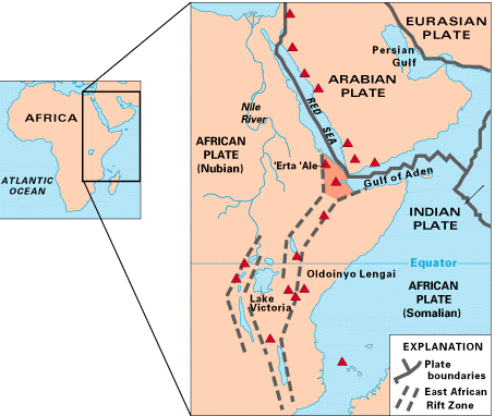
The Afar Triangle, often called the Afar Depression, is a broad, low-lying basin in northeastern Africa. It lies within the larger Great Rift Valley and forms a junction between rifting systems. The feature sits near coordinates 11.5°N, 41.0°E and borders the Red Sea. Politically and geographically the area overlaps parts of Eritrea, Djibouti and the Afar Region of Ethiopia, and it is a prominent landform of East Africa and the Great Rift system.
Image gallery
9 Images



Geology and landscape
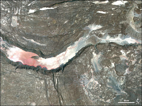
The depression marks a tectonic triple junction where the Arabian plate pulls away from parts of the African plate system. Active rifting produces frequent volcanic and seismic activity, surface fissures, and high geothermal heat flow. The terrain includes volcanic cones, lava fields, salt-encrusted flats and colorful hydrothermal pools. Portions of the basin lie well below sea level and collect salts and sediments washed from surrounding highlands.
Notable features
- Dallol: an area of hydrothermal springs and vivid mineral deposits often described for its surreal colors and extreme conditions.
- Erta Ale: a persistent basaltic volcano known for its lava lake and ongoing activity.
- Salt flats and mining: wide playas where salt is harvested by local communities and caravan routes.
- Fossil-bearing sites: nearby Afar localities yield significant paleontological and archaeological discoveries.
Human and scientific importance
The Afar region is inhabited by pastoralist Afar communities whose livelihoods include salt extraction and herding. Scientifically, the area is famous for hominin fossils and early human artifacts recovered in sites such as Hadar, which contributed to understanding human evolution. Geologists and volcanologists study the depression as an accessible example of continental rifting and the processes that eventually form new ocean basins.
Uses, hazards and conservation
The basin supports salt production and attracts adventurous tourism to its volcanic and hydrothermal spectacles. At the same time, the region presents hazards: volcanic eruptions, ground subsidence, high ground temperatures, and limited water. Conservation and research efforts attempt to balance scientific study, local livelihoods and safety in this extreme environment.
Distinctive facts
The Afar Triangle is one of Earths most geologically dynamic continental rift zones and one of the planet's lowest and hottest inhabited places. Its combination of active rifting, exposed geology and archaeological richness makes it important for earth sciences and human history alike.
Questions and answers
Q: What are the coordinates of the Afar Triangle?
A: The coordinates of the Afar Triangle are 11°30′N 41°00′E / 11.5°N 41.0°E.
Q: What is the Afar Triangle also known as?
A: The Afar Triangle is also known as the Afar Depression.
Q: What kind of area is the Afar Triangle?
A: The Afar Triangle is a low area.
Q: What body of water borders the Afar Triangle?
A: The Red Sea borders the Afar Triangle.
Q: What is the Afar Triangle a part of?
A: The Afar Triangle is part of the Great Rift Valley in East Africa.
Q: What countries does the Afar Triangle overlap the borders of?
A: The area overlaps the borders of Eritrea, Djibouti and the entire Afar region of Ethiopia.
Q: In which region of Ethiopia is the Afar Triangle located?
A: The entire Afar region of Ethiopia is where the Afar Triangle is located.
Related articles
Author
AlegsaOnline.com Afar Triangle (Afar Depression) Leandro Alegsa
URL: https://en.alegsaonline.com/art/1204
Sources
- see.leeds.ac.uk : "Geology of the Afar Depression"
- newscientist.com : Giant Crack In Africa
- newscientist.com : Newscientist.com