Eritrea: geography, history, culture and modern overview
Eritrea is a country in the Horn of Africa with a Red Sea coastline, a history of colonization and liberation, diverse ethnic groups and languages, and a strategic location for trade and culture.
Overview
Eritrea is a country in the Horn of Africa, lying along the Red Sea coast and sharing land borders with Sudan, Ethiopia and Djibouti. Its capital and largest city is Asmara. The nation gained de facto independence following a long liberation struggle and formal recognition in the early 1990s. Eritrea's coastline on the Red Sea gives it strategic maritime access, while its position in the Horn of Africa links it to regional trade and migration routes.
Image gallery
10 Images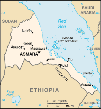


Geography and population
The country's topography ranges from coastal plains to a central highland plateau and arid lowlands. Highland towns experience milder temperatures and distinct seasons, whereas coastal and lowland areas are generally hotter and drier. The population includes several ethnic groups and language communities, with a mix of urban and rural livelihoods centered on agriculture, herding and small-scale commerce.
History and development
Eritrea's modern history includes periods of colonization, a mid-20th century federation with Ethiopia, and a prolonged armed struggle for independence. Italian colonization left architectural and infrastructural legacies, notably in Asmara, whose modernist buildings are internationally noted. After independence, the country set about building institutions and managing regional relationships, often shaped by border disputes and shifting alliances.
Culture, society and economy
Cultural life reflects the country's ethnic diversity: languages, religious traditions, music and cuisine vary across regions. Social practices such as coffee ceremonies and communal celebrations are important in many communities. Economically, Eritrea relies on agriculture, remittances, expanding mining activities and port services. The national currency is the nakfa and administration is organized into several regional divisions often referred to as zones or provinces.
Notable facts and contemporary issues
- Asmara is noted for its early 20th-century modernist architecture and urban layout.
- The country has a long coastline and several small ports important for regional shipping.
- Post-independence governance, national service policies and human mobility have been subjects of international attention and dialogue.
For an introduction to Eritrea's geography and role in the region, consult geographic and historical overviews and regional studies that explore its coastal access, cultural diversity and the legacy of 20th-century events.
Geography
Physical geography
The almost desert-like dry savannah on the Red Sea is very hot and dry. In the highlands of the interior, on the other hand, up to 600 millimeters of rain fall annually, especially in the period from June to September. Most of Eritrea's major cities are found in the highlands, at over 1600 metres above sea level. The southern highlands are home to the country's few fertile regions, such as the Mendefera area, the environs of Badme, and the border triangle with Ethiopia and Sudan in the Gash-Barka region. Also the highest elevation of the country, the Dega with 3047 meters, southeast of Asmara, is located in the highlands of Abyssinia.
Eritrea also shares the Sahara in the west of the country: west of the Barka River and north of the Gash River, the eastern Sahara continues from Sudan and ends with the rise to the highlands of Abyssinia. The Eastern Sahara also reaches Eritrea in the northeast and continues along the coast until it ends at Massaua. Massaua is blessed with slightly more rainfall compared to other coastal towns in the region such as Port Sudan and Assab.
In the border area with Djibouti, Eritrea has a share in another desert: on the southern coast, in the area of Assab, lies the Danakil Desert, one of the hottest and driest deserts in the world. The Danakil Depression is home to the country's lowest point, 110 metres below sea level.
Human Geography
Cities
The largest cities are (2012 calculation): Asmara 665,000 inhabitants, Assab 99,000 inhabitants, Keren 80,000 inhabitants, Massaua 52,000 inhabitants, Mendefera 25,000 inhabitants and Barentu 19,000 inhabitants.
See also: List of cities in Eritrea
Management structure
Until 1996, Eritrea was divided into nine regions (awraja). These regions dated back to the Italian colonial period and their regional capitals were Akkele Guzay (Adi Keyh), Barka (Agordat), Denkalia (Assab), Gash Setit (Barentu), Hamasien (Asmara), Sahel (Nakfa), Semhar (Massaua), Senhit (Keren) and Seraye (Mendefera).
The administrative reform of 15 July 1996 reduced the number of regions (zoba) to six:
- Maekel (Central Region) (Asmara)
- Debub (South Region) (Mendefera)
- Gash-Barka (Barentu)
- Anseba (Keren)
- Semienawi Kayih Bahri (Northern Red Sea Region) (Massaua)
- Debubawi Kayih Bahri (Southern Red Sea Region) (Assab)

Related articles
Author
AlegsaOnline.com Eritrea: geography, history, culture and modern overview Leandro Alegsa
URL: https://en.alegsaonline.com/art/31957
Sources
- chr.up.ac.za : "Multilingualism and Nation Building: Language and Education in Eritrea"
- cia.gov : Eritrea
- cia.gov : CIA – Eritrea – Ethnic groups
- imf.org : "Eritrea"
- shabait.com : "ERITREA AT A GLANCE"
- haaretz.com : "'The North Korea of Africa': Where You Need a Permit to Have Dinner With Friends"
- commons.wikimedia.org : Eritrea
Social
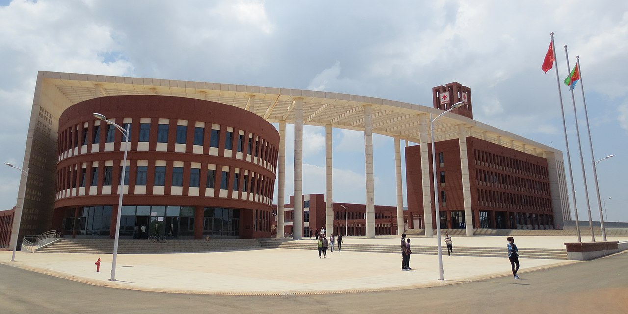
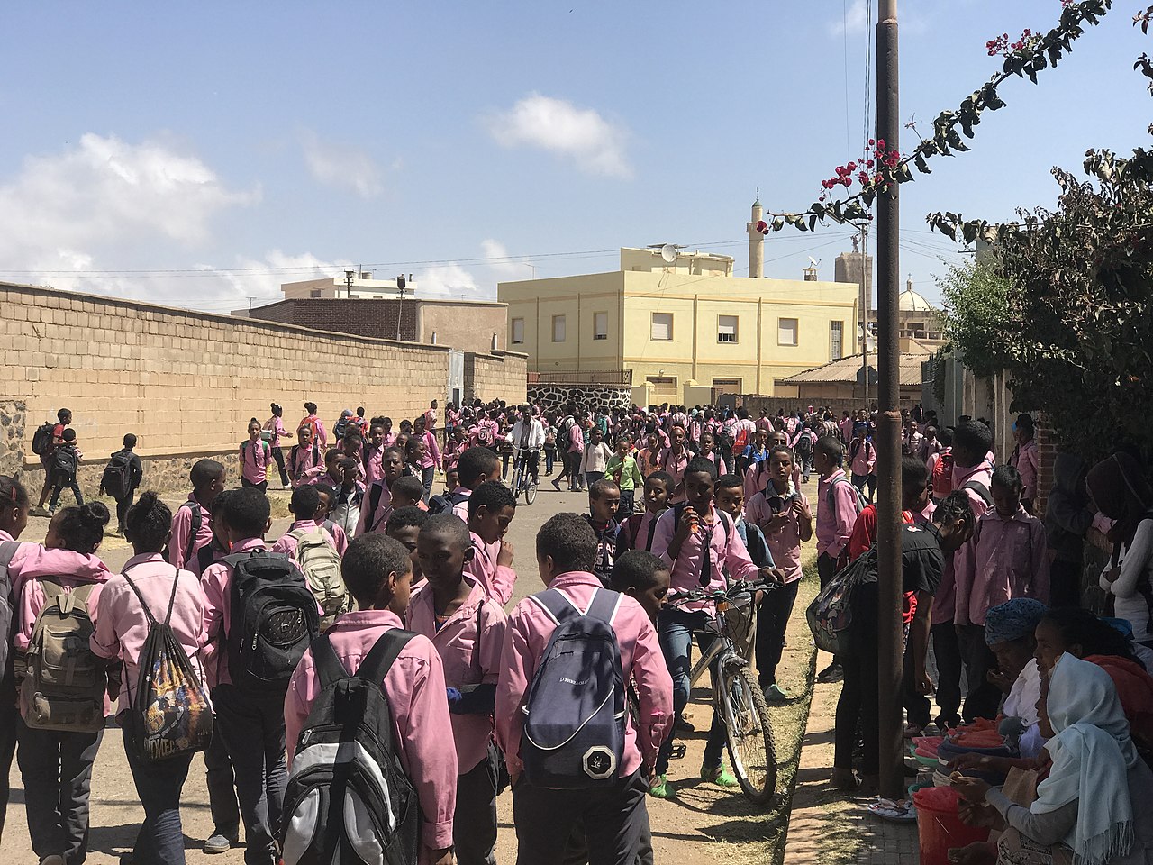
Education
Since independence, great progress has been made in the education sector: Literacy levels for people aged 15-24 were among the highest in sub-Saharan Africa in 2015 at 93% (2002: 78%).
Formally, school attendance is compulsory for children between the ages of 7 and 13, but only between 39 and 57 percent of those of compulsory school age attend primary school, and only around 21 percent attend secondary school. The schools are poorly equipped, with average class sizes of 63 (primary schools) and 97 (secondary schools) pupils per class. Girls are clearly disadvantaged. The proportion of illiterates is 30 percent.
Health
Health care is largely financed by the state and is free of charge for people with a poverty certificate.
Life expectancy is estimated at 63.4 years in 2010-2015. The fertility rate was 4.7 children per woman in 2012. The infant mortality rate is 74 per 1000 live births, ranking Eritrea 51st in the world. Maternal mortality was reduced by 75% between 1990 and 2013.
In 2002, almost 89% of women between the ages of 15 and 49 were still affected by female genital mutilation, compared to 94.5% in 1995. The success of the educational work was more clearly demonstrated by the prevalence among daughters, which was also surveyed in 2002, ranging from 40% to 67.5%, depending on the level of education of the mothers, with an average of 62.5%. On 31 March 2007, a legal ban on female circumcision came into force.
Development of life expectancy
Period
Life expectancy
(years)
Period
Life expectancy
(years)
1950–1955
34,1
1985–1990
48,7
1955–1960
36,7
1990–1995
50,8
1960–1965
40,1
1995–2000
54,0
1965–1970
42,1
2000–2005
56,7
1970–1975
44,1
2005–2010
60,7
1975–1980
45,9
2010–2015
63,4
1980–1985
47,3
Source: UN
Media
See also: Freedom of the press in Eritrea
Eritrea's media is state-run. There is the newspaper New Eritrea (ሓዳስ ኤርትራ Ḥaddas Erətra = ارتريا الحديثة Iritriya 'l-ḥadīṯa = ኤሪትርየ ሐዳስ Eritrəya ḥaddas), the radio stations Voice of the Masses (ድምጺ ሓፋሽ Dəmṣi ḥaffaš = صوت الجماهير Ṣaut al-ǧamāhīr), Zara FM and Radio Numa, and the television station ERi-TV.