
The Fylde: coastal plain and peninsula of western Lancashire
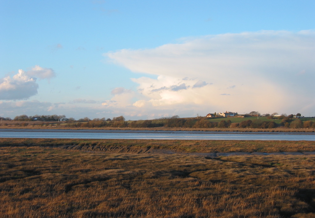
The Fylde is a low-lying coastal plain in western Lancashire, England. This largely agricultural and urban peninsula is bounded by Morecambe Bay, the Ribble estuary, the Irish Sea and the Bowland hills.
Overview
The Fylde is a broad, flat coastal plain in western Lancashire, England. Roughly a 13-mile (20-kilometre) square-shaped peninsula, it forms a distinct landscape between major tidal estuaries and the Irish Sea. The name is traditionally connected with open country; historically the area has been farmed, settled and used for seaside resort development.
Image gallery
3 Images

Geography and boundaries
The Fylde is bordered to the north by Morecambe Bay, a broad tidal bay; to the south by the tidal waters of the Ribble estuary; to the west by the Irish Sea; and to the east by the rising ground of the Bowland hills. The eastern margin lies close to the national motorway network, with the M6 motorway running near the transition to higher ground. These limits create a discernible coastal plain with marshes, dunes and reclaimed agricultural land.
Landscape, soils and land use
Much of the Fylde consists of low-lying agricultural fields, former salt marshes and peatlands, overlaid in places by glacial deposits and coastal sands. Coastal dunes and beach systems fringe parts of the western shore, while inland areas support intensive mixed farming. Urban development is concentrated along the coast where tourism and seaside towns have expanded.
Towns, economy and tourism
Significant settlements on the Fylde include the major seaside resort of Blackpool and neighbouring towns such as Lytham St Annes, Fleetwood and several market towns and villages inland. The local economy combines agriculture, tourism, light industry and services; Blackpool, in particular, has long been a focal point for visitors and entertainment, while other communities balance coastal leisure with residential and commuter roles.
Ecology and conservation
The tidal shores of Morecambe Bay and the Ribble estuary create important intertidal habitats for wading birds and marine life. Salt marshes, mudflats and dune systems support diverse plant and bird communities and have attracted conservation measures and local nature reserves. Parts of the coast are sensitive to erosion and changing sea levels, so coastal management and habitat protection are ongoing concerns.
History and transport
Human activity on the Fylde has long reflected its accessible plains and coastal position: farming, fishing and later seaside leisure shaped settlement patterns. Transport links by road and rail connect the peninsula to the rest of Lancashire and beyond; the proximity of the M6 motorway and coastal rail routes has influenced commuting and tourism. Administratively the Fylde lies within Lancashire and is often referenced in place names and local government districts.
Notable facts and distinctions
- The Fylde is a named geographic unit used in local planning and cultural identity.
- Its nearly square form and clear tidal boundaries make it a recognizable peninsula within north-west England.
- Conservation, coastal protection and sustainable development are key themes for the area’s future.
For maps and detailed local information consult regional guides and planning documents; online resources and local authorities provide further context and current initiatives.
Morecambe Bay resource | Lancashire overview | England regional info | Peninsulas and coastal landforms | Irish Sea environment | Transport and motorways
Related articles
Author
AlegsaOnline.com The Fylde: coastal plain and peninsula of western Lancashire Leandro Alegsa
URL: https://en.alegsaonline.com/art/98028