Scandinavian Mountains
Mountain range spanning the Scandinavian Peninsula, noted for fjords, glaciers and high peaks. Covers Norway, Sweden and parts of Finland; important for ecology, culture, hydroelectric power and recreation.
Overview
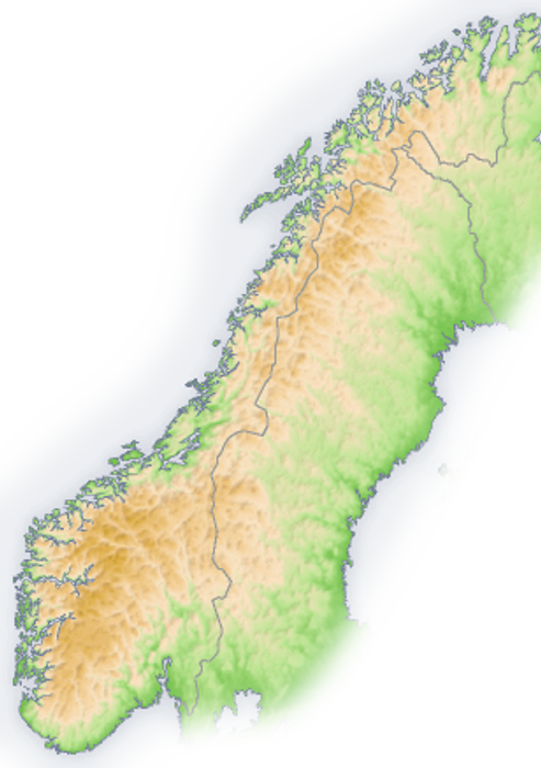
The Scandinavian Mountains form the principal highland spine of the Scandinavian Peninsula and extend roughly north–south across Norway and Sweden, with a small extension into Finland. The range shapes the region’s climate and waterways: its steep western escarpments descend to the North Sea and the Norwegian Sea and give rise to the deep, glacially carved fjords that define much of Norway’s coastline. For a basic geographic reference, see the peninsula map here and regional sea connections here and here.
Image gallery
10 Images


Geology and formation
These mountains are not a young fold range like the Alps; their present form reflects a long history of uplift, erosion and repeated glaciation. Ancient Precambrian bedrock was raised and dissected by tectonic forces and then sculpted during multiple ice ages. The west-facing cliffs and fjords are the product of glacial erosion and subsequent sea-level changes. For geological summaries and field guides consult resources such as regional glacial studies and continental reconstructions here.
Landscape, ice and ecology
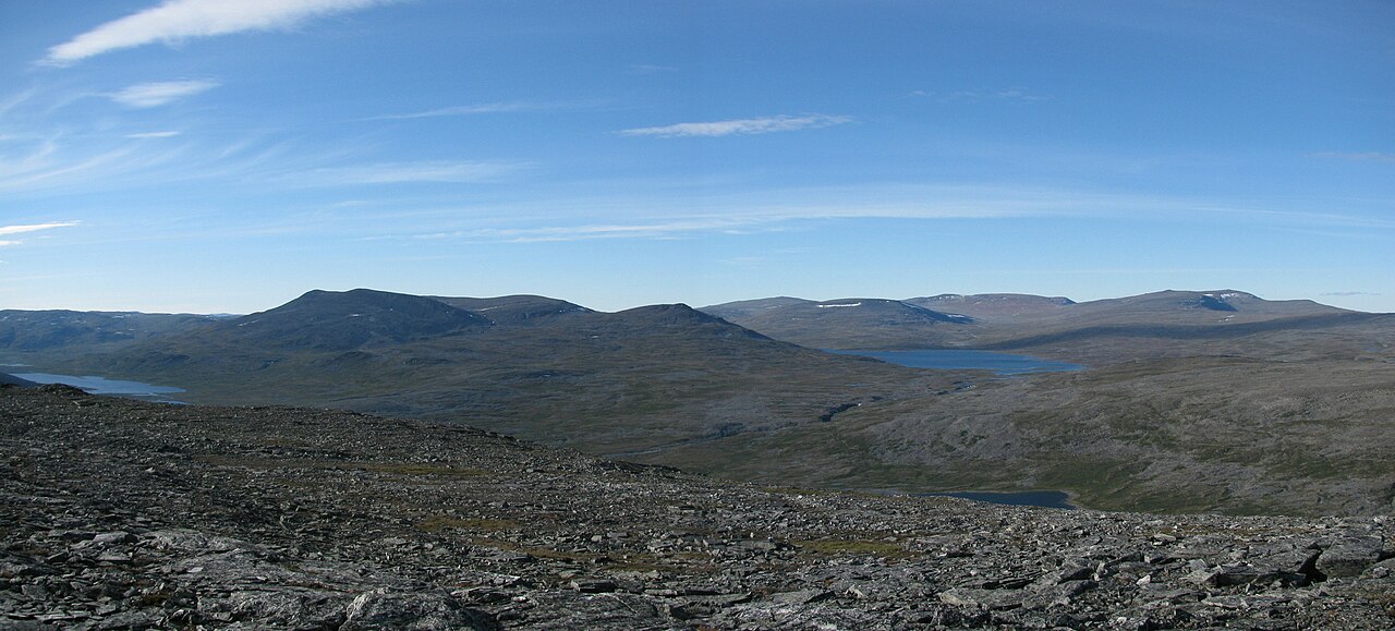
The range includes rugged peaks, broad plateaus, deep valleys and extensive icefields and glaciers fed by Arctic and North Atlantic influences. Large glaciers and persistent snowfields remain at higher elevations, especially in the north and west. Vegetation zones change with altitude and latitude: boreal forests on lower slopes give way to alpine tundra and lichen-dominated summits. The mountains support distinctive wildlife and plant communities adapted to cold, nutrient-poor conditions and are important for migratory birds and reindeer herding. Further ecological overviews are available here and climate interactions are discussed here.
Human use and cultural significance
Human communities have long used the mountains for subsistence and transport. Indigenous Sámi peoples practice reindeer husbandry across parts of the uplands, and farming and fishing communities occupy sheltered valleys and coastal inlets. In modern times the range is significant for hydroelectric power production, freshwater storage, and timber harvesting in lower zones. It is also a major destination for outdoor recreation—hiking, skiing, mountaineering and fishing draw visitors year-round. Cultural and tourism information can be found here and practical visitor guidance here.
Notable peaks and features
- Galdhøpiggen (southern Norway) — the highest peak in the range, rising to about 2,469 m.
- Kebnekaise (northern Sweden) — the highest point in Sweden, reaching roughly 2,104 m.
- Halti (on the Finland–Norway border area) — the highest point in Finland at approximately 1,324 m; the highest Finnish mountain summit is modest compared with the Norwegian peaks.
These summits are representative rather than exhaustive: many other massifs, passes and plateaus contribute to the range’s complex topography. The presence of glaciers and permanent snow has important effects on river regimes, sediment transport and coastal ecosystems; for glacier inventories and monitoring data see glacier resources.
Distinctive facts and modern challenges
The Scandinavian Mountains create some of Europe’s most dramatic fjord landscapes, provide habitat for specialized Arctic and alpine species, and shape local weather patterns. Contemporary concerns include glacier retreat, changing snow regimes, land use pressures from tourism and energy development, and the need to balance economic uses with conservation. For planning, conservation measures and further reading consult national authorities and regional studies available through the links above.
Related articles
Author
AlegsaOnline.com Scandinavian Mountains Leandro Alegsa
URL: https://en.alegsaonline.com/art/87764
Sources
- ne.se : "Galdhøpiggen"
- ne.se : "fjällkedjan"