Scarp (landform): escarpments, fault scarps and steep slopes
A scarp is a steep slope or cliff formed by erosion, faulting or human activity. This article explains types, formation, hazards, uses, and notable examples of scarps and escarpments.
Overview
A scarp is a steep slope, cliff or abrupt change in slope in the landscape. In geology and geography the term covers a range of features from long escarpments that separate plateaus and lowlands to isolated fault scarps created by single earthquakes. In historical military use, scarp denotes the inner slope of a ditch around a fort and is paired with the counterscarp. For technical background see scarp (geology) and related geographic descriptions at regional resources.
Image gallery
5 Images


Formation and characteristics
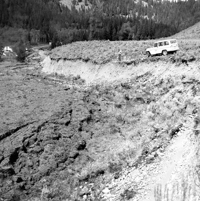
Scarps form by several distinct processes. Tectonic faulting can displace ground vertically, producing a relatively fresh, linear fault scarp. Long-term erosion and differential weathering can carve an escarpment at the edge of uplifted terrain. Coastal processes erode shorelines to form sea cliffs and coastal scarps. Man-made cuts, quarries and road excavations also create artificial scarps. Characteristics such as slope angle, height, continuity and bedrock exposure vary widely and influence soil development, drainage and vegetation patterns.
Types and distinctions
- Fault scarp — a steep face formed by displacement along a fault during seismic events.
- Erosional escarpment — a long slope formed where resistant rock overlies softer strata, producing a scarp retreating inland over time.
- Coastal scarp / cliff — produced by wave attack and marine erosion at shorelines.
- Artificial scarp — excavated slopes from mining, construction or roadworks.
Human significance and hazards
Scarps shape human activity: they form natural boundaries, influence routes for roads and railways, create scenic landscapes and host specific ecosystems. They can also pose hazards. Fresh fault scarps mark seismic rupture and may indicate active faults; steep scarps are prone to rockfall and landsliding, especially when undermined by water or human excavation. Engineers assess scarp stability when siting infrastructure and when planning slope reinforcement or drainage control.
Notable examples and further reading
Well-known escarpments include the Niagara Escarpment in North America and the Great Escarpment systems that border elevated interiors in several continents. Cuestas and cuesta-like scarps are common where gently tilted sedimentary layers produce asymmetric ridges. For regional lists, maps and technical descriptions consult geological and geographic sources using the links above: geology overview and geography resources.
Understanding scarps aids interpretation of landscape history, assessment of natural hazards and conservation of distinctive landforms. Their variety—tectonic, erosional, coastal or artificial—makes the term broadly useful across earth sciences and practical land-use planning.
Related articles
Author
AlegsaOnline.com Scarp (landform): escarpments, fault scarps and steep slopes Leandro Alegsa
URL: https://en.alegsaonline.com/art/87801
Sources
- tec.army.mil : Summary: Escarpments
- merriam-webster.com : scarp - Definition from the Merriam-Webster Online Dictionary