Randstad (Netherlands): overview of the Dutch conurbation
The Randstad is the densely populated conurbation in the western Netherlands that includes Amsterdam, Rotterdam, The Hague and Utrecht. This article covers its geography, history, economy, transport and planning.
Randstad refers to the large, polycentric urban region in the western part of the Netherlands. The term is commonly used to describe a ring-like cluster of cities, towns and suburbs that together form one of Europe's most concentrated economic and population centers. The area spans multiple provinces and contains a mix of historic centres, post-war suburbs and modern infrastructure.
Image gallery
10 Images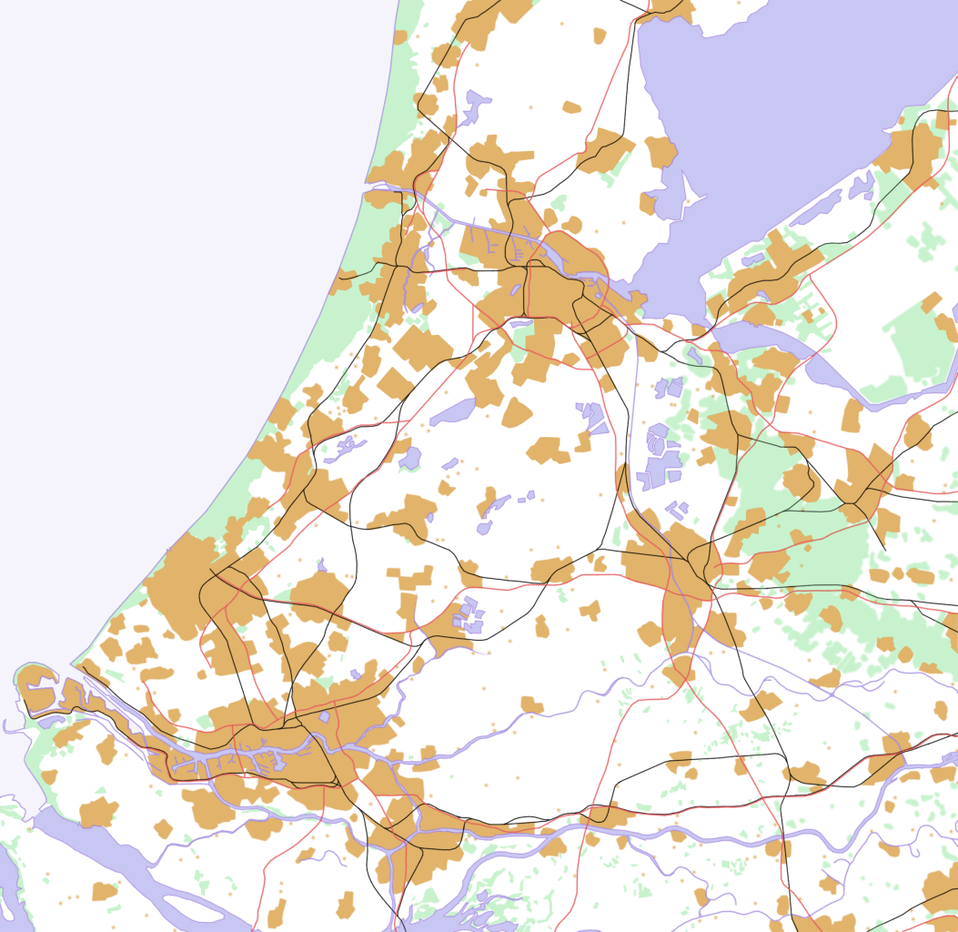


Geography and composition
The Randstad crosses provincial boundaries rather than aligning with a single administrative region. It includes parts of North Holland, South Holland, Flevoland and Utrecht. The urban fabric links a number of major cities, smaller municipalities and commuter towns. Although the built-up areas are contiguous in places, there remain lower-density corridors and green spaces within the ring.
Origins of the name and concept
The label Randstad, literally meaning "rim city" or "edge city" in Dutch, was popularized in the twentieth century. The name is traditionally attributed to Albert Plesman, who observed from the air that Dutch cities form a rough semicircle or ring around a central, more rural zone. Planners and geographers adopted the idea to discuss metropolitan coordination across municipal and provincial borders.
Population, economy and transport
As the country's demographic and economic core, the Randstad contains a substantial share of the Netherlands' inhabitants and businesses. It hosts major international transport facilities and economic clusters: the region includes large ports, important airports and extensive rail and road networks that facilitate domestic commuting and international trade. The area supports diverse sectors such as finance, logistics, creative industries and advanced manufacturing.
Urban structure, distances and the Groene Hart
The Randstad is not a single continuous metropolis but a network of urban cores separated by belts of lower-density land. Distances between principal cities vary; for example, some city pairs are about 26 kilometres apart while others are nearer to 77 kilometres. At the heart of the ring lies the Groene Hart, a central green area of agricultural land, wetlands and smaller towns that acts as a landscape buffer and a focus for regional conservation and recreation.
Major cities and municipalities
Key urban centres commonly associated with the Randstad include:
- Amsterdam — the national capital and cultural hub;
- Rotterdam — a major port city with extensive logistics and industry;
- Den Haag (The Hague) — seat of government and international institutions;
- Utrecht — a central transport junction and historic city;
- Haarlem, Leiden, Delft, Dordrecht, Hilversum, Almere and other towns that contribute to the region's diversity.
Planning challenges and notable facts
Managing the Randstad requires cross-jurisdictional cooperation to address housing demand, commuter flows, environmental protection and economic development. Planners balance the pressure to build more homes and infrastructure against the desire to protect the Groene Hart and preserve local identities. The Randstad remains a distinct example of a multi-centre metropolitan area where coordination among cities, provinces and national agencies shapes long-term sustainability and growth.
Related articles
Author
AlegsaOnline.com Randstad (Netherlands): overview of the Dutch conurbation Leandro Alegsa
URL: https://en.alegsaonline.com/art/81124