Netherlands (Kingdom of the Netherlands)
Overview of the Netherlands: geography, government, history, culture, economy and notable facts about this low-lying Western European country with Caribbean ties.
Overview
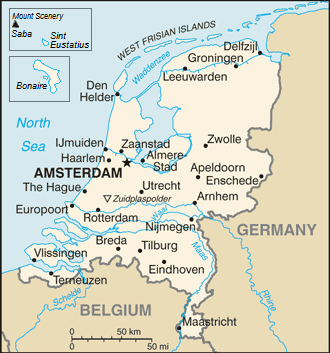
The Netherlands is a low-lying country in northwestern Europe and a constituent part of the Kingdom of the Netherlands. While most of its territory lies in Western Europe, the kingdom has territories in the Caribbean, so the realm has a transatlantic character. More than 17 million people live in the European part of the country, concentrated in a dense urban and agricultural landscape. The Dutch-language name is Nederland and residents are commonly called the Dutch.
Image gallery
7 Images


Geography and environment
The Netherlands borders the North Sea to the north and west and shares land borders with Germany to the east and Belgium to the south. Large parts of the country are at or below sea level; a system of dikes, canals and reclaimed polders has shaped its coastline and interior for centuries. Major rivers such as the Rhine, Meuse and Scheldt form important waterways and fertile river deltas. The country's compact size and flat terrain have encouraged dense transport links, cycling infrastructure and intensive agriculture.
Government, law and international role
The Netherlands is a constitutional monarchy with a parliamentary system. The capital is Amsterdam, while the seat of government, many ministries and numerous international courts are in The Hague. The country is a founding member of the European project and participates actively in NATO, the European Union and international judicial institutions. The Dutch legal and diplomatic presence is prominent in The Hague, which hosts organizations addressing international law and dispute resolution.
History and development
The territory now called the Netherlands has a long history of settlement, trade and maritime activity. Emerging from the medieval Low Countries, the region rose as a major commercial and cultural power in the 17th century — often called the Dutch Golden Age — when trade, shipping and the arts flourished. Subsequent centuries brought industrialization, political reform and recovery from wartime occupation. In the modern era the Netherlands developed a prosperous, open economy and progressive social policies.
Economy, society and culture
The Dutch economy is diversified and trade-oriented, with major ports, advanced manufacturing, high-value agriculture and services. Rotterdam is one of Europe’s busiest harbors and a logistics hub. Socially, the Netherlands is characterized by strong urbanization, high levels of education and significant international connections. Dutch cultural contributions include painters from the Golden Age to modern masters, distinctive architecture, design and a global reputation for tolerance on issues such as civil liberties and social policy.
Key facts and distinctions
- Language: Dutch is the official language; regional languages such as Frisian have recognition in parts of the country. Dutch language also appears in communities abroad.
- Administrative divisions: The European country is divided into provinces that coordinate regional planning and services. Western Europe hosts most of the population.
- International links: The Kingdom includes Caribbean ties and relationships with other constituent countries and public bodies. See notes on the Kingdom and its overseas parts for context.
- Cities: Besides Amsterdam and The Hague, major urban centers include Rotterdam, Utrecht and Eindhoven, each with distinct economic profiles. European transport and trade corridors connect these nodes.
For further reading on geography, politics and culture consult resources focused on national statistics, historical overviews and international institutions. Additional context is available through national and regional portals, as well as international organizations. See general country profiles and official sources for the most current data and specific administrative details (Caribbean territories, North Sea, Germany, Belgium, European Union).
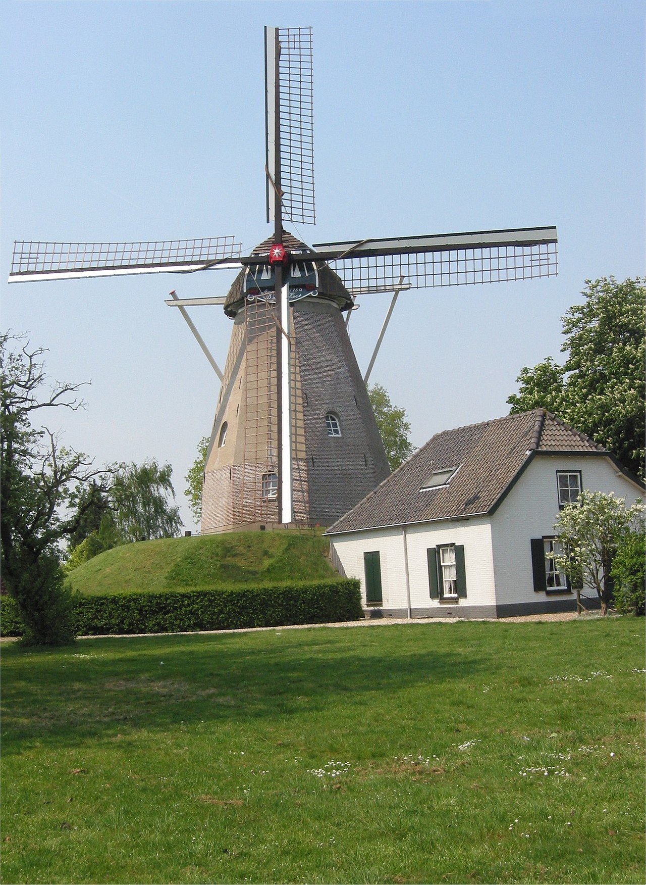
Note: the Netherlands often figures in comparative discussions about land reclamation, water management and urban planning. Visitors frequently observe cycling culture, windmills and tulip fields, which are emblematic but do not alone define a modern and diverse society that spans urban innovation and rural productivity. For diplomatic and legal matters the country remains influential, partly because of institutions hosted in The Hague and long-standing commercial networks linking Europe and beyond. Learn more through official and scholarly channels.
Country name
The official name of the country in Dutch is Nederland. This is also the name that is taken for granted in the colloquial language for Dutch people. In German, however, the country is called "Netherlands" (plural); in German colloquial speech one often says "Holland". The name "Holland" refers to a former county in the west of the Netherlands. In 1815, the Kingdom of the Netherlands was founded. Holland was initially a province until 1843, when it was divided into the provinces of Noord-Holland (capital Haarlem) and Zuid-Holland (capital The Hague).
In Dutch, the term Holland or Dutch by all means is occasionally used ironically or to emphasize Dutch folkways. In football, the self-designation is also Holland, for example in the battle cry Hup Holland Hup. The Dutch tourism industry uses the internationally better known Holland in marketing in English, German and other languages.
However, in 2019, a government and business roundtable decided that the country should present itself as the Netherlands. The fear is that the term Holland will be associated with clichés such as tulips and windmills, while the country prefers to see itself as modern and cosmopolitan. They also want to divert the flow of visitors to the other areas and thus relieve the capital Amsterdam.
The country name Netherlands (plural) derives from history. At the end of the Middle Ages, the Netherlands were part of the dominion of the House of Burgundy. In the 15th century, under Charles the Bold, their lands were divided into the upper lands (the Duchy and the Free County of Burgundy and tributary lands) and the lower lands (Flanders, Artois with part of Picardy, Brabant, Holland, Luxembourg, etc.). In 1482 the Burgundian inheritance passed to the House of Habsburg. At that time, the hereditary lands were already divided into Lower, Inner and Upper Austria (around Vienna, Graz and Innsbruck), the coastal lands (on the Adriatic) and the foothills (on the Upper Rhine). Thus the designation Netherlands, Burgundian Netherlands or Habsburg Netherlands (initially Spanish Netherlands, since 1714 Austrian Netherlands) arose somewhat consistently. (The Burgundian Oberland - the duchy around Dijon, which had always been outside the imperial borders, i.e. today's Bourgogne region - was lost to France in 1493, as was the Free County around Besançon, today's Franche-Comté, in 1678).
In Dutch, the historical regions are also called de Lage Landen, i.e. the low-lying or low-lying lands, as there are no mountains and few elevations in the Netherlands. The northern Dutch provinces of the Union of Utrecht (Holland, Zeeland, Utrecht, Gelderland, Overijssel, Groningen and Fryslân) declared themselves independent from the sovereign Philip II of Spain on 26 July 1581. Independence from the Holy Roman Empire was proclaimed in the treaties of the Peace of Westphalia in 1648, and the territory roughly corresponded to the later Netherlands. The southern part of the territory, including Flanders, however, remained with the Empire; later it became the state of Belgium. One spoke then of the northern and the southern Netherlands.
The Congress of Vienna united north and south as an independent state Koninkrijk der Nederlanden once again for a short time. However, as early as 1830, the southern Netherlands declared itself independent under the name of Belgium. Belgica is the name of an ancient Roman province; since the Renaissance, the term has been used as the Latin name of the Netherlands, including its northern provinces.
In Middle Dutch, the adjectives dietsc (corresponding to German deutsch) denoted the Dutchlanguage. This gave rise to the English term Dutch.
See also: Dutch (name) and German (etymology)
Batavia is an ancient Latin name for what is now the Netherlands, referring to the Germanic tribe of Batavians who settled near the Rhine delta. The Dutch also called the present capital of Indonesia, Jakarta, Batavia during their colonial period.
Geography
Landscape
About half of the country is less than one metre above sea level, and about a quarter of the country is below sea level (measured near Amsterdam; see picture on the right). The flat areas are usually protected from storm surges by dikes, which have a total length of about 3,000 km. The highest point in the Netherlands, at 877 metres, is Mount Scenery on the Caribbean island of Saba. The highest point on the mainland, the Vaalserberg in the extreme south, in the province of Limburg in the border triangle with Germany and Belgium, is 322.5 m above the Amsterdam water level.
Parts of the Netherlands, such as almost the entire province of Flevoland, were reclaimed from the sea by land reclamation. They are called polders (on the German North Sea coast Koog or Groden). The largest land reclamation project is associated with the Zuiderzee works. In 1932 the 29 km long final dike was completed, which separated the Zuiderzee sea bay from the North Sea. Several freshwater lakes were created in the area of the former sea bay, of which the IJsselmeer makes up the largest part. Of the polders created, the Flevopolder is the largest. It is (depending on the calculation) the largest artificial island in the world.
The most important rivers in the Netherlands (de grote rivieren - the big rivers) are the Rhine, Meuse and Scheldt. They divide the country into a north and a south The Rhine river comes from the German North Rhine-Westphalia and is a border river for a short distance. It soon branches out, thanks in part to canals that have been built to better distribute the water masses. The branches of the Rhine eventually join the Meuse, which comes from Belgium. Only in places are the rivers still called the Rhine, the Nederrijn or the Oude Rijn. The rivers shape the west of the Netherlands, the Rhine-Meuse delta. An important arm flows through Rotterdam and then at Hoek van Holland into the North Sea, other arms connect the rivers with Amsterdam and the IJsselmeer. Of the Scheldt, only its estuary lies north of Antwerp, Belgium, in the Netherlands.
The main wind direction is southwest, resulting in a temperate maritime climate with cool summers and mild winters. Especially in the west of the country, on the North Sea coast, the climate is more Atlantic (mild winters, cool summers). Towards the east, the Atlantic influence decreases somewhat, so that in the vicinity of the German border one can speak of a sub-Atlantic climate with somewhat colder winters (mild to moderately cold) and slightly warmer summers.
See also: Geology of the Netherlands and Flanders and Delta Works
Natural sights
- De Hollandse Biesbosch, a river and marsh landscape
- National Park Weerribben-Wieden
- The Hoge Veluwe and Veluwezoom National Parks in the Veluwe region
- The nature reserves on Texel
- Oostvaardersplassen, a nature development area that is now home to the largest herds of wild animals in Europe
- Reeuwijkse Plassen near Gouda
- Nieuwkoopse Plassen
- Schiermonnikoog
- The Deltawerke: protective weirs against storm surges, built after the storm surge of 1953
- De Meinweg National Park near Roermond in the province of Limburg


Questions and answers
Q: What is the Netherlands part of?
A: The Netherlands is part of the Kingdom of the Netherlands.
Q: Where is most of the Netherlands located?
A: Most of the Netherlands is located in Western Europe.
Q: How many people live in the Netherlands?
A: More than 17 million people live in the Netherlands.
Q: What countries border the European part of the Netherlands?
A: To the north and west, there is the North Sea; to the east, there is Germany; and to the south, there is Belgium.
Q: What organization did The Netherlands help found?
A: The Netherlands helped found the European Union.
Q: Who are people who live in The Netherland called? A: People who live in The Netherland are called "Dutch".
Q: What language do people speak in The Netherland? A: People in The Netherland speak Dutch.
Q:What are two cities that have important roles for government activities in The Netherland ? A:The official capital of The Netherland is Amsterdam and government activities take place mainly at The Hague.
Related articles
Author
AlegsaOnline.com Netherlands (Kingdom of the Netherlands) Leandro Alegsa
URL: https://en.alegsaonline.com/art/69270
Sources
- rijksoverheid.nl : "Welke erkende talen heeft Nederland? [[English]]"
- wetten.overheid.nl : "Wet gebruik Friese taal"
- wetten.overheid.nl : "Invoeringswet openbare lichamen Bonaire, Sint Eustatius en Saba"
- statline.cbs.nl : Official CBS website containing all Dutch demographic statistics
- cbs.nl : "Helft Nederlanders is kerkelijk of religieus"
- cbs.nl : "Population counter"
- imf.org : "Netherlands"
- appsso.eurostat.ec.europa.eu : "Gini coefficient of equivalised disposable income (source: SILC)"
- hdr.undp.org : "2016 Human Development Report"
- wetten.overheid.nl : "Wet geldstelsel BES"
- statline.cbs.nl : "Regionale Kerncijfers Nederland"
- statline.cbs.nl : "Bevolking per regio naar leeftijd, geslacht en burgerlijke staat"
- commons.wikimedia.org : Netherlands
- en.wikivoyage.org : Netherlands