
South Holland (Zuid-Holland): geography, cities, economy and history
South Holland (Zuid‑Holland) is a densely populated Dutch province on the North Sea coast, home to Rotterdam, The Hague, major ports, historic cities and extensive reclaimed land.
Overview
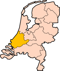
South Holland (Dutch: Zuid-Holland) is a province in the western Netherlands along the North Sea coast. It is one of the country's most densely populated and urbanized regions and combines major ports, government institutions, historic towns and intensive agriculture. The province had roughly 3.7 million inhabitants in the early 2020s.
Image gallery
10 Images



Geography and environment
South Holland stretches across coastal dunes, river deltas and reclaimed lowlands (polders). Important waterways — including branches of the Rhine and Meuse — cross the province before flowing to the sea. Much of the landscape is below sea level and depends on an intricate system of dikes, pumps and storm-surge defenses such as the post-war Delta Works for flood protection.
Major cities and population
The province contains several internationally known cities. Rotterdam is an industrial and port center with one of the busiest seaports in the world. The Hague is the seat of the Dutch government and many international organizations and courts. Other notable towns include Leiden, Delft and Gouda, each with their own historic centers, universities, and cultural heritage.
Economy and transport
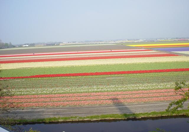
South Holland's economy rests on a mix of shipping and logistics, manufacturing, high technology, services, education and horticulture. The Port of Rotterdam links the region to global maritime trade. Extensive road, rail and inland waterway networks connect the province internally and to the rest of Europe. Intensive greenhouse horticulture and floriculture are important in the more rural parts.
History and water management
Human settlement and land reclamation in the area go back centuries: farms, towns and polder systems were developed to manage flood risk and create agricultural land. During the Dutch Golden Age (17th century) many South Holland towns prospered as centers of trade, science and art. Flood control, engineering and spatial planning have remained central themes in the province's development.
Culture, education and notable facts
South Holland hosts major museums, historic architecture and prominent universities that attract students and researchers. The mix of urban ports and preserved historic towns gives the province a varied cultural profile. The Hague's role as a national and international governance center coexists with Rotterdam's global trade orientation and the region's extensive greenhouses and coastal nature reserves.
Further reading and resources
Questions and answers
Q: What is South Holland?
A: South Holland is a province in the west of the Netherlands.
Q: How is it referred to in Dutch?
A: In Dutch, it is called Zuid-Holland.
Q: What provinces surround South Holland?
A: South Holland is surrounded by North Sea, North Holland, Utrecht, Gelderland, North Brabant and Zeeland.
Q: How many people live in South Holland (2021)?
A: About 3,726,000 people are living in South Holland (2021).
Q: Where is South Holland located?
A: South Holland is located in the west of the Netherlands.
Q: What sea borders South Holland?
A: The North Sea borders South Holland.
Q: What other provinces border South Holland? A: Other provinces that border South Hollands are North Hollands, Utrecht, Gelderland, North Brabant and Zeeland.
Related articles
Author
AlegsaOnline.com South Holland (Zuid-Holland): geography, cities, economy and history Leandro Alegsa
URL: https://en.alegsaonline.com/art/92163