North Luzon Expressway (NLEX): Route, History, and Importance
Controlled-access toll expressway linking Metro Manila to Central and Northern Luzon; overview of route, history, features, and its role in Philippine transport.
Overview
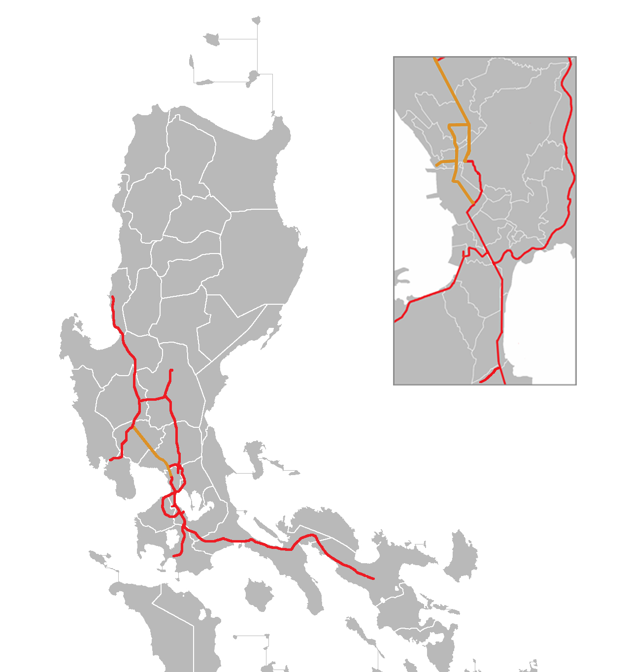
The North Luzon Expressway, commonly abbreviated as NLEX or NLEx, is a major controlled-access highway in the Philippines. It serves as the principal high-speed road link from the National Capital Region (Metro Manila) to the northern provinces of the island of Luzon. Designed primarily for fast, long-distance vehicular travel, the expressway supports both private and commercial transport and functions as an arterial corridor for people and goods moving between the capital region and the central and northern parts of the country.
Image gallery
10 Images


Route and characteristics
The expressway begins at a major interchange in Quezon City, connecting with local thoroughfares such as Epifanio de los Santos Avenue (EDSA). From there it runs northward through urban and peri-urban areas, passing close to communities like Caloocan and Valenzuela, before entering the provinces. Its principal alignment traverses sections of Bulacan and Pampanga, and terminates where it connects with other major northbound highways.
Lane configurations vary along the corridor, with sections built to four lanes and others expanded to six or eight lanes to accommodate traffic volumes. The roadway is largely tolled and includes interchanges, service areas, and safety features typical of modern expressways: grade separations, limited entry and exit points, emergency lanes, and traffic monitoring systems.
History and development
Conceived to improve access out of Metro Manila, the expressway was constructed in phases to respond to rising transport demand and regional economic growth. Over time, upgrades and expansions have been implemented to reduce congestion and improve safety, including pavement rehabilitation, widening projects, and the addition of new toll plazas and ramps. Management and maintenance have alternated between public and private operators under different arrangements common to infrastructure projects in the country.
Uses, importance and economic role
NLEX is a vital logistics artery: it shortens travel time between the capital and industrial, agricultural, and commercial centers in Central and Northern Luzon. Freight trucks, buses, and private cars routinely use the expressway for both intercity travel and local commuting between suburban areas and Metro Manila. The corridor supports tourism, trade, and supply chains by offering a more predictable travel time compared with conventional highways.
Design features and traveler information
- Typical cross-section: multi-lane divided carriageways with shoulders and median barriers.
- Tolling: electronic toll collection systems and several toll plazas along the route.
- Facilities: rest/service areas, emergency call boxes, and traffic enforcement presence.
- Interchanges: configured to distribute traffic into adjacent cities and provincial roads.
Notable facts and distinctions
Because it links a major metropolitan area to outlying provinces, the expressway has been central to urban expansion patterns and regional connectivity. It is a focus for future improvements such as capacity enhancement and integration with other transport projects. Travelers and planners often compare NLEX with adjacent routes and alternative highways when assessing travel options in northern Luzon.
For additional operational details, route maps, toll schedules and service advisories, consult official transport and road operator sources or local government information pages. The expressway's role in national mobility continues to evolve as traffic demands and infrastructure investments change.
Related links: expressway standards, country context, Metro Manila transport, provincial networks, central region, Luzon island, Quezon City interchange, EDSA connection, Caloocan corridor, Valenzuela access, Bulacan segment, Pampanga segment.
Related articles
Author
AlegsaOnline.com North Luzon Expressway (NLEX): Route, History, and Importance Leandro Alegsa
URL: https://en.alegsaonline.com/art/70908