New Britain (Papua New Guinea)
New Britain is the largest island of the Bismarck Archipelago in Papua New Guinea, known for active volcanoes, World War II history, diverse cultures and economies based on agriculture, forestry and marine resources.
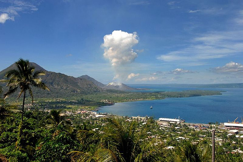
New Britain is the largest island in the Bismarck Archipelago and one of the major islands of Papua New Guinea. It lies to the east of the New Guinea mainland, separated by the Dampier Strait, and to the west of New Ireland by St. George's Channel. The island has a long, narrow shape with a rugged interior and several volcanic centers along its length. Principal urban centers include Rabaul (and the relocated township of Kokopo) and Kimbe.
Image gallery
9 Images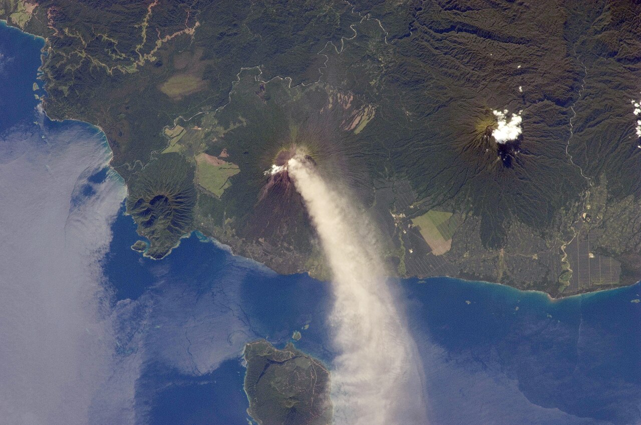


Geography and geology
New Britain forms part of a tectonically active region on the western edge of the Pacific "Ring of Fire." Volcanic activity has shaped much of the land, producing fertile soils and a landscape of calderas and cones. Coastal plains and mangrove swamps fringe many areas, while inland rainforests support high biodiversity. The island's position within the archipelago gives it important maritime routes and biologically rich coral reefs.
History and status
European contact and colonial administration brought name changes and new governance: the name New Britain reflects a period of German influence and was later administered under other colonial arrangements. During the Second World War Rabaul became a strategically important base and was occupied by Japanese forces; it remained a focal point of military operations in the southwest Pacific. After the war New Britain returned to civil administration and became part of the independent state of Papua New Guinea.
People, languages and culture
The island is home to a variety of indigenous communities speaking Austronesian and Papuan languages alongside Tok Pisin and English. In the Gazelle Peninsula the Tolai people are a culturally prominent group with distinct customary practices and social organization. Traditional subsistence activities — fishing, shifting cultivation and gardening — remain important, while contemporary life combines these with wage labour and plantation employment.
Economy, environment and uses
New Britain's economy draws on agriculture, forestry and fisheries. Plantation crops such as coconuts and oil palms are widely grown; timber and mineral resources have been exploited in places. The island's reefs and wrecks also attract recreational diving and tourism. Conservation concerns include rainforest clearance, logging impacts and the vulnerability of coastal ecosystems. Coral reefs and marine life are notable assets for both biodiversity and livelihoods.
Notable facts and travel
- Volcanic eruptions have periodically affected settlements — for example, eruptions around Rabaul forced the relocation of some administrative functions to nearby Kokopo.
- The wartime history of New Britain is visible in sunken ships, relics and memorial sites that interest historians and divers.
- Administratively, the island is divided into provinces and districts with local centres such as Kimbe serving as commercial hubs.
For further geographic and historical context, see summaries of the Bismarck Archipelago, the island's relationship to New Guinea, and materials on colonial-era naming after figures like Otto von Bismarck (Bismarck). General country and travel information is also available from national and regional sources (archipelago overview, Papua New Guinea).
Related articles
Author
AlegsaOnline.com New Britain (Papua New Guinea) Leandro Alegsa
URL: https://en.alegsaonline.com/art/69469