
Near South Side (Chicago)
One of Chicago’s 77 community areas, the Near South Side lies just south of the Loop on the lakefront. It includes museum campus sites, historic commercial corridors, evolving residential districts, and major civic venues.
Overview
The Near South Side is one of Chicago’s 77 official community areas, located in Cook County, Illinois, United States. It sits immediately south of the central business district known as the Loop and forms a transitional zone between downtown and the larger South Side.
Image gallery
10 Images


Boundaries and neighborhoods
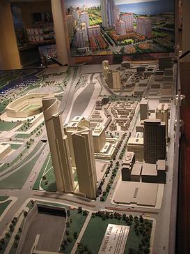
The community area is roughly bounded by Roosevelt Road on the north and 26th Street on the south. Its western edge follows the Chicago River for part of the boundary and then follows city streets such as Clark and stretches to the lake on the east, with Lake Michigan defining the waterfront side. Within these borders are several named neighborhoods and districts, including sections commonly called the South Loop, Printers Row (Printing House Row), and the Motor Row historic corridor.
Landmarks and institutions
- Lakefront cultural sites and parkland, including the cluster of museums and stadiums on or near the lakefront.
- Commercial historic districts formerly dominated by automobile showrooms and printing businesses; many buildings have been preserved or repurposed.
- Large convention and exhibition facilities and other civic venues near the lakeshore.
History and development
The Near South Side has shifted through phases of industrial, commercial, and institutional uses. In the late 19th and early 20th centuries parts of the area hosted printing houses and automobile dealerships. During the post‑industrial era many former commercial and warehouse structures were converted to lofts, galleries, and condominium developments. Redevelopment accelerated in the late 20th and early 21st centuries as demand for near‑downtown housing and lakefront amenities grew.
Transportation, land use and character
Because of its proximity to the Loop and the lake, the Near South Side is well served by arterial streets and public transit connecting to downtown. The mix of uses is varied: high‑density residential towers coexist with cultural institutions, historic low‑rise buildings, parks, and event spaces. This combination gives the neighborhood a hybrid character—residential at times, intensely civic during major events, and commercially active along key corridors.
Notable facts and distinctions
The Near South Side illustrates how central urban districts can evolve: from manufacturing and specialized retail to mixed‑use neighborhoods anchored by culture, recreation, and convention activity. Its lakefront location and adjacency to the Loop continue to make it a focal point for city planning, tourism, and residential growth.
For official maps, planning documents, and statistical profiles see municipal and county resources via local government portals: Cook County, Illinois, and city community area guides often link back to the Loop and waterfront references such as the Chicago River and Lake Michigan.
Related articles
Author
AlegsaOnline.com Near South Side (Chicago) Leandro Alegsa
URL: https://en.alegsaonline.com/art/68931