
Chicago River: history, course, engineering and cultural significance
The Chicago River is an engineered urban waterway running through Chicago. Noted for its branches, early 20th‑century flow reversal, and role linking the Great Lakes and the Mississippi watershed.
Overview
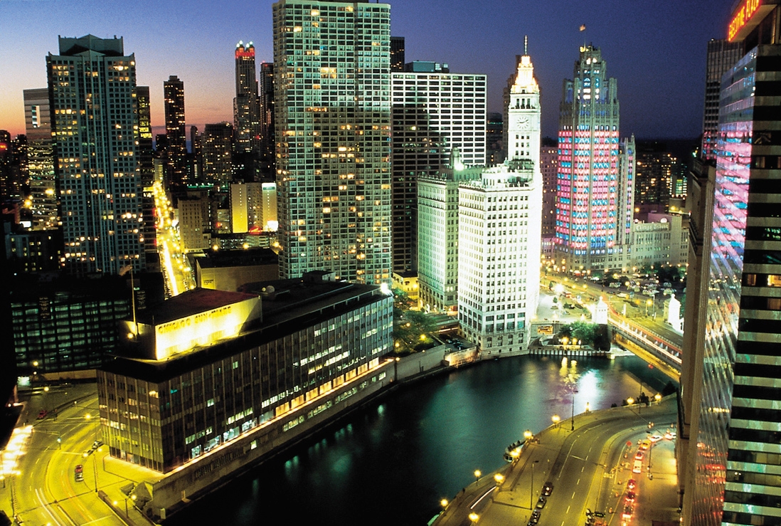
The Chicago River is an interconnected system of waterways that runs through the city of Chicago, Illinois, including the downtown Chicago Loop. Measured across its main channels and man‑made extensions, the system is often cited as about 156 miles (251 km) of waterways. It is best known for serving as a transportation, drainage and civic artery in a dense urban setting.
Image gallery
10 Images




Course and components
The river system comprises a main stem that flows through the central business district and two principal branches often called the North Branch and the South Branch, plus numerous canals and engineered cuts. Locks and canals connect it to Lake Michigan and, via the Chicago Sanitary and Ship Canal, to the larger Great Lakes and the Mississippi River system, permitting navigation and commercial traffic.
History and engineering
From the 19th century onward the river shaped Chicago's growth because it provided an inland water link between the Great Lakes and interior river systems. In the late 19th and early 20th centuries engineers constructed the Chicago Sanitary and Ship Canal and related works to address sanitation and navigation. Those projects famously altered the river's flow direction to move polluted water away from the lake that supplied the city's drinking water; the major reversal work was completed around 1900.
Uses and cultural role
Historically the Chicago River carried freight, industrial effluent and sewage; over time its role diversified. Today it supports commercial barge traffic, recreational boating, tour boats that highlight architecture, and public amenities such as the Chicago Riverwalk. The river is also a focus of civic rituals and celebrations—most famously the tradition of dyeing the river green each St. Patrick's Day.
Environmental change and restoration
Decades of industrialization degraded water quality, prompting large‑scale cleanup and habitat restoration in the late 20th and early 21st centuries. Modern efforts combine pollution control, combined‑sewer improvements, shoreline greening and wildlife habitat projects. These actions have improved water quality and made sections of the river more attractive for recreational use and urban development.
Notable facts and distinctions
- Engineered reversal: The Chicago River is widely noted for its early 20th‑century reversal by civil engineering to protect drinking water supplies.
- Urban waterway: It passes through the heart of a major American city and is integrated into streets, bridges and public spaces.
- Navigation link: Through canals and locks it connects Great Lakes shipping to inland river networks, shaping Chicago's role as a transportation hub.
For maps, navigation guidance and more historical context see local resources and municipal overviews maintained by the City of Chicago and regional authorities (Loop studies and planning pages provide details).
Related articles
Author
AlegsaOnline.com Chicago River: history, course, engineering and cultural significance Leandro Alegsa
URL: https://en.alegsaonline.com/art/19525
Sources
- chicagoriver.org : "About Friends of the Chicago River"
- suntimes.com : "Parades, music, festivals abound for St. Patrick's Day celebrations"
- doi.org : 10.1061/(ASCE)0733-9429(2007)133:12(1356)
- chipublib.org : "Municipal Flag of Chicago"
- dnr.illinois.gov : "Chicago River & North Shore Channel River Corridors & Wilmette Harbor"
- chicagotribune.com : "Chicago River is dyed blue for Cubs celebration"