Mount Kenya: Geography, Ecology, and Human Significance
Mount Kenya, a 5,199 m extinct volcano on the equator, is Kenya's highest peak and Africa's second tallest. The mountain is a protected park, a UNESCO site, and a center for biodiversity and mountaineering.
Overview — Mount Kenya rises to 5,199 metres (17,057 ft), making it the highest mountain in Kenya and the second-highest on the African continent. Its main massif sits almost on the equator, about 193 kilometres northeast of Nairobi. For concise official information see the national park page and for geographic context consult the location summary.
Image gallery
10 Images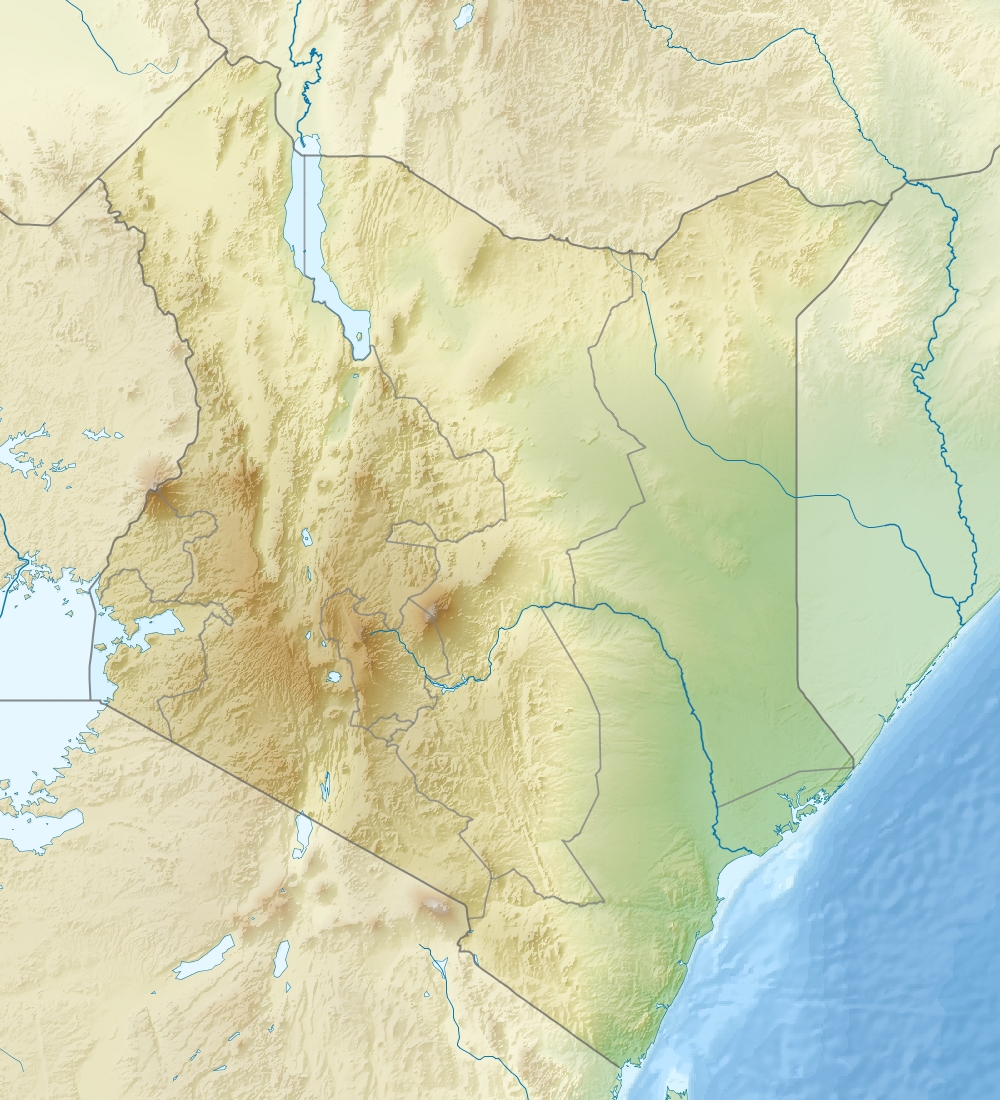


Peaks and physical features
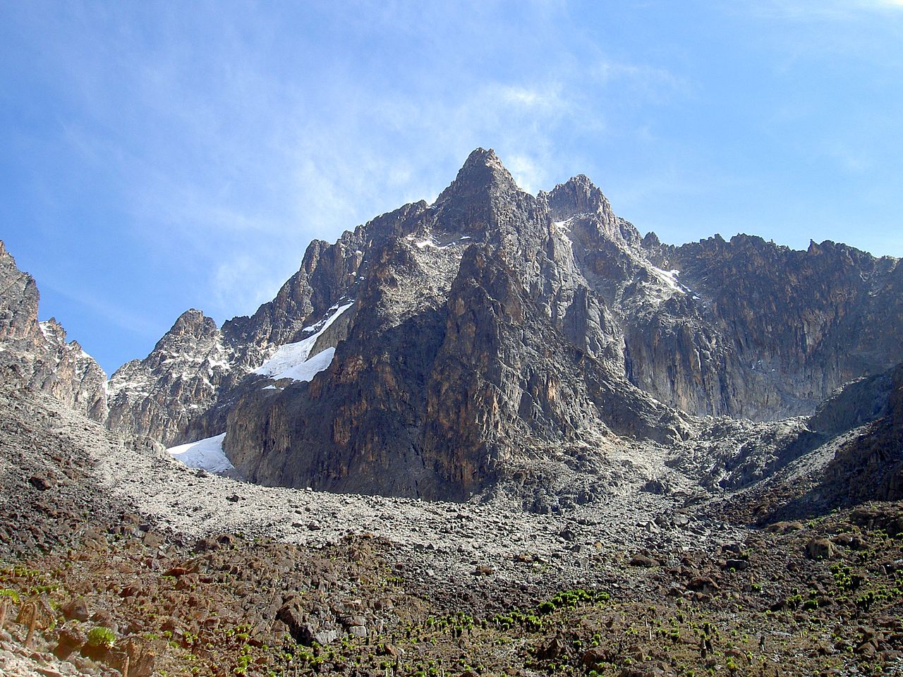
The summit area is a cluster of jagged peaks and ridges rather than a single cone. Notable summits include Batian and Nelion, which form steep rocky pinnacles near the top. Several high valleys and cirques descend from these summits toward lower forests and moorlands. More about its standing among African mountains is available at regional comparisons.
Geology and glaciers
Mount Kenya is the deeply eroded remnant of an ancient stratovolcano. Volcanic activity built the mountain millions of years ago; later glaciation and erosion carved the central peaks and valleys. Small glaciers and permanent ice patches still exist close to the summit but have been retreating in recent decades. A plain-language geology overview can be found at geology resources.
Ecology and conservation
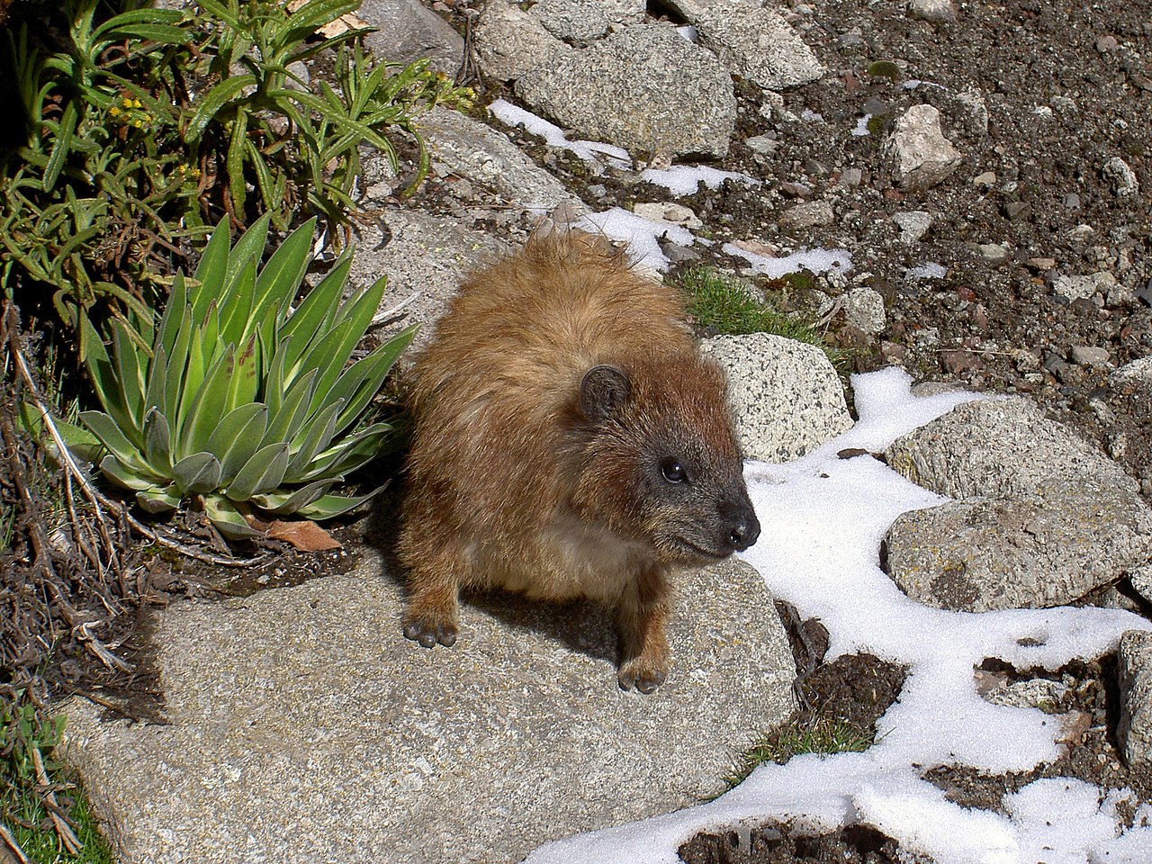
The mountain supports a sequence of vegetation zones from montane forest at lower elevations to bamboo and afro-alpine moorland higher up. Unique plants such as giant lobelias and senecios inhabit the high zones, while mammals, birds and rich insect communities occupy the forested slopes. Much of the area is protected as Mount Kenya National Park and a designated UNESCO World Heritage Site, recognized for its biodiversity and scenic value (UNESCO).
Cultural and historical notes
Local communities have long regarded the mountain as culturally significant; it features in oral traditions and ceremonies. European explorers and climbers began mapping and ascending its peaks in the late 19th and early 20th centuries. Conservation programs work with neighboring communities to balance traditional use, water resources, and tourism.
Recreation and access
Mount Kenya is a popular destination for trekkers and technical climbers. Several well-established routes approach the summit area, including Sirimon, Naro Moru and Chogoria, each offering different scenery and difficulty. Visits usually require permits and certified guides; practical route and permit information is available from park authorities and local operators (visitor services). For further reading on trips and logistics see park guidance and climbing resources.
Related articles
Author
AlegsaOnline.com Mount Kenya: Geography, Ecology, and Human Significance Leandro Alegsa
URL: https://en.alegsaonline.com/art/67047
Sources
- peaklist.org : "Africa Ultra-Prominences"
- ewpnet.com : "Mount Kenya Map Sample" · web.archive.org
- whc.unesco.org : Mount Kenya National Park/Natural Forest