Matsu Islands — a small archipelago (Lienchiang County) in the Taiwan Strait
The Matsu Islands are a small group of islands in the Taiwan Strait administered by the Republic of China as Lienchiang County (Fujian Province). Known for military history, Mazu temples, fishing and tourism.
Overview
The Matsu Islands are a compact archipelago in the Taiwan Strait, close to the southeastern coast of mainland China. Their local and formal Chinese names are often cited together: 馬祖列島 / 連江縣 and the romanized pronunciations appear as Mǎzǔ and Liánjiāng. Geographically they lie in the busy waters between Taiwan and the Chinese mainland, sometimes shown on regional maps as part of the island groups in the Taiwan Strait.
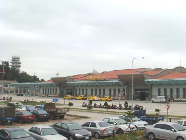
Image gallery
10 Images


Geography and composition
The group is commonly described in administrative terms as consisting of 19 principal islands and a number of smaller islets and rock outcrops. The terrain is generally rocky and exposed to strong sea winds; shorelines are a mix of steep cliffs and small harbors. Vegetation is limited by salt spray and wind, but the islands support small-scale agriculture, fishing harbors and clustered settlements.
Administration and political status
Administratively the Matsu Islands form Lienchiang County, governed by the Republic of China (ROC). Under ROC organization they are part of Fujian Province as defined by the island government (Fujian Province, ROC). This arrangement distinguishes them from other nearby territories and reflects the complex cross‑strait political context.
History and development
Historically the islands have been shaped by their coastal position: seafaring communities, temples dedicated to the sea goddess Mazu, and frequent contact with the Fujian mainland. In the 20th century they acquired strategic military importance and hosted significant garrisons during periods of cross‑strait tension. In recent decades military restrictions have relaxed and many former fortifications and landscapes have been adapted for civilian use and heritage tourism.
Economy, culture and transport
The economy blends fishing, small-scale farming, public services and growing tourism. Local culture reflects maritime traditions, with Mazu worship, temple festivals and Fuzhou-influenced dialect and cuisine. Transport connections include regular ferry services and local air links that connect residents and visitors to the main island of Taiwan and to nearby ports on the mainland when routes operate.
Notable features and distinctions
- Named after the sea goddess Mazu, whose temples remain focal points of community life.
- Often mentioned in discussions of cross‑strait geography because of their proximity to the Chinese coast and their administration by the ROC.
- Transitioning from a heavily militarized frontier to an area emphasizing cultural heritage and tourism.
For maps, historical context and current administrative details consult dedicated sources and regional overviews: see entries and resources linked here for further reading and verification of up-to-date transport and governance arrangements (map and location, local names, romanization). Additional official information about administration, services and travel may be available through county and national pages (Lienchiang County, ROC, Fujian Province).
Name
The islands are named after the Chinese mother deity Matsu, a popular deity among sailors and fishermen.
Communities
The part of Lienchang County administered by the Republic of China is divided into four rural communes (鄉 / 乡, Xiāng), which in turn consist of several islands, reefs and villages.
| Name |
| Ones. | ||
| Community of Nangan | 南竿鄉 / 南竿乡 | Nángān Xiāng | 10,6450 | 7663 |
| Nangan Island | 南竿島 / 南竿岛 | Nángān Dǎo | 10,4332 | - – |
| Huangguan Island | 黃官嶼 / 黄官屿 | Huángguān Yǔ | 00,1917 | - – |
| Liuquan Reef | 劉泉礁 / 刘泉礁 | Liúquán Jiāo | 00,0142 | - – |
| Beiquan Reef | 北泉礁 / 北泉礁 | Běiquán Jiāo | 00,0041 | - – |
| Xiejiao Reef | 鞋礁 | Xié Jiāo | 00,0018 | - – |
| Community of Beigan | 北竿鄉 / 北竿乡 | Běigān Xiāng | 08,9424 | 2425 |
| Beigan Island | 北竿島 / 北竿岛 | Běigān Dǎo | 06,4363 | - – |
| Daqin | 大坵 / 大丘 | Dàqiū | 00,5373 | - – |
| Xiaoqiu | 小坵 / 小丘 | Xiǎoqiū | 00,1604 | - – |
| Gaodeng | 高登 | Gāodēng | 01,3907 | - – |
| Wuming Island | 無名島 / 无名岛 | Wúmíng Dǎo | 00,0774 | - – |
| Qiaotou | 峭頭 / 峭头 | Qiàotóu | 00,0364 | - – |
| Jinyu Island | 進嶼 / 進屿 | Jìn Yǔ | 00,0311 | - – |
| Sanlian Island | 三連嶼 / 三连屿 | Sānlián Yǔ | 00,0254 | - – |
| Gui Island | 龜嶼 / 龟屿 | Guī Yǔ | 00,0034 | - – |
| Bangshan | 蚌山 | Bèngshān | 00,0594 | - – |
| Luoshan | 螺山 | Luóshān | 00,0488 | - – |
| Tiejian Island | 鐵尖島 / 铁尖岛 | Tiějiān Dǎo | 00,0098 | - – |
| Queshi | 鵲石 / 鹊石 | Quèshí | 00,0083 | - – |
| Hali | 蛤蜊 | Hálí | 00,0780 | - – |
| Zhongdao Island | 中島 / 中岛 | Zhōng Dǎo | 00,0193 | - – |
| Baimiao | 白廟 / 白庙 | Báimiào | 00,0188 | - – |
| Laoshu | 老鼠 | Lǎoshǔ | 00,0016 | - – |
| Community of Juguang | 莒光鄉 / 莒光乡 | Jǔguāng Xiāng | 05,2587 | 1618 |
| Dongju Island | 東莒島 / 东莒岛 | Dōngjǔ Dǎo | 02,6391 | - – |
| Xiju Island | 西莒島 / 西莒岛 | Xījǔ Dǎo | 02,3651 | - – |
| Xiniu Island | 犀牛嶼 / 犀牛屿 | Xīniú Yǔ | 00,0779 | - – |
| Dayu Island | 大嶼 / 大屿 | Dà Yǔ | 00,0113 | - – |
| Lin'ao | 林坳 | Línào | 00,1314 | - – |
| Sheshan | 蛇山 | Shéshān | 00,0315 | - – |
| Yongliu Island | 永留嶼 / 永留屿 | Yǒngliú Yǔ | 00,0024 | - – |
| Dongyin Parish | 東引鄉 / 东引乡 | Dōngyǐn Xiāng | 04,7594 | 1350 |
| Dongyin Island | 東引島 / 东引岛 | Dōngyǐn Dǎo | 03,2193 | - – |
| Xiyin Island | 西引島 / 西引岛 | Xīyǐn Dǎo | 01,1250 | - – |
| Liangdao Island | 亮島 / 亮岛 | Liàng Dǎo | 00,3575 | - – |
| Langyan | 浪岩 | Làngyán | 00,0020 | - – |
| Nanyin | 南引 | Nányǐn | 00,0458 | - – |
| Shuangzi Reef | 雙子礁 / 双子礁 | Shuāngzǐ Jiāo | 00,0095 | - – |
| Beigu Reef | 北固礁 | Běigù Jiāo | 00,0002 | - – |


Related articles
Author
AlegsaOnline.com Matsu Islands — a small archipelago (Lienchiang County) in the Taiwan Strait Leandro Alegsa
URL: https://en.alegsaonline.com/art/62857