
MacDonnell Ranges (Central Australia)
A rugged east–west mountain range in Australia's Northern Territory, notable for deep gaps and gorges, Aboriginal cultural significance, conservation parks and the long-distance Larapinta walking track.
Overview
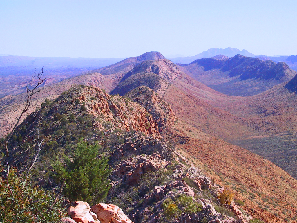
The MacDonnell Ranges form a prominent, narrow chain of mountains that cross the interior of central Australia roughly east–west for hundreds of kilometres on either side of Alice Springs. Rising from arid plains, the ranges include steep ridges, sharp gorges and isolated waterholes that create a distinctive landscape in the Northern Territory of Australia. Their colours, rock forms and important springs have made them a focal point for both scientific study and visitor activity.
Image gallery
10 Images




Geology and geography
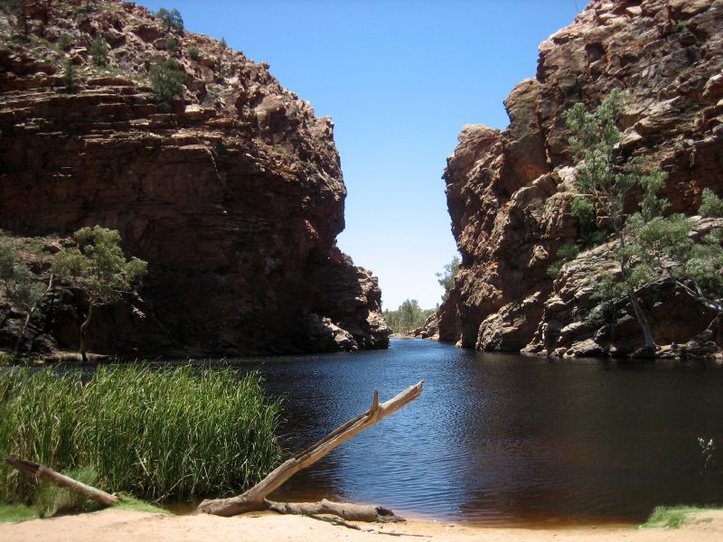
The ranges are composed of very old rock sequences — folded, faulted and partly metamorphosed sedimentary formations — that record a long and complex geological history spanning hundreds of millions of years. Erosion has carved deep gaps through the ridgelines, revealing banded sandstone, quartzite and other durable rock layers. The topography funnels seasonal water into permanent and semi-permanent waterholes that sustain pockets of vegetation not found on the surrounding plains.
Cultural significance
The MacDonnell country is the traditional land of the Arrernte people, who maintain strong spiritual and cultural connections to the landscape. Many features are associated with ancestral creation stories and songlines. One widely known Dreaming involves giant caterpillar ancestors commonly referred to in Arrernte stories as Yerrenye, which are linked to particular ridges, gaps and rockholes.
Exploration and naming
European exploration of the interior encountered the ranges in the 19th century; the explorer John McDouall Stuart named them after Sir Richard MacDonnell, then Governor of South Australia. Since that era the mountains have marked both a natural barrier and a guide for overland routes. Heavitree Gap, for example, provides one of the principal passages carrying road and rail lines into Alice Springs.
Protected areas, access and recreation
Large parts of the range are protected within reserves such as the West MacDonnell National Park. A long-distance walking route, the Larapinta Trail, follows much of the ridge and links many popular sites. Visitors are drawn to dramatic clefts and gorges — including Simpsons Gap and Standley Chasm — as well as waterholes such as Ormiston Gorge, Glen Helen and Ellery Creek, which are often listed among the most accessible and scenic examples.
Ecology and management
Vegetation varies with aspect and water availability, from mulga and spinifex on drier slopes to riverine trees near permanent water. The ranges support native mammals, birds and reptiles adapted to arid environments, and conservation work focuses on fire management, invasive species control and protecting culturally significant sites. Careful visitor management aims to balance public access with ecological and cultural values.
Notable features
- Gaps and gorges: Simpsons Gap, Standley Chasm, Serpentine Gorge and Heavitree Gap.
- Waterholes: Ormiston Gorge, Ellery Creek and Glen Helen.
- Tracks and parks: Larapinta Trail and West MacDonnell National Park provide routes and protections for recreation and conservation.
The MacDonnell Ranges remain a place of layered meaning: an active ecological corridor, a record of deep geological time, and a living cultural landscape for the Arrernte people. For practical information on visiting and stewardship, readers can consult regional park authorities and local cultural custodians via official visitor resources.
Northern Territory information • Australia overview • John McDouall Stuart • Sir Richard MacDonnell • Yerrenye (Dreaming)
Related articles
Author
AlegsaOnline.com MacDonnell Ranges (Central Australia) Leandro Alegsa
URL: https://en.alegsaonline.com/art/60296
Sources
- en.travelnt.com : "MacDonnell Ranges, Northern Territory Official Travel Site"
- nt.gov.au : "West MacDonnell National Park"