Machair: fertile coastal grasslands of northwest Scotland and western Ireland
Machair (Gàidhlig) are low-lying, calcareous coastal grasslands on parts of western Scotland and Ireland, valued for species-rich flora, traditional crofting management and important breeding bird habitats.
Overview
Machair (also spelled machar) is a Gàidhlig term for a distinctive coastal plain of sand-derived, calcareous fertile grassland found mainly along the north-west coasts and islands of Scotland and on some western coasts of Ireland. These low-lying plains lie immediately landward of beaches and strandlines and are recognisable as relatively flat or gently undulating grassland rather than steep dune ridges. The machair landscape is closely associated with traditional crofting communities and a unique mix of cultural and ecological values.
Image gallery
7 Images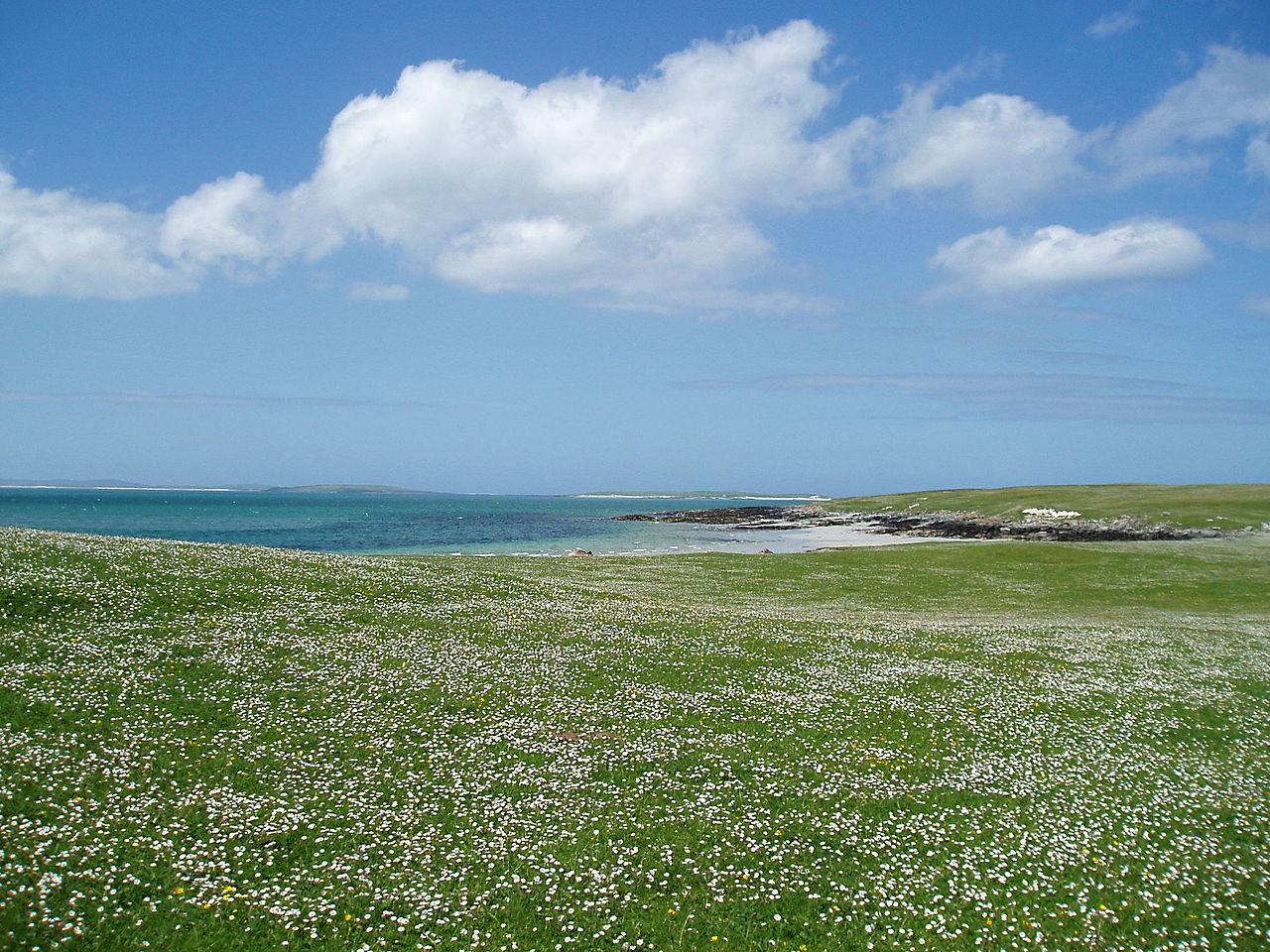


Formation and soils
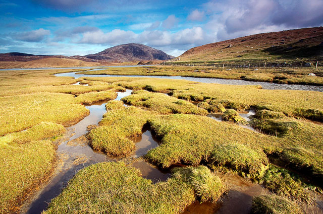
Machair forms where wind-blown shell sand, rich in calcium carbonate, accumulates behind a strandline and mixes with organic matter and thin mineral soils. The high shell content produces alkaline soils that are more fertile than the acidic peat and heather moorland often found inland. In many places the machair grades into mobile dunes at the seaward edge and into saltmarsh or wetter hollows inland, resulting in a varied mosaic of habitats within a relatively narrow coastal zone.
Vegetation and wildlife
The vegetation of machair is typically species-rich, with a mix of low grasses, herbs and spring-flowering plants that benefit from the calcareous, well-drained substratum. Invertebrate communities, including pollinators, are supported by the flower-rich swards. Machair is also important for ground-nesting and wading birds; traditional, lightly managed machair is noted for breeding populations of species such as corncrake, lapwing, snipe and various sandpipers.
Human use and traditional management
For centuries, coastal communities have used machair for a range of low-intensity agricultural practices. Traditional management includes winter grazing by cattle and sheep, the spreading of seaweed and sand to maintain fertility, and small-scale rotational cropping. These practices tend to create a patchwork of sward heights and soil conditions that favour high plant and animal diversity. The cultural landscape of machair is closely tied to crofting traditions and local knowledge.
Conservation and management challenges
Machair systems are fragile and highly sensitive to changes in land use. Threats include intensification of agriculture, loss of traditional management, fertiliser application, afforestation, development and coastal erosion or sea-level rise. Abandonment of grazing or sudden increases in stocking density can both reduce botanical diversity. Conservation efforts typically promote continuation of light grazing, control of damaging land-uses and protection of key sites through local and national schemes.
Comparisons and key features
Although often referred to as a type of dune grassland, machair differs from high mobile dunes: it is generally lower, flatter and richer in shell-derived carbonate, producing alkaline soils and distinctive plant communities. The close juxtaposition of beach, machair, dune ridges and wet hollows creates a range of niches within a compact coastal zone.
Distribution and notable areas
Machair occurs in a number of coastal locations in the Outer Hebrides and on some west-coast islands and peninsulas of Scotland and Ireland. Well-known areas include stretches on North Uist, South Uist, Benbecula, Barra, Harris and parts of Skye, together with selected sites on the western Irish seaboard. Many of these areas are the focus of habitat protection and community-based conservation projects.
Practical guidance and further reading
Management guidance for machair emphasises maintaining traditional, low-intensity grazing regimes, avoiding artificial fertilisers and preserving a diversity of sward structures and wet features. For site-specific information and practical advice, see the resources linked below.
- Regional overview and habitat descriptions
- Conservation guidance, management case studies and agri-environment advice
- Cultural history, crofting practices and community projects
- Visitor information and practical fieldwork guidance
Note: Because machair is both ecologically sensitive and culturally important, local knowledge and site-specific plans are central to successful conservation. Researchers and visitors are encouraged to consult land managers and the publications above before undertaking fieldwork or recreational activities on machair areas.
Questions and answers
Q: What is machair?
A: Machair is a fertile low-lying grassy plain found on some of the north-west coastlines of Ireland and Scotland, in particular the Outer Hebrides.
Q: What language is the word machair derived from?
A: The word machair is derived from Gàidhlig, which is Scottish Gaelic.
Q: Where can machairs be found in Scotland?
A: Machairs can be found in the Isle of Skye, The Isle of Barra, the Isle of Harris and all throughout the west coast and islands of Scotland.
Q: Are there machairs in Ireland as well?
A: Yes, machairs can also be found on the north-west coastlines of Ireland.
Q: What type of terrain characterizes machair?
A: Machair is characterized by its low-lying grassy plain.
Q: Is machair a fertile area?
A: Yes, machair is a fertile area.
Q: What are some other features commonly found in machair regions?
A: Other features commonly found in machair regions include sand dunes and a diverse range of plant and animal species.
Related articles
Author
AlegsaOnline.com Machair: fertile coastal grasslands of northwest Scotland and western Ireland Leandro Alegsa
URL: https://en.alegsaonline.com/art/60323