Antarctic Peninsula: geography, environment, history and human activity
Summary of the Antarctic Peninsula: its geography, climate, wildlife, research presence, warming trends and the governance and historical context of human activity.
Overview
The Antarctic Peninsula is the largest and northernmost extension of the Antarctic mainland. Stretching roughly along a north–south axis, it projects toward South America and is one of the continent's most accessible regions. Its proximity to other landmasses and to oceanic routes has made it a focal point for scientific research, seasonal tourism and long-term environmental monitoring. For maps and general context see regional map and broader information about Antarctica at Antarctica overview.
Image gallery
10 Images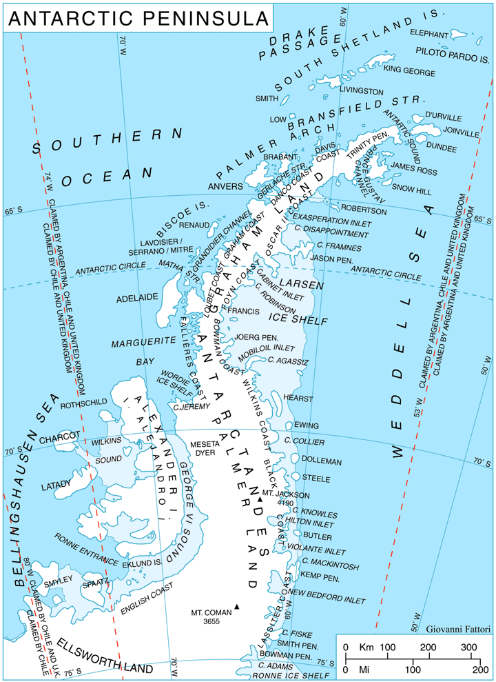
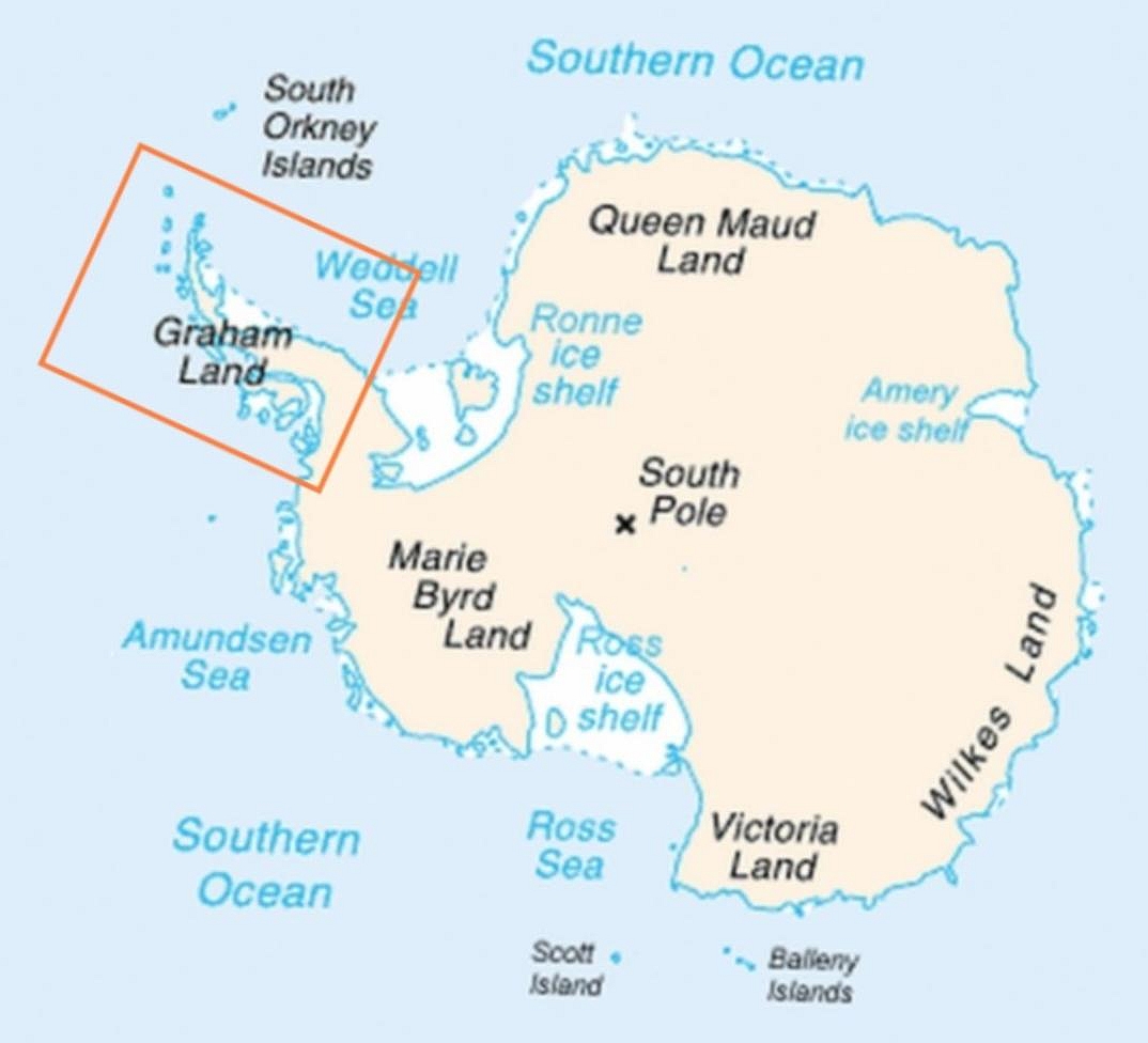


Geography and environment
Geologically the peninsula is mountainous and heavily glaciated. It includes coastal plains, steep ridges, and large ice shelves that fringe its outer margins. Major features include mountain ranges, outlet glaciers and prominent ice shelves that periodically retreat or collapse. Much of the marine environment around the peninsula supports productive food webs driven by krill and seasonal sea-ice dynamics.
- Terrain: rugged mountains and glaciated valleys; detailed boundary descriptions are available at mainland boundary.
- Length and position: the peninsula extends over a large distance toward South America; for measurements consult length and distance data.
- Nearest lands: the peninsula's northern reaches lie a comparable distance from Tierra del Fuego and related islands; see proximity notes.
History and research
Explorers first charted parts of the peninsula during 19th- and early 20th-century expeditions. In the 20th century the area became increasingly important for scientific stations and logistic hubs. Today many permanent and seasonal research facilities operate there, supporting studies in glaciology, biology, oceanography and atmospheric science. Information about research activity can be found at research hub and station directories at station listings.
Climate change and environmental impacts
The Antarctic Peninsula has experienced some of the most rapid regional warming recorded on the planet over recent decades. Temperatures and seasonal sea-ice patterns have shifted, and several ice shelves have retreated or broken off in dramatic events; these changes have been closely monitored by the scientific community. For summaries of observed warming and its consequences see temperature trends and regional assessments at environmental reports.
Human presence, governance and significance
Although multiple nations have historical claims overlapping the peninsula, the Antarctic Treaty System governs activities there and emphasizes peaceful scientific cooperation. The region's ecological importance, ongoing research programs and seasonal tourism make it a key area for studying environmental change and for international scientific collaboration.
Further notes
The Antarctic Peninsula combines striking landscapes, active scientific inquiry and pronounced environmental change. Its glaciers, wildlife and coastal waters are indicators of broader Southern Ocean and polar processes, and continued monitoring remains a global priority.
Useful links: map, Antarctica overview, mainland boundary, dimensions, research centers, proximity notes, station listings, temperature data, environmental reports.
Related articles
Author
AlegsaOnline.com Antarctic Peninsula: geography, environment, history and human activity Leandro Alegsa
URL: https://en.alegsaonline.com/art/4545
Sources
- sciencedaily.com : "New Climate History Adds to Understanding of Recent Antarctic Peninsula Warming"
- commons.wikimedia.org : Antarctic Peninsula
- commons.wikimedia.org : Commons
- wikidata.org : wikidata.org/wiki/Q185605
- d-nb.info : 4207012-0
- id.loc.gov : sh85005489
- viaf.org : 235089664
- worldcat.org : 235089664