Tierra del Fuego: geography, history, and human presence at South America's southern tip
Tierra del Fuego is an archipelago at the southern extremity of South America, shared by Argentina and Chile. Its rugged islands, cold climate, and maritime history shape its ecology, settlements, and economy.
Tierra del Fuego is an island group located off the southernmost tip of the South American continent. The name, which means "Land of Fire," dates from early European exploration when sailors saw the glow of fires lit by indigenous inhabitants along the shore. The archipelago lies south of the Strait of Magellan and forms a transition zone between the Atlantic and Pacific oceans. It is often discussed as a single geographic unit, though it is politically divided between Argentina and Chile.
Image gallery
10 Images
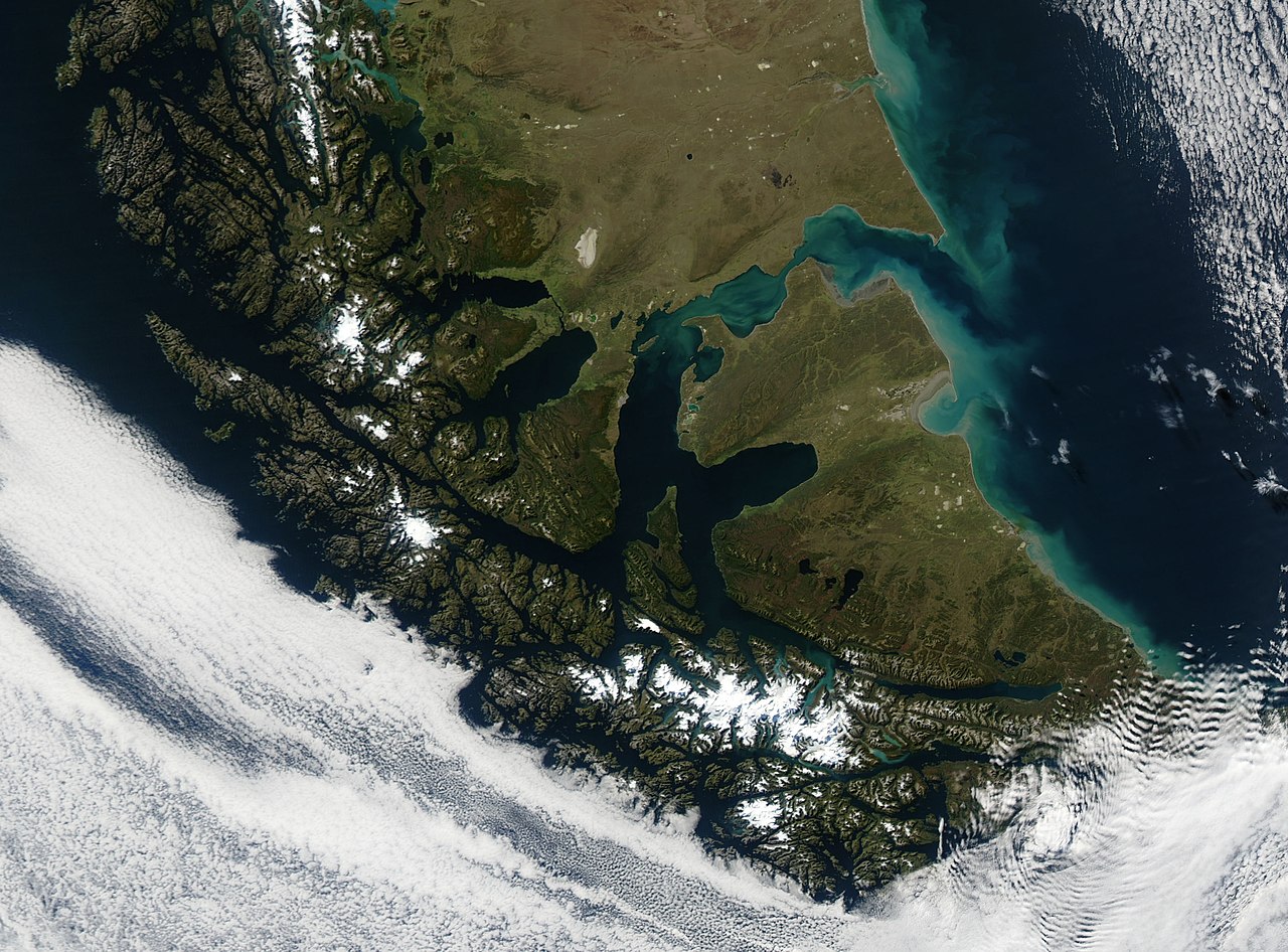


Geography and main islands
The largest element of the archipelago is Isla Grande de Tierra del Fuego, which accounts for roughly half of the total land area. Surrounding this main island are many smaller islands, channels, and fjords carved by glacial and marine forces. The archipelago covers tens of thousands of square kilometers and features a heavily indented coastline, mountain ranges, peat bogs, and lenga beech forests in more sheltered areas. The region experiences a cold, windy, and generally wet climate influenced by maritime systems.
Political division and settlements
Tierra del Fuego is divided between Argentina and Chile. The Argentine portion is organized as a province and contains several towns and cities; the Chilean portion belongs to a southern administrative region that also covers parts of Patagonia and Chilean claims in Antarctica. Principal settlements on the islands include:
- Rio Grande – a major Argentine town with industry and services.
- Ushuaia – a well-known Argentine port and tourism center often described as one of the southernmost cities in the world. More on Ushuaia
- Porvenir – a small Chilean town on the main island's western coast.
- Puerto Williams – a Chilean settlement on Navarino Island often cited among the southernmost inhabited places.
For general geographic context see the archipelago overview and its location relative to South America. The Argentine administrative unit is described at the provincial page.
History and indigenous peoples
Long before European arrival, the islands were home to several indigenous groups, including peoples known from historical records as the Yaghan, Selk'nam (Ona), and Kawésqar. These groups adapted to the harsh maritime environment through skills in seafaring, hunting, and the use of natural resources. European contact began in the early 16th century during voyages that sought southern passages between oceans. Over subsequent centuries, colonization, mission activity, and economic expansion dramatically altered indigenous ways of life.
Economy, environment, and contemporary importance
Today the local economy combines fishing, sheep ranching, limited oil and gas activity, and a growing tourism sector. Ushuaia functions as a gateway for Antarctic cruises and polar expeditions, while scenic routes and wildlife viewing attract visitors year-round. The islands are ecologically significant for seabirds, marine mammals, and unique southern forest communities; many areas are subject to conservation measures and scientific study. Navigationally, the waterways around Tierra del Fuego have long been important for international shipping and for vessels transiting between the Atlantic and Pacific via the Strait of Magellan.
Notable distinctions and facts
Tierra del Fuego is notable for its dramatic landscapes, extreme southern latitude, and mixed cultural heritage. It illustrates interactions between indigenous peoples and arriving Europeans, the challenges of human settlement in subpolar zones, and contemporary issues of resource use, tourism, and conservation. For readers seeking quick orientation, maps and travel resources often highlight the archipelago's position and principal towns; see archipelago maps and regional descriptions such as the provincial overview or local guides like Ushuaia information.
Related articles
Author
AlegsaOnline.com Tierra del Fuego: geography, history, and human presence at South America's southern tip Leandro Alegsa
URL: https://en.alegsaonline.com/art/99816