Gulf of Alaska: geography, climate, ecology, and human connections
The Gulf of Alaska is a large arm of the North Pacific bounded by Alaska’s southern coast. This article covers its geography, glaciers and coasts, climate and oceanography, ecology, history, and notable features.

Overview
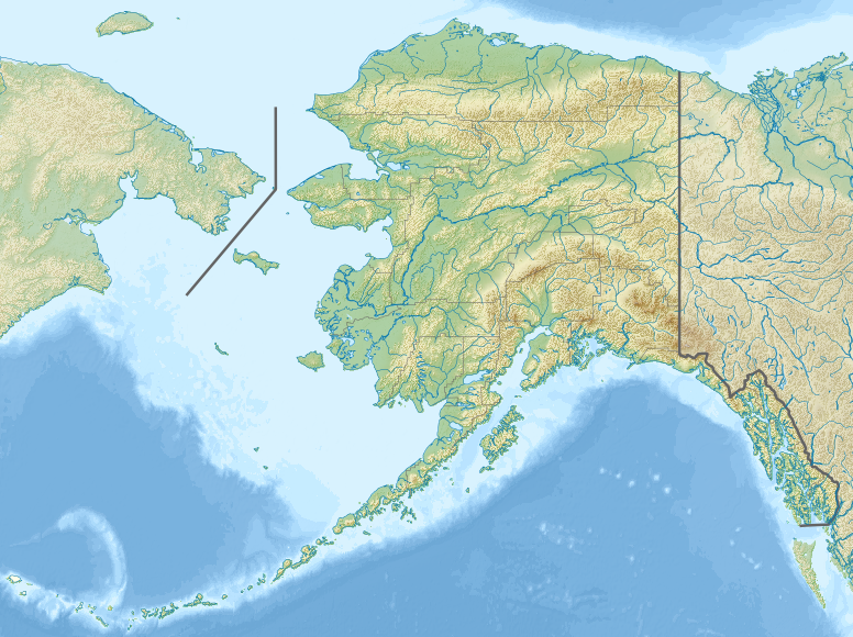
The Gulf of Alaska is a broad arm of the Pacific Ocean that lies off the southern coast of the U.S. state of Alaska. It extends from the western end of the Alaska Peninsula and Kodiak Island to the islands and channels of the Alexander Archipelago in the east. The gulf links a complex set of inlets, channels, bays and sounds and acts as a transitional zone between the open North Pacific and Alaska’s coastal ecosystems.
Image gallery
4 Images


Geography and physical features
The shoreline that bounds the gulf is diverse: temperate rainforest and steep, glaciated mountain ranges meet rocky coasts and extensive coastal plains. The western and central boundaries are anchored by the Alaska Peninsula and Kodiak Island, while the eastern side includes the Alexander Archipelago and protected waters such as Glacier Bay and the Inside Passage. The gulf contains major embayments like Cook Inlet and Prince William Sound, as well as Yakutat Bay, Cross Sound, and many smaller fjords and bays.
Glaciers, tides and oceanography
Large tidewater glaciers drain from the coastal mountain ranges into the gulf; notable examples include the Malaspina Glacier and the Bering Glacier, which terminate on coastal plains or in glacial fjords. Tidal regimes, strong winter storms, heavy precipitation, and large seasonal freshwater inputs from rivers and melting ice influence the gulf’s circulation. Cold, nutrient-rich waters upwell in places, supporting productive marine food webs.
Ecology and human uses
The Gulf of Alaska supports important fisheries—salmon, groundfish and shellfish—and is habitat for marine mammals (whales, seals, sea lions), seabirds and coastal wildlife. Coastal forests and estuaries provide breeding and feeding grounds for many species. Humans use the region for commercial fishing, subsistence harvests by Indigenous communities, shipping, recreation and limited oil and mineral activities. Communities along the coast have long adapted to a climate shaped by storms, ice, and seasonal resource cycles.
History, hazards and notable facts
Indigenous peoples have inhabited Gulf of Alaska shores for millennia, developing seafaring cultures and economies tuned to tidal and seasonal cycles. The region is geologically active—earthquakes, landslides and glacial calving occur regularly. One dramatic local event was the record-setting tsunami generated in Lituya Bay; the bay is often cited in discussions of extreme coastal hazards and is associated with the largest measured tsunami run-up. Navigational hazards, severe weather and rapidly changing ice conditions have shaped historical travel and settlement.
Distinctive characteristics
- Mix of glaciated mountains, temperate rainforest and complex archipelagos.
- High marine productivity linked to upwelling and freshwater inputs.
- Important commercial and subsistence fisheries supporting local economies.
- Geological activity and episodic extreme events—earthquakes, tsunamis, glacier surges.
For maps, navigation details and conservation status of particular subregions such as Glacier Bay or Cook Inlet, consult regional resources and marine charts maintained by governmental and scientific organizations. Further reading and data resources are available through general oceanographic references and local Alaskan agencies (southern Alaska coastal information).
Related articles
Author
AlegsaOnline.com Gulf of Alaska: geography, climate, ecology, and human connections Leandro Alegsa
URL: https://en.alegsaonline.com/art/41365