Ghats (Eastern and Western): Geography, Ecology, and Significance
Two mountain systems flanking the Deccan Plateau in southern India, the Western and Eastern Ghats are distinct in form, ecology, and cultural importance and host many endemic species.
Overview
The term "Ghats" refers to two separate mountain systems that run along the edges of the Deccan Plateau in southern India. Together they form a broad rim between the plateau and the coasts. See a regional map of the ranges for orientation. Locally these ranges are important landmarks, climatic barriers, and watersheds.
Image gallery
1 Image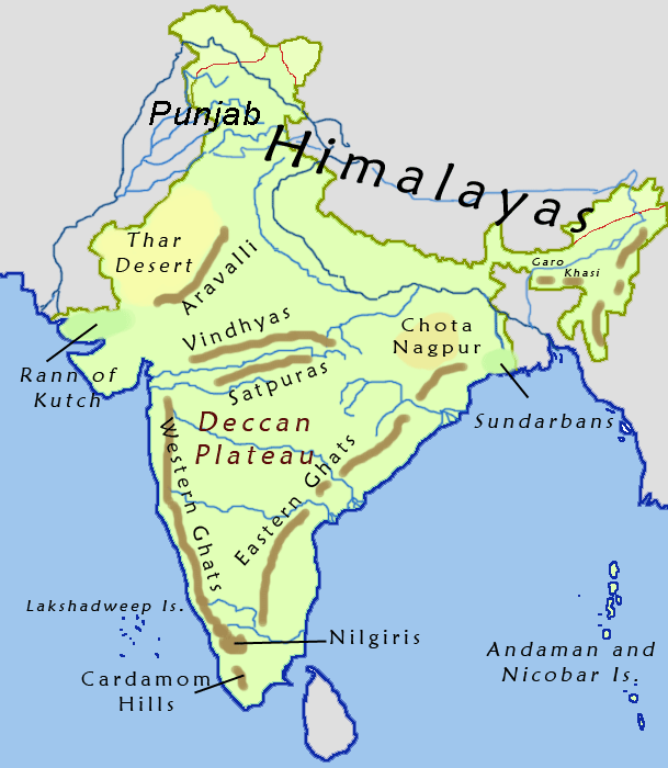
Physical characteristics
The Western Ghats form a relatively continuous escarpment that faces the sea and slopes more gently back toward the Deccan. The chain is abrupt on the seaward side and is separated from the Arabian Sea by narrow coastal plains. By contrast, the Eastern Ghats consist of a series of disconnected hills trending along the coast of the Bay of Bengal, with broad breaks and lower, more eroded summits. Both ranges border the Deccan Plateau and influence local topography and drainage.
Geology and development
These mountain systems are the product of long geological processes including ancient uplift, prolonged erosion and, in places, volcanic episodes and faulting. The Western chain appears as a prominent escarpment because of differential weathering and past volcanic deposits, while the Eastern group is older and more fragmented. The different histories of the two systems account for their contrasting shapes and continuity.
Ecology and hydrology
The Ghats play a major role in regional climate and hydrology. They intercept monsoon winds, produce high rainfall on their windward slopes and feed many rivers and streams whose headwaters supply water to the plains below. The Western Ghats are widely recognized for their rich biodiversity and high level of endemism; the Eastern Ghats, though less continuous, also support important forest tracts and unique species adapted to their varied terrain. For more on the Eastern range see Eastern Ghats resources.
Human use, conservation and importance
Human activities in the Ghats include agriculture, plantation crops, forestry, hill stations, pilgrimage and tourism. Large areas are now protected by national parks and reserves, but both ranges face pressures from habitat loss, fragmentation, invasive species and infrastructure development. Conservation efforts emphasize habitat connectivity, protection of endemic species and sustainable land use to maintain water supplies for downstream populations.
Key distinctions and notable facts
- The Western Ghats are more continuous and often steeper toward the sea; the Eastern Ghats are a broken series of hills.
- Both act as watersheds for many peninsular rivers and regulate regional climate and monsoon patterns.
- They are culturally significant: sites of pilgrimage, traditional livelihoods and historic settlements.
- Further reading and maps are available through regional sources and geological surveys; consult a regional map and specialized guides for detailed routes and protected-area information.
Related articles
Author
AlegsaOnline.com Ghats (Eastern and Western): Geography, Ecology, and Significance Leandro Alegsa
URL: https://en.alegsaonline.com/art/38622