Fellhorn — mountain of the Allgäu Alps on the German–Austrian border
Fellhorn is a 2,038 m mountain in the Allgäu Alps near Oberstdorf, straddling Germany and Austria. Known for its alpine flora and the Fellhorn–Kanzelwand ski area with lifts and summer hiking trails.
Fellhorn is a prominent peak in the Allgäu Alps, rising above the resort town of Oberstdorf. It stands on the international boundary between Germany and Austria. The mountain’s commonly cited elevation is 2,038 metres; Austrian sources often give 2,039 metres, a small difference that reflects mapping conventions and survey methods.
Image gallery
4 Images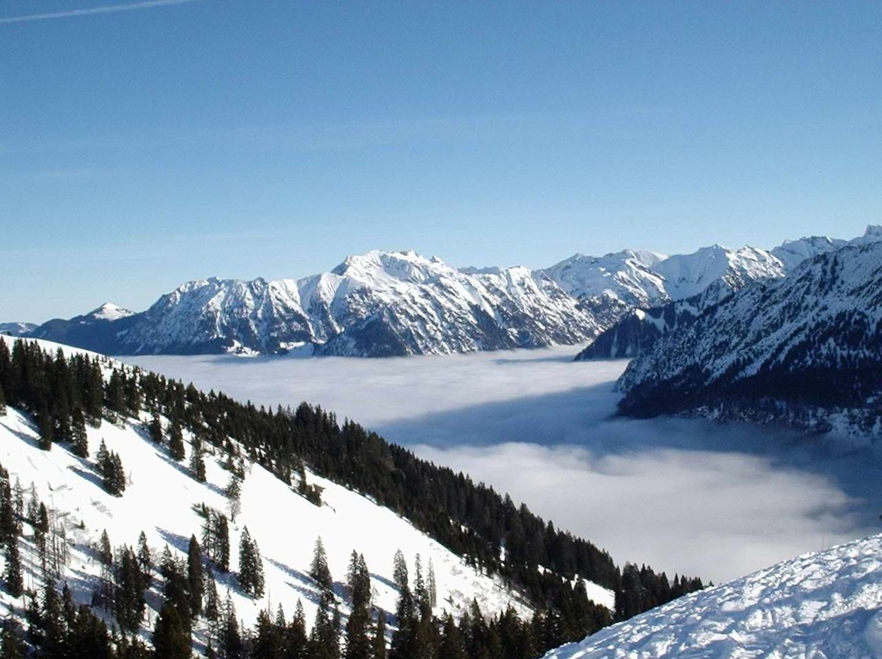


Geography and physical characteristics
Fellhorn forms part of a limestone ridge and features steep, grassy slopes above tree line. Its summit plateau and surrounding meadows host typical high-alpine terrain with rocky outcrops, making it visually distinct in the northern Alps. From exposed points near the top, visitors can enjoy broad views over the Allgäu valleys and into neighbouring Austrian ranges.
History and tourism development
The Fellhorn attracted tourists and mountaineers as mountain recreation became popular in the 19th and 20th centuries. Today the mountain is linked to infrastructure for visitors: a system of lifts and trails connects the peak with valley stations and with the adjacent Kanzelwand, creating a cross-border resort area used year-round for skiing and hiking.
Flora, fauna and conservation
Above the timberline the Fellhorn’s alpine meadows support a rich display of flowers in summer, including gentians and alpine rose species typical of the region. Wildlife of the high slopes includes birds and mountain mammals adapted to steep terrain. Parts of the surrounding landscape are managed to balance recreation with habitat protection.
Recreation and access
- Skiing and winter sports via a linked Fellhorn–Kanzelwand ski area and lift network.
- Marked hiking routes and ridge walks for summer visitors, with panoramic viewpoints.
- Mountain huts and seasonally operated facilities that serve walkers and skiers.
Fellhorn remains a notable destination for those seeking accessible high-alpine scenery on the border of Germany and Austria, and for its role in the cross-border tourism economy between Oberstdorf and neighbouring Austrian communities. Further practical information on routes and current lift operations can be found through regional tourist services and mountain transport operators.
Related articles
Author
AlegsaOnline.com Fellhorn — mountain of the Allgäu Alps on the German–Austrian border Leandro Alegsa
URL: https://en.alegsaonline.com/art/33940
Sources
- amap.at : Austrian Map online (Austrian 1:50,000 map series)
- das-hoechste.de : Skigebiet Fellhorn/Kanzelwand