Dhaulagiri: Himalayan massif and its principal peak
Dhaulagiri is a Himalayan mountain massif in Nepal, about 120 km long. Its highest summit, Dhaulagiri I (8,167 m), is the world’s seventh-highest peak and a major objective for mountaineers and trekkers.
Overview
Dhaulagiri refers to a compact group of high mountains in north-central Nepal. The massif stretches roughly 120 km and contains several major summits, the tallest of which is Dhaulagiri I at 8,167 metres (26,795 ft), ranked among the world’s highest peaks. The range forms a dramatic backdrop to valleys and is a distinct landmark in the western Himalaya. For a general reference to the range see group of mountains.
Image gallery
4 Images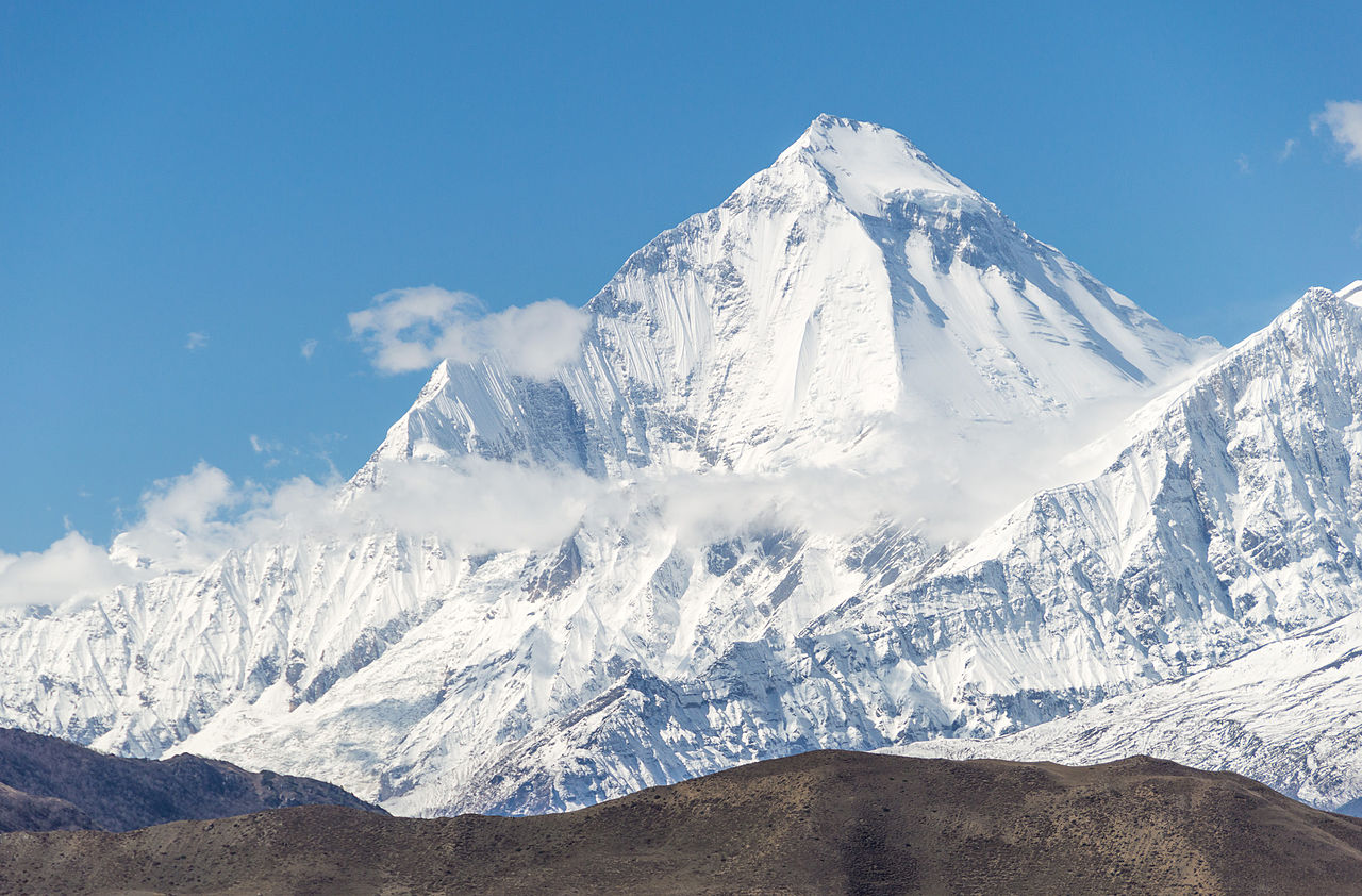


Name and etymology
The name Dhaulagiri derives from Sanskrit roots: dhawala meaning white or dazzling and giri meaning mountain. This alludes to the snow-clad appearance of the summits. The massif lies within modern-day Nepal, and the local names and cultural associations reflect centuries of Himalayan travel and settlement.
Geography and notable features
The Dhaulagiri massif occupies territory between the Kali Gandaki valley to the east and the Bheri drainage to the west. The deep gorge of the Kali Gandaki separates Dhaulagiri from the Annapurna range and contributes to the region’s extreme relief. Numerous glaciers and steep faces characterize the massif, which includes several subsidiary peaks such as Dhaulagiri II, III, IV and V. The highest summit, often cited as the world’s seventh-highest, is listed in many sources as Dhaulagiri I.
Mountaineering history and routes
Dhaulagiri I was first reached in 1960; since then it has remained a serious objective for experienced alpinists because of its steep faces, frequent avalanches and difficult weather. Routes approach the massif from multiple valleys and base camps are usually established on glacial moraines. Beyond the summit climbs, the region is known for long trekking circuits that offer remote high-mountain scenery and cultural contact.
Ecology, culture and significance
The high ridges and valleys around Dhaulagiri support alpine ecosystems with seasonal grazing and pockets of subalpine forest lower down. For local communities the mountains are part of traditional grazing lands, pilgrimage routes and a growing trekking economy. Environmental concerns such as glacial change and pressure from tourism are part of modern management discussions in the region.
Quick facts and context
- Location: western-central Nepal, within Himalayan belt.
- Extent: approximately 120 km of mountainous terrain.
- Main summit: Dhaulagiri I, 8,167 m.
- Nearby features: Kali Gandaki gorge and Bheri river valleys.
- Further reading: overview entries and regional guides can be consulted at Sanskrit and regional name sources and general mountain databases covering the range.
For those seeking more detailed route descriptions, historical accounts or conservation updates, specialized mountaineering literature and regional planning documents provide in-depth information. Basic maps and trekking guides also highlight the Dhaulagiri Circuit and access approaches used by trekkers and climbers.
Related articles
Author
AlegsaOnline.com Dhaulagiri: Himalayan massif and its principal peak Leandro Alegsa
URL: https://en.alegsaonline.com/art/27046
Sources
- 8000ers.com : "High Asia – All mountains and main peaks above 6750 m"