
Cyclone Nargis (2008): Myanmar’s catastrophic storm and humanitarian impact
Cyclone Nargis struck Myanmar in April–May 2008 as a Category 4 cyclone, producing a devastating storm surge in the Irrawaddy delta and causing widespread destruction, large-scale displacement and complex relief challenges.
Overview
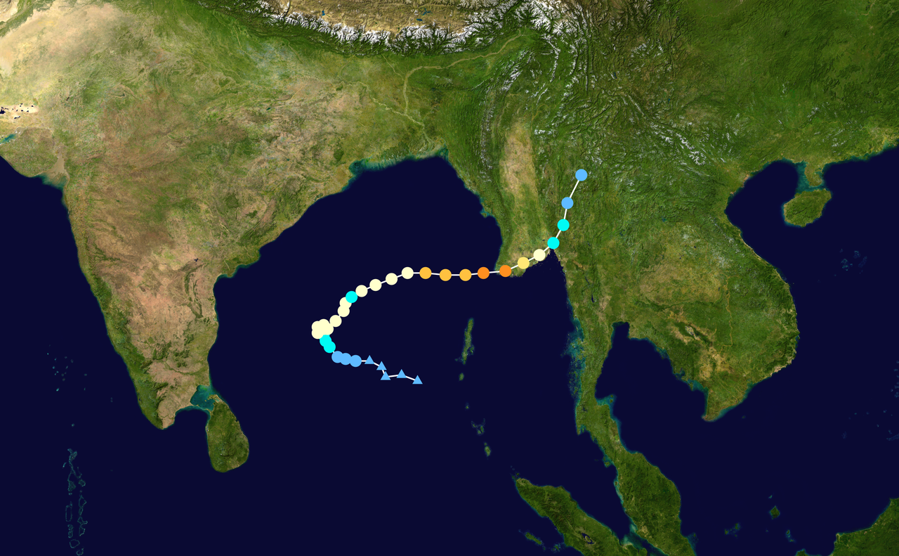
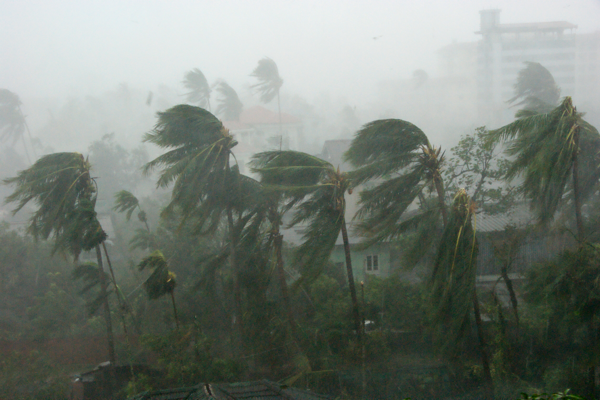
Cyclone Nargis was a powerful tropical cyclone that formed over the northern Indian Ocean and made landfall in Myanmar (Burma) in late April and early May 2008. Classified at the time as a Category 4 storm, Nargis moved across the Bay of Bengal before striking the low-lying Irrawaddy (Ayeyarwady) delta and adjacent coastal areas. The cyclone combined intense winds, torrential rainfall and a large storm surge, producing one of the most destructive meteorological events in the country’s recent history.
Image gallery
9 Images




Meteorological characteristics
Nargis developed over warm waters of the Bay of Bengal and intensified rapidly as it approached the Myanmar coast. The storm produced a significant storm surge — an abnormal rise of sea level driven by wind and low pressure — which inundated the delta plain. These central coastal lowlands are particularly vulnerable: they are densely populated, crisscrossed by waterways, and host extensive rice cultivation. The combination of surge, floodwaters and wind damage caused broad destruction to settlements, crops and infrastructure.
Human impact and affected areas
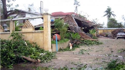
The human toll and the number of people affected were enormous, and estimates varied widely in the weeks following landfall. United Nations agencies reported that more than a million people were severely affected and that up to several million required urgent assistance. Official counts, nongovernmental estimates and media reports differed on fatalities and missing persons, reflecting access problems and disrupted communications in the worst-hit zones. Large numbers of homes were destroyed or rendered uninhabitable, and many coastal towns and villages suffered near-total structural collapse.
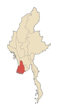
- Primary zones of damage included the Irrawaddy (Ayeyarwady) delta and parts of Yangon, Bago and other coastal divisions and states.
- Localities such as Labutta and Bogale were widely reported as experiencing catastrophic building loss and high casualty rates.
- The government declared multiple administrative areas disaster zones to coordinate response and relief.
Relief, access and international response
Providing rapid assistance after Nargis proved difficult. Restrictions on entry to certain areas, damaged transport links and logistical limits complicated the delivery of food, clean water, medical care and shelter. International agencies, national governments and charities sought to offer aid, while United Nations representatives and the International Red Cross made assessments and appealed for resources. The crisis raised attention to the importance of rapid humanitarian access, coordination with national authorities and the logistics of moving supplies into isolated delta communities.
Consequences for agriculture, economy and recovery
The storm surge and flooding damaged large tracts of farmland, including rice paddies and seasonal crops. Saltwater intrusion and deposited debris impaired soil and delayed planting cycles, affecting food security and rural livelihoods. Fishing communities lost boats and gear. Rebuilding homes, restoring roads and repairing livelihoods required sustained effort; reconstruction needs extended beyond immediate shelter and food to water and sanitation, health services and restoration of local economies.
Context, comparisons and lessons
Nargis was widely compared with other major disasters in the region, including the 2004 Indian Ocean tsunami and earlier deadly storms, to convey its scale and humanitarian consequences. Observers and analysts emphasized the storm’s role in highlighting disaster preparedness shortcomings and the need for improved early warning systems, land-use planning and coordinated emergency response. The storm also prompted discussion about how political and administrative choices affect relief delivery and long-term recovery.
Notable facts and legacy
Cyclone Nargis remains a major reference point for natural hazards in Myanmar. It underscored the particular vulnerability of delta regions to cyclones and storm surges and left a complex legacy of reconstruction, displacement and policy debate. In international coverage and post-disaster reports, the event is frequently cited when discussing large-scale cyclone impacts in the Indian Ocean region.
For further context on the phenomenon and international reaction, see references to the storm as a tropical cyclone, its landfall in Myanmar, assessments by the United Nations, comparisons with the 2004 Indian Ocean tsunami and commentary noting similarities with devastation experienced elsewhere, including in Sri Lanka. Historical cyclones used for comparison include Hurricane Mitch and other deadly storms from the late 20th century, such as those recorded in 1998.
Summary: Cyclone Nargis was a fast-developing, high-impact disaster that struck a vulnerable delta region, producing a deadly storm surge and long-term humanitarian and economic consequences. The event is an important case study in coastal risk, disaster response and the challenges of delivering assistance in complex environments.
Questions and answers
Q: What kind of storm was Cyclone Nargis?
A: Cyclone Nargis was a tropical cyclone and it was categorized as a Category 4 storm.
Q: When did the cyclone make landfall?
A: The cyclone made landfall in Myanmar (Burma) in April and May 2008.
Q: How many people were affected by this cyclone according to the United Nations report?
A: According to the United Nations report, 1.5 million people were severely affected by this cyclone.
Q: How many people have been reported dead due to the storm?
A: Officially at least 78,000 were killed with 58,000 not found (missing); however, more recent reports from the government say that about 80,000 have died and some non-governmental organizations estimate that the final number will be well over 100,000.
Q: What areas did the Burmese government declare disaster areas after the storm?
A: After the storm, the Burmese government declared five regions as disaster areas - Yangon, Ayeyarwady, Bago Divisions, Mon and Kayin States.
Q: What is believed to be one of its effects on food prices in Myanmar?
A: The Daily Telegraph reported that food prices in Myanmar could be affected by this disaster.
Related articles
Author
AlegsaOnline.com Cyclone Nargis (2008): Myanmar’s catastrophic storm and humanitarian impact Leandro Alegsa
URL: https://en.alegsaonline.com/art/24873
Sources
- abs-cbnnews.com : "UN: 1.5 million people affected by Myanmar storm"
- news.bbc.co.uk : "Burma death toll jumps to 78,000"
- news.bbc.co.uk : "Burma's cyclone death toll soars"
- news.bbc.co.uk : "Aid call as Burma casualties rise"
- news.bbc.co.uk : "Disaster tests Burma's junta"
- news.yahoo.com : "Myanmar deaths may top 100,000: U.S. diplomat"
- timesonline.co.uk : "Burma cyclone: up to 50,000 dead and millions homeless, but still no call for aid"
- news.bbc.co.uk : "'No access' to Burma cyclone zone"
- news.bbc.co.uk : Hundreds killed by Burma cyclone
- reuters.com : Cyclone kills 10,000 in one Myanmar Town - Reuters, 6 May 2008
- in.reuters.com : UPDATE 1-Myanmar cyclone stirs more rice supply fears
- msnbc.msn.com : "351 die as Cyclone Nargis hits Myanmar"
- telegraph.co.uk : "Burma cyclone kills more than 350 people"
- thairath.co.th : "พม่านับล้านไร้ที่อยู่ ศพอืดเน่า ผวาโรคระบาดซํ้า"