Coral Sea Islands Territory: remote reefs, cays and meteorological outposts
An Australian external territory of scattered coral cays and reefs in the Coral Sea, largely uninhabited except for a small weather station. Important for navigation, meteorology and marine conservation.
Overview
The Coral Sea Islands Territory is a dispersed group of small islands, islets and coral reefs in the Coral Sea. The landforms are mostly low, sandy cays and emergent reef platforms that rise from the surrounding ocean. The name in common use for the group is the Coral Sea Islands, and the chain lies to the east and northeast of the Australian coastline, near the outer edge of the Great Barrier Reef.
Image gallery
7 Images


Location and administration
The islands form an external territory of Australia. They are remote from population centres and are administered by the Australian government. Geographically they sit within the broader Coral Sea region and are located to the northeast of the state of Queensland, out in the open waters of the Coral Sea.
Physical characteristics and ecology
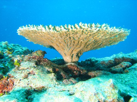
Most features are coral cays, low-lying and composed of sand and biogenic debris. Vegetation, where it occurs, is typically grasses, salt-tolerant shrubs and pioneer plants that can establish on shifting sediments. The cays and reefs provide nesting and roosting sites for seabirds, and several are used by marine turtles for nesting. Because of their small area and low elevation, these islands are vulnerable to storm surge, cyclones and long-term sea-level change.
Human presence and facilities
Almost all of the islands are uninhabited. A few host infrastructure such as lighthouses and automated monitoring equipment. Several locations have automatic meteorological stations and environmental instruments — the territory contributes weather and ocean observations through a network of remote sites, including permanent installations on selected cays. Willis Island is notable as the only island with a staffed facility; a small team maintains a meteorological outpost there and keeps round‑the‑clock observations that support forecasting. Some of the remote installations function as unmanned sites with solar power and telemetry systems (automatic weather stations, lighthouses).
Uses, importance and protections
- Meteorology and marine safety: the stations help monitor tropical weather, assist shipping and contribute to cyclone warnings.
- Biodiversity: reefs and cays support seabirds, turtles and coral communities important for marine ecosystems.
- Conservation and management: Australia has established marine protection measures in parts of the Coral Sea to conserve habitats and species, and the islands are managed with a focus on preserving wildlife and ensuring safe navigation.
History and notable facts
The region has long been known to mariners because of its extensive coral formations and shoals. European exploration and charting increased in the 18th and 19th centuries; later, the Coral Sea gained wider historical significance during the Pacific conflict of World War II, when the area was the scene of the naval engagement known as the Battle of the Coral Sea. Today the islands are best known for their remoteness, their role in meteorological observation and their ecological value.
Because of the scattered nature of the territory and its largely unpopulated cays, visits are typically restricted to authorised scientific, environmental management or maintenance missions. The Coral Sea Islands remain one of Australia’s most isolated maritime territories, with a combination of practical uses for weather and navigation and intrinsic importance as fragile coral environments.
For more information about the islands and the wider region see resources linked to the territory and the Coral Sea: Coral Sea Islands overview, Great Barrier Reef context, Australian external territories, automatic weather stations, lighthouses and aids to navigation, Coral Sea geography, Queensland proximity.
Related articles
Author
AlegsaOnline.com Coral Sea Islands Territory: remote reefs, cays and meteorological outposts Leandro Alegsa
URL: https://en.alegsaonline.com/art/23014
Sources
- commons.wikimedia.org : Coral Sea Islands
- ag.gov.au : "Coral Sea Islands"
- thecommonwealth.org : Commonwealth Secretariat - Member States
- wikidata.org : wikidata.org/wiki/Q172216
- id.loc.gov : n90679187
- aleph.nkp.cz : ge754650
- viaf.org : 138506852
- worldcat.org : lccn-n90679187