British Columbia Highway 1 — the Trans‑Canada route across southern British Columbia
British Columbia Highway 1 is the provincial section of the Trans‑Canada Highway that traverses southern BC from the Alberta border, across the Interior and Lower Mainland, and via ferry to Vancouver Island and Victoria.
Overview
Highway 1 in British Columbia is the province's portion of the national Trans‑Canada Highway. It runs roughly east–west across the southern part of the province and, including ferry connections, is about 1,039 kilometres long. The route links mountain passes at the Alberta boundary with coastal corridors and extends by ferry to Vancouver Island, where it continues to the provincial capital.
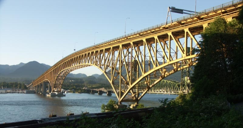
Image gallery
5 Images


Route and characteristics
On the eastern end the highway approaches British Columbia from the direction of Alberta, crossing the Rockies near Kicking Horse Pass and passing through mountain towns such as Field. From the high mountain sections the route descends into the Fraser and Thompson interior corridors, then follows the Lower Mainland urban and suburban network toward the Pacific. On the mainland the highway terminates at a ferry terminal in West Vancouver, where a ferry link carries the Trans‑Canada designation across the Strait of Georgia.
On Vancouver Island the highway resumes at a ferry terminal near Departure Bay and proceeds south along the island’s eastern side to the provincial capital, Victoria. Between Monte Creek and Cache Creek the highway shares roadways with other major provincial routes, notably Highway 5 and Highway 97, resulting in stretches of concurrency where a single roadway carries multiple highway numbers.
Major communities and junctions
- Mountain and Interior towns: Field, Golden, Revelstoke, Salmon Arm, Kamloops area.
- Interior junctions: Monte Creek, Cache Creek — important transfer points for traffic heading to northern and central BC.
- Lower Mainland: Metro Vancouver corridors and ferry access at Horseshoe Bay in West Vancouver.
- Vancouver Island: ferry landing near Departure Bay and the route into Victoria.
History and development
The Trans‑Canada designation was applied to existing highways as provincial routes were upgraded and linked to form a continuous coast‑to‑coast road in the mid‑20th century. In British Columbia this required challenging mountain engineering — tunnels, avalanche control and seasonal maintenance — as well as the integration of ferry services to connect the mainland and Vancouver Island. Over decades the corridor has been improved with bypasses, interchanges and safety upgrades to accommodate growing traffic and commercial transport.
Uses and importance
Highway 1 is a vital artery for cross‑country travel, freight movement and regional commuting. It carries tourism traffic to national and provincial parks, links ports and urban centres, and serves as a primary route for goods entering and leaving the province by road. The corridor’s role changes along its length: alpine transit and scenic travel in the mountains, long‑distance freight through the Interior, and dense commuter flows in the Lower Mainland and on Vancouver Island.
Notable facts and distinctions
Several stretches of Highway 1 are noted for their engineering challenges and scenic value. The route includes high mountain passes and avalanche-prone valleys that require active mitigation, and the ferry segment is an official part of the highway’s continuous designation. For further maps, route details and service information see provincial publications and route planners linked by regional transport authorities via resources such as British Columbia section information pages and national Trans‑Canada summaries at Trans‑Canada Highway resources. Additional local references include planning and traffic pages for the Lower Mainland and Vancouver Island.
Readers seeking turn‑by‑turn route details, current road conditions or historical studies of the corridor should consult government highway reports and regional archives accessible through transportation agencies and municipal sites.
Related articles
Author
AlegsaOnline.com British Columbia Highway 1 — the Trans‑Canada route across southern British Columbia Leandro Alegsa
URL: https://en.alegsaonline.com/art/14252