Biratnagar — Major industrial and commercial city in eastern Nepal
Biratnagar is a principal industrial, transport and commercial center in eastern Nepal, located in Morang District on the Terai plain near the India border. It serves as a regional hub for trade and services.
Overview
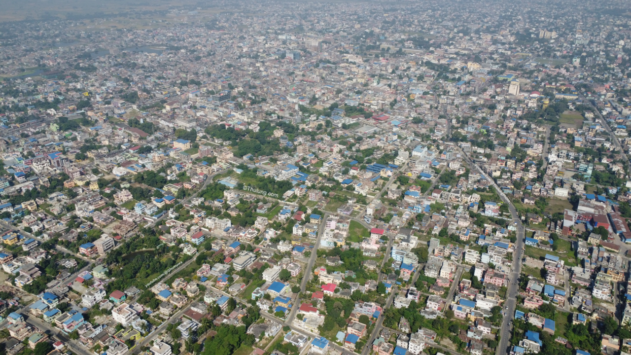
Biratnagar is a large city in eastern Nepal known for its industry, commerce and role as a regional gateway. Administratively located in Morang District, the city lies on the flat Terai plain at approximately 26°28'60"N 87°16'60"E. Historically associated with the former Kosi Zone, it is part of the broader Province No. 1 area and functions as an important urban center for eastern Nepal.
Image gallery
10 Images


Geography and character
The city occupies lowland plains that combine agricultural hinterland with urban neighborhoods. The climate is broadly subtropical, with hot summers and mild winters typical of the Terai belt. Biratnagar's urban fabric mixes industrial zones, residential sectors and commercial streets; markets and transport terminals link the city to surrounding towns and to cross-border points into India.
Economy and infrastructure
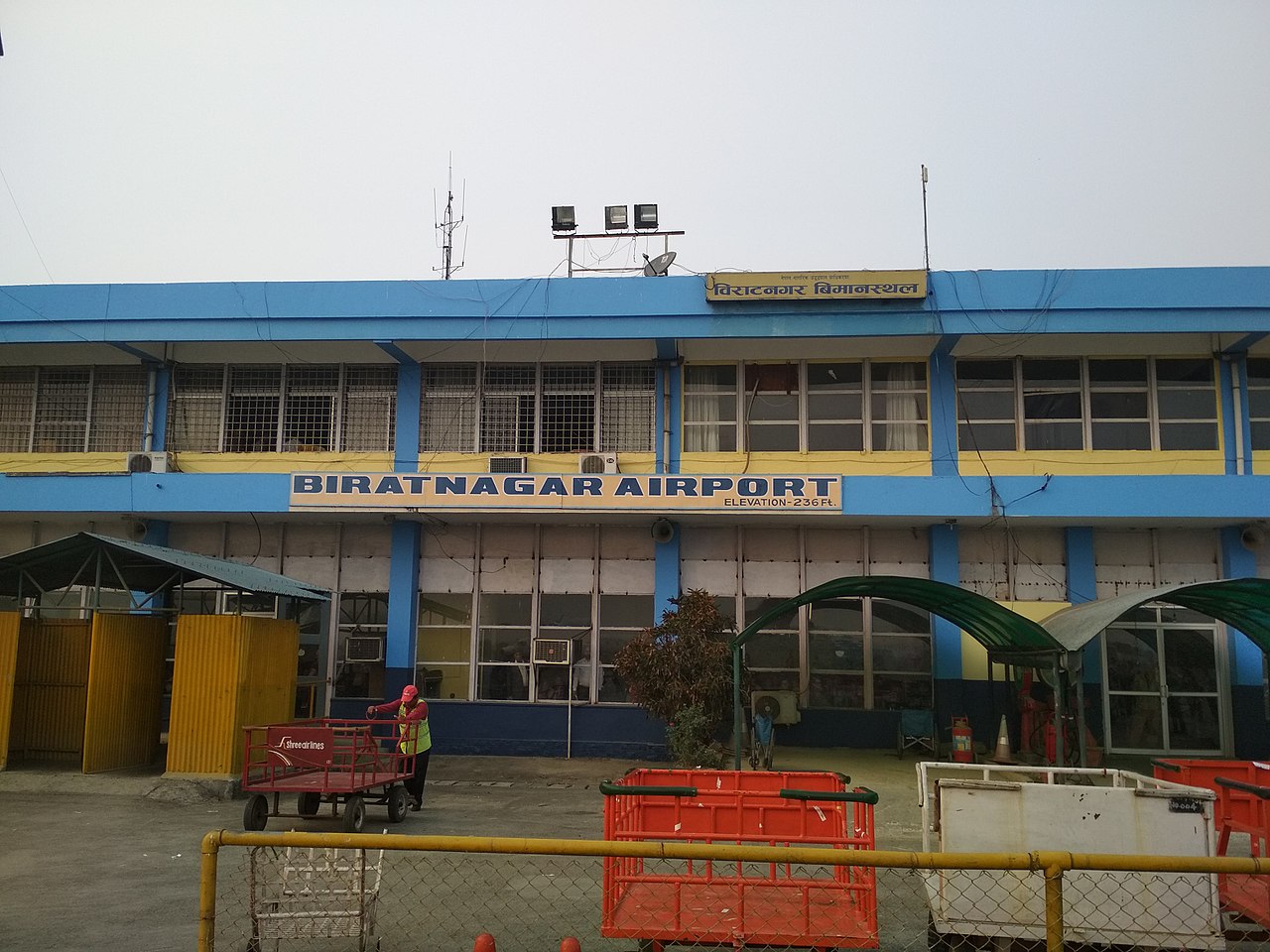
Biratnagar is widely recognized as an industrial hub: textile and processing plants, light manufacturing and service industries form the backbone of the local economy. It hosts factories, wholesale markets and logistics firms that serve eastern Nepal. The city is served by an airport providing domestic connections and by major road links that support freight and passenger movement to other Nepali cities and to neighboring Indian border towns.
History and culture
Originally a market and agricultural center, Biratnagar grew significantly in the 20th century as industry developed. One early modern enterprise there was a prominent jute mill that contributed to urban employment and to early labor activism. The population is multiethnic and multilingual, with Nepali and regional languages commonly spoken. Cultural life includes local festivals, markets and civic institutions typical of Nepal’s Terai cities.
Notable facts and distinctions
- Location: sits in eastern Nepal near the India–Nepal frontier and serves as a trade hub.
- Industrial role: home to several long‑standing manufacturing and processing facilities.
- Administrative context: historically part of the Kosi Zone and now within Province No. 1.
- Transport: has a domestic airport and significant road connections to other regional centers.
Further reading
For language and local names, see local usage. Administrative and district details are available via Morang District and historic zone information via Kosi Zone. General city and travel profiles can be consulted at regional sources: industrial overview, urban statistics, and geographic references at coordinate and mapping data.
Tags
Related articles
Author
AlegsaOnline.com Biratnagar — Major industrial and commercial city in eastern Nepal Leandro Alegsa
URL: https://en.alegsaonline.com/art/11690
Sources
- cbs.gov.np : "National Population Census 2011"
- lonelyplanet.com : "Introducing Biratnagar"