
Yukon River
Major river of northwestern North America, rising in British Columbia, flowing through the Yukon and Alaska, important ecologically and historically for transportation, salmon runs, and the Klondike Gold Rush.
Overview
The Yukon River is a major waterway of northwestern North America. It rises in the mountains of northern British Columbia and flows northwest through the Canadian territory of the Yukon before turning west into the U.S. state of Alaska, where it empties into the Bering Sea. The river is one of the longest on the continent and is the principal drainage artery across a broad subarctic landscape. It has long supported Indigenous cultures, served as a transportation corridor, and played a central role in the late 19th-century gold rush era.
Image gallery
9 Images





Course and characteristics
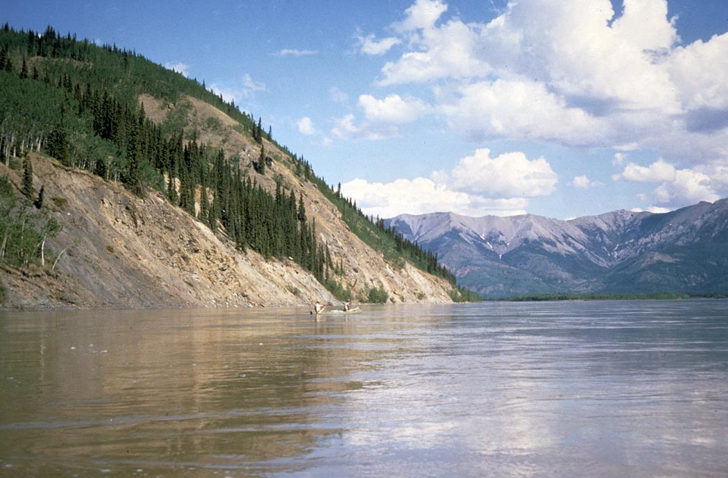
The Yukon begins in British Columbia and continues through the Yukon Territory and Alaska. Its length is commonly given as roughly 3,190 km (about 1,980 miles), making it the longest river in both the Yukon and Alaska. The river’s character varies from narrow mountain streams in its headwaters to broad, braided channel sections across lowland plains before its delta reaches the Bering Sea.
- Major regions crossed: northwestern North America, British Columbia, Yukon, and Alaska.
- Terminates in the Bering Sea and forms extensive wetlands at its mouth.
- Notable tributaries include the Porcupine and Tanana rivers.
Ecology and resources
The Yukon River basin supports extensive boreal forest, tundra and riparian habitats. It is critically important for anadromous fish, especially several species of Pacific salmon that migrate upriver to spawn. These salmon runs are central to regional ecosystems and to the subsistence and commercial fisheries of communities along the river. The watershed also supports diverse wildlife such as moose, caribou and waterfowl, and contains peatlands and wetlands that store carbon and influence regional hydrology.
Human history and use
For millennia Indigenous peoples used the Yukon for travel, trade and fishing; their communities and cultures remain tied to the river. The Yukon became internationally prominent during the Klondike Gold Rush of 1896–1903, when prospectors used the river as a primary route to the goldfields—an episode often associated with the river’s history and migration of people and supplies in that era. Today the river continues to serve local transportation needs, supports subsistence lifestyles, and attracts recreational boating and fishing.
Notable facts and distinctions
The Yukon is an international river crossing Canada and the United States, and it experiences dramatic seasonal changes: long winters with ice cover and short summers with spring break-up and floods. Its scale, ecological role, and historical importance make it a defining feature of the subarctic North. For more on its history and cultural significance, see information about the Klondike Gold Rush and regional references listed online.
Further reading and links
For geographic, ecological, and historical details consult regional resources and government agencies that manage water, fish and wildlife in the Yukon basin. General overviews and maps are available through national and territorial sources as well as local cultural organizations that document Indigenous connections to the river. See additional references: region overview, British Columbia sources, Yukon Territory, Alaska resources, Bering Sea studies, and historical coverage of the Klondike Gold Rush.
Related articles
Author
AlegsaOnline.com Yukon River Leandro Alegsa
URL: https://en.alegsaonline.com/art/110215