
Belle Fourche River — tributary of the Cheyenne River in Wyoming and South Dakota
The Belle Fourche River is a roughly 290-mile tributary of the Cheyenne River that flows from the Black Hills region through Wyoming and South Dakota and is important for irrigation, wildlife, and local communities.
Overview
The Belle Fourche River (pronounced bel FOOSH) is a tributary of the Cheyenne River that flows across northeastern Wyoming and western South Dakota. Running roughly 290 miles (about 470 km), it is part of the larger Mississippi River drainage via the Missouri River and contributes to the region's agricultural and natural landscapes within the watershed.
Image gallery
3 Images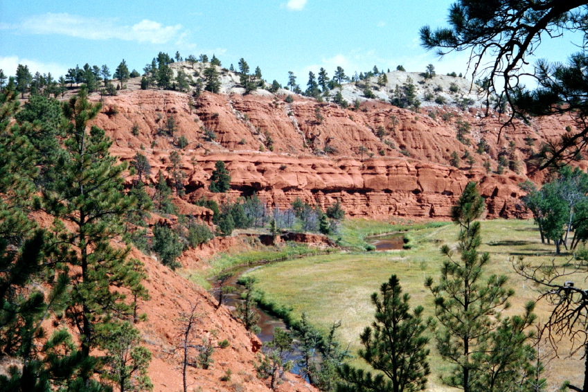

Course and physical characteristics
The river rises in the Black Hills region of northeastern Wyoming and generally flows northeast and east into South Dakota before joining the Cheyenne River. Its channel traverses canyons, prairie breaks and irrigated plains. Elevations along the river vary substantially; the point where the Belle Fourche crosses from Wyoming into South Dakota marks the lowest elevation in Wyoming at about 3,099 feet, a notable geographic statistic referenced as a state's lowest point (see low elevation).
History and name
The river's name comes from French—belle fourche—often translated as "beautiful fork" and likely applied by 19th-century French-speaking trappers and explorers who traveled the region. Long before Euro-American arrival the valley and river corridor were used seasonally by Indigenous peoples for hunting, fishing and travel. Later the Belle Fourche became a landmark for settlers, ranchers and irrigation projects that reshaped local land use.
Uses, ecology and management
The Belle Fourche supports riparian vegetation, wetlands and a variety of aquatic and bird life typical of mixed prairie and Black Hills transition zones. Water from the river is central to local agriculture: diversion and storage projects supply irrigation to farmland in the surrounding plains. The river and associated reservoirs are also managed for flood control, water supply and habitat conservation under federal and state programs.
Communities and recreation
Towns and rural communities near the river rely on it economically and recreationally. The city of Belle Fourche, South Dakota, takes its name from the river and serves as a regional center. Anglers, boaters and birdwatchers use stretches of the river and nearby reservoirs for sport and wildlife viewing; seasonal hunting also occurs in adjacent uplands.
Notable facts and context
- The Belle Fourche contributes to the Mississippi River system through the Cheyenne and Missouri River connections, illustrating how western streams feed continental drainage networks.
- Its crossing at the Wyoming–South Dakota border marks Wyoming's lowest elevation point, often cited in state geography summaries (state low point).
- Water development projects on the river, including irrigation infrastructure and reservoirs, have shaped settlement, land use and habitat patterns across the basin (watershed management).
For more detailed mapping, historical accounts and management plans consult regional resources and federal water agencies that maintain records on the river and its tributaries (Cheyenne River relations, Mississippi watershed context, Wyoming origins, South Dakota impacts).
Related articles
Author
AlegsaOnline.com Belle Fourche River — tributary of the Cheyenne River in Wyoming and South Dakota Leandro Alegsa
URL: https://en.alegsaonline.com/art/10292
Sources
- erg.usgs.gov : "Elevations and Distances" · web.archive.org