Wyoming: Geography, History, Economy, and Culture
An encyclopedic overview of Wyoming covering its landscape, history, people, economy, major attractions such as Yellowstone and the Tetons, and notable demographic and political features.
Wyoming is a sparsely populated state in the mountain West of the United States. Much of its terrain lies within the Rocky Mountains, and the state combines high plains, rugged ranges, and wide basins. Wyoming occupies roughly 97,914 square miles and is the ninth-largest state by area, while its population is small enough to make it the least populous state in the nation. The capital and largest city is Cheyenne, which serves as the political and cultural center for a state whose economy and identity are closely tied to wide-open landscapes.
Image gallery
10 Images


Geography and natural features
The state includes major mountain ranges, river valleys, and high desert. Notable mountain areas include the Teton Mountains in the northwest and many ranges associated with the Rockies. Wyoming is home to extensive public lands, national forests, and two of the best-known American national parks. Yellowstone National Park, mostly in Wyoming, protects geothermal features and wildlife; Grand Teton National Park preserves the dramatic skyline of the Tetons. Rivers such as the North Platte and Bighorn cut through plains and canyons, while elevation and continental location produce broadly continental climates: cold winters, warm summers, and large local variation.
Bordering states and location
Wyoming is landlocked and shares long borders with neighboring states. From the north clockwise it borders Montana, South Dakota, Nebraska, Utah, Idaho, and Colorado. These connections shape regional travel, commerce, and ecosystems, linking Wyoming’s mountains and basins to the surrounding Interior West.
History and peoples
Human presence in the region dates back thousands of years, beginning with Paleo-Indian groups and later a variety of Native American tribes such as the Cheyenne, Arapaho, Crow, Ute, and Shoshone. Euro-American exploration increased in the 18th and 19th centuries with fur traders, military expeditions, and settlers crossing the area. The territory that became Wyoming played a major role in westward migration and was the first U.S. territory to grant women the right to vote; it later entered statehood in 1890. The arrival of railroads, ranching, and mining industries greatly influenced settlement patterns.
Economy, resources, and culture
Wyoming’s economy is shaped by natural resources, agriculture, and tourism. Energy production—especially coal, natural gas, and oil—has been a significant source of jobs and revenue; coal production in particular has long been part of the state’s industrial profile. Ranching and livestock remain important in rural areas, while tourism linked to parks, ski areas, and outdoor recreation draws millions annually. The state’s cultural image often emphasizes cowboy heritage, wide-open country, and western recreational traditions.
Government, demographics, and notable facts
With a small population spread over a large area, Wyoming has low population density and a political structure typical of U.S. states. The state capital, Cheyenne, is the seat of government and the largest urban center. Despite modest population figures, Wyoming has national prominence through landmarks like Yellowstone and the Tetons, and through historical firsts such as early women's suffrage. Energy resources such as coal and other minerals influence both local economies and broader policy discussions about land use and conservation.
- Major attractions: Yellowstone National Park, Grand Teton, scenic drives and wilderness areas.
- Principal cities: Cheyenne, other small urban centers and county seats.
- Key industries: energy (including coal), tourism, ranching, and services.
- Regional links: Part of the Interior and Mountain West of the United States; neighboring states include Montana, South Dakota, Nebraska, Utah, Idaho, and Colorado.
For further reading on geography, history, and travel planning consult official resources and park authorities, or specific state and regional guides that provide current visitor information and data on economic trends. Primary-source materials and archaeological studies provide deeper perspectives on the state’s ancient inhabitants and territorial development.
State overview • Mountain ranges • Idaho border • Utah border
Climate
Wyoming has a semi-arid continental climate that can boast all sorts of extremes. It is shaped by several geographical factors that are reflected in the climatic conditions in different ways.
Overview
The state's location in the heart of the North American continent, far from any major bodies of water that could have a balancing effect on the climate, makes for a strictly continental climate characterized by hot summers, cold winters and low precipitation. The relatively high altitude of large parts of the country (there are hardly any areas that are below 1000 m above sea level), coupled with southern exposure (roughly between the 41st and 45th parallel, which in Europe corresponds roughly to the altitude of central Italy, southern France and northern Spain) and dry air, makes for strong temperature fluctuations between day and night. In addition, the Rocky Mountains have a decisive effect: On the one hand, they constitute a veritable barrier, shielding humid and rainy air masses from the Pacific, thus providing semi-arid conditions in their rain shadow. On the other hand, their folding up in a north-south direction allows a more or less unhindered exchange of air masses parallel to it. This means that sudden bursts of polar cold air can occur throughout the year. Thirdly, the mountains also allow the exact opposite effect: warm downdrafts - known as Chinook (comparable to the Alpenföhn) - can provide unusually mild temperatures, especially in winter. Finally, the location near the jet stream, as well as wide, hilly prairie landscapes and plateaus, make for fairly windy conditions.
Detail
In detail, two local climate types can be identified: On the one hand, the vast prairies, plateaus, and basins of central, eastern, and southwestern Wyoming exhibit a continental steppe climate - such as the Powder River Basin, Bighorn Basin, Great Divide Basin, and Green River Basin, which, with the largest towns (Casper, Cheyenne, Gillette, Green River, Rawlins, Rock Springs, and Sheridan), also contain a majority of the population. On the other hand, the mountain ranges and high valleys above 1900 m have a mountain climate - this applies, for example, to the Absaroka Range, the Bighorn Mountains, Laramie Mountains, Wind River Range and Wyoming Range, which run in a north-south direction through the state and have several peaks above 4000 m; the entire world-famous Yellowstone National Park, which is consistently above 2000 m, and the adjoining area of Jackson Hole to the south, which is famous for its winter sports facilities, also fall into this climate range.
Steppe climate
The steppe climate of the prairies is characterized by distinctly cold but very dry winters. The months of December, January and February are the driest of the year; nighttime temperatures drop to -13 to -8 °C on average, while daytime highs are usually around freezing or in the soft plus range (typically -1 to +4 °C), despite freezing mornings. Cold waves, which can arrive unimpeded from the north, occasionally cause significant temperature drops and severe frost: then it can cool down to below -30 °C at night, and often temperatures do not rise above -15 °C during the day either. Blizzards can also usher in sudden, heavy snowfalls that can paralyze public life. On the other hand, when the warm fall Chinook winds blow through the basins and plains, it can be a good +15 °C (even at night); on peak days, up to +20 °C is possible.
In spring and early summer, humidity rises with the temperatures. Precipitation can fall on up to ten days a month (resulting in between 30 and 65 mm of precipitation, which is rarely achieved in much of central Europe even in the driest months!). In summer, the rain often falls in the form of violent thunderstorms, which unload over the heated prairies, often bringing devastating hail, storms or lightning. By midsummer, it becomes drier again, and temperatures rise to an average maximum of 27 to 33 °C during the day. At night, however, altitude, drought and high-pressure zones cause most areas to cool considerably (9-14 °C); except in July and August, morning frosts can occur anywhere. On the other hand, heat waves of more than 35 °C are not uncommon, and in many places more than 40 °C have already been recorded; this is often accompanied by dry periods during which there can be no rainfall at all for weeks. In autumn there is again a slight increase in humidity, before very dry conditions prevail again with the frost in winter.
Some valleys in the rain shadow of the Rockies receive so little precipitation that they can be described as semi-deserts, such as the Bighorn Basin, which receives only 130-200 mm of precipitation per year.
Mountain climate
In the mountains, it is generally cooler and wetter. In the mountain ranges and high valleys, especially in the mountainous and high-altitude northwest of the state (with Yellowstone and Jackson Hole), permafrost prevails from early December to late February (e.g. Jackson: night -18, day -4 °C; down to below -40 °C possible). There, in contrast to the plains, precipitation peaks in the winter half of the year, falling heavily and mostly in the form of snow. This benefits snow-sure ski resorts in Jackson Hole and surrounding areas, which receive up to 8 m of snow per year. This is due to a frequent cloud jam caused by the westerly wind drift, which shovels moist air masses from the Pacific towards the Rocky Mountains, where they unload their wet cargo.
Until late May, winter and spring fight in the mountain regions, chasing each other rain showers, sun and snow storms. Only in midsummer does drier and warmer weather prevail.
In principle, however, it can snow at altitudes above 2000 m at any time of year, even in July. The summers are generally very different: sometimes the mountain valleys are constantly hit by violent thunderstorms, including hail, storms, lightning and heavy rain, then again it is very dry and sunny; in some years the summer is very cool (in the town of Jackson there are summers in which never more than 25 ° C were measured), in others almost hot (in Jackson, for example, up to 36 ° C were measured). Morning frosts occur practically every summer.
Weather extremes
The strongly continental character of Wyoming's climate, coupled with local conditions, leads to frequent weather extremes. In the winter months, these are primarily blizzards that sweep in from the north and can paralyze public life with freezing rain and heavy snowfall. Except in midsummer, there is always a danger of blizzards. The blizzards are countered by the extremes of summer: weeks of blazing heat and no precipitation regularly take their toll on agriculture, as do the violent (hail) thunderstorms that fall in large numbers. The southeast of the state is also in the catchment area of tornadoes, which are significantly less frequent and destructive than in the prairies further south, but nevertheless sweep across the country again and again. One weather phenomenon that occurs regardless of season is notable temperature drops. While daytime and nighttime fluctuations can already be considerable (up to 30 °C), changes in air masses or other wind phenomena (blizzards, chinook) repeatedly cause temperatures to rise or fall enormously within a few hours. Temperature fluctuations of up to 40 °C within 24 hours have already been observed.
The lowest temperature ever recorded in Wyoming is -54.4 °C (= -66 °F). This record comes from two places, Riverside (2177 m) in the south of the state and Moran (2057 m) in the northwest near Yellowstone Park, the coldest permanently inhabited place in Wyoming, and was measured on February 9, 1933. Similar low readings have only been recorded in the Yellowstone area since then (-54 °C). The highest temperature was recorded in the town of Basin in the north-central semi-desert Bighorn Basin, generally known as hot and dry: it was 46.7 °C (= 116 °F) on August 8, 1983.

Population
| Population development | |||
| Census | Inhabitants | ± in % | |
| 1870 | 9,118 | - — | |
| 1880 | 20,789 | 128 % | |
| 1890 | 62,555 | 200,9 % | |
| 1900 | 92,531 | 47,9 % | |
| 1910 | 145,965 | 57,7 % | |
| 1920 | 194,402 | 33,2 % | |
| 1930 | 225,565 | 16 % | |
| 1940 | 250,742 | 11,2 % | |
| 1950 | 290,529 | 15,9 % | |
| 1960 | 330,066 | 13,6 % | |
| 1970 | 332,416 | 0,7 % | |
| 1980 | 469,557 | 41,3 % | |
| 1990 | 453,588 | −3,4 % | |
| 2000 | 493,782 | 8,9 % | |
| 2010 | 563,626 | 14,1 % | |
| Estimate 2017 | 579,315 | 2,8 % | |
| Before 1900 1900–1990 2000 | |||
Wyoming has been the least populous state in the U.S. since 1985; previously it was Alaska. In 2005, Wyoming's population was estimated at 509,294. This would have increased the number by 3,407 people in one year, a population increase of 0.7 percent. Since the 2000 census, the population has increased by 12,165 due to a higher birth rate than death rate and by 4,035 due to a higher in-migration than out-migration. In 2004, the proportion of foreigners was 11,000 persons (2.2 per cent).
In 2000, 88.9 percent of the population was white, 6.4 percent Hispanic, 2.3 percent American Indian, 0.8 percent African American, 0.6 percent Asian, and 2.5 percent other. 1.8 percent belonged to more than one so-called "race." Over a quarter of the population (25.9 percent) had German ancestry, 15.9 percent English, 13.3 percent Irish, 6.5 percent American, and 4.3 percent Norwegian.
The area was already very sparsely populated before the white immigrants, mainly due to unfavorable geographical and climatic factors. The approximately 12,000 Native Americans currently living in Wyoming belong primarily to the two tribes of Cheyenne and Arapaho. Almost the entire native population lives on the state's only reservation in west-central Wyoming, the Wind River Indian Reservation, which ranks as the seventh largest reservation in the U.S. by area at 9148 km².
Religions
In Wyoming, 71% of residents reported being Christian in a 2014 Pew Research Center survey. Christians are divided among Protestants (43%, including 27% Evangelicals and 16% mainline Protestants), Catholics (14%), Church of Jesus Christ of Latter-day Saints/Mormons (9%), Jehovah's Witnesses (3%), and smaller churches. Non-Christian denominations together account for 3%, with only Buddhism above 1%. 26% said they had no faith, of which 3% each described themselves as atheists and agnostics. 20 % did not assign themselves to any definition at all.
Education
Wyoming has a total of eight colleges: Casper College, Central Wyoming College, Eastern Wyoming College, Laramie County Community College, Northwest College, Sheridan College, Western Wyoming Community College, Wyoming Technical Institute.
The University of Wyoming at Laramie is the only university in the state.
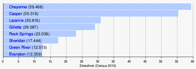
Largest cities
With Cheyenne and Laramie, two of the largest cities belong to the Front Range or Front Range Urban Corridor. This settlement band below the easternmost mountain range of the Rocky Mountains has its center with Denver and Colorado Springs in the state of Colorado, but reaches as far north as Cheyenne.
The small town of Cody is located about 40 km east of Yellowstone National Park. It is home to a Buffalo Bill Museum, dedicated to the memory of William Frederick 'Buffalo Bill' Cody (1846-1917). Buffalo Bill was a co-founder of the town of Cody in the late 19th century.
See also: List of cities in Wyoming

Related articles
Author
AlegsaOnline.com Wyoming: Geography, History, Economy, and Culture Leandro Alegsa
URL: https://en.alegsaonline.com/art/109392
Sources
- commons.wikimedia.org : Wyoming
- census.gov : "Wyoming: Population estimates"
- kff.org : "Median Annual Household Income"