Staten Island: Overview, Geography, History and Transportation
Staten Island is one of New York City's five boroughs, known for its suburban character, parks, historic sites and the free Staten Island Ferry linking it to Manhattan.
Overview
Staten Island is one of the five boroughs of New York City and shares its boundaries with Richmond County (Richmond County). With a population of fewer than half a million people, it is the least populous of the city’s boroughs and has a more suburban feel than most other parts of New York. The borough includes residential neighborhoods, protected green spaces and several historic districts.
Image gallery
10 Images


Geography and transport
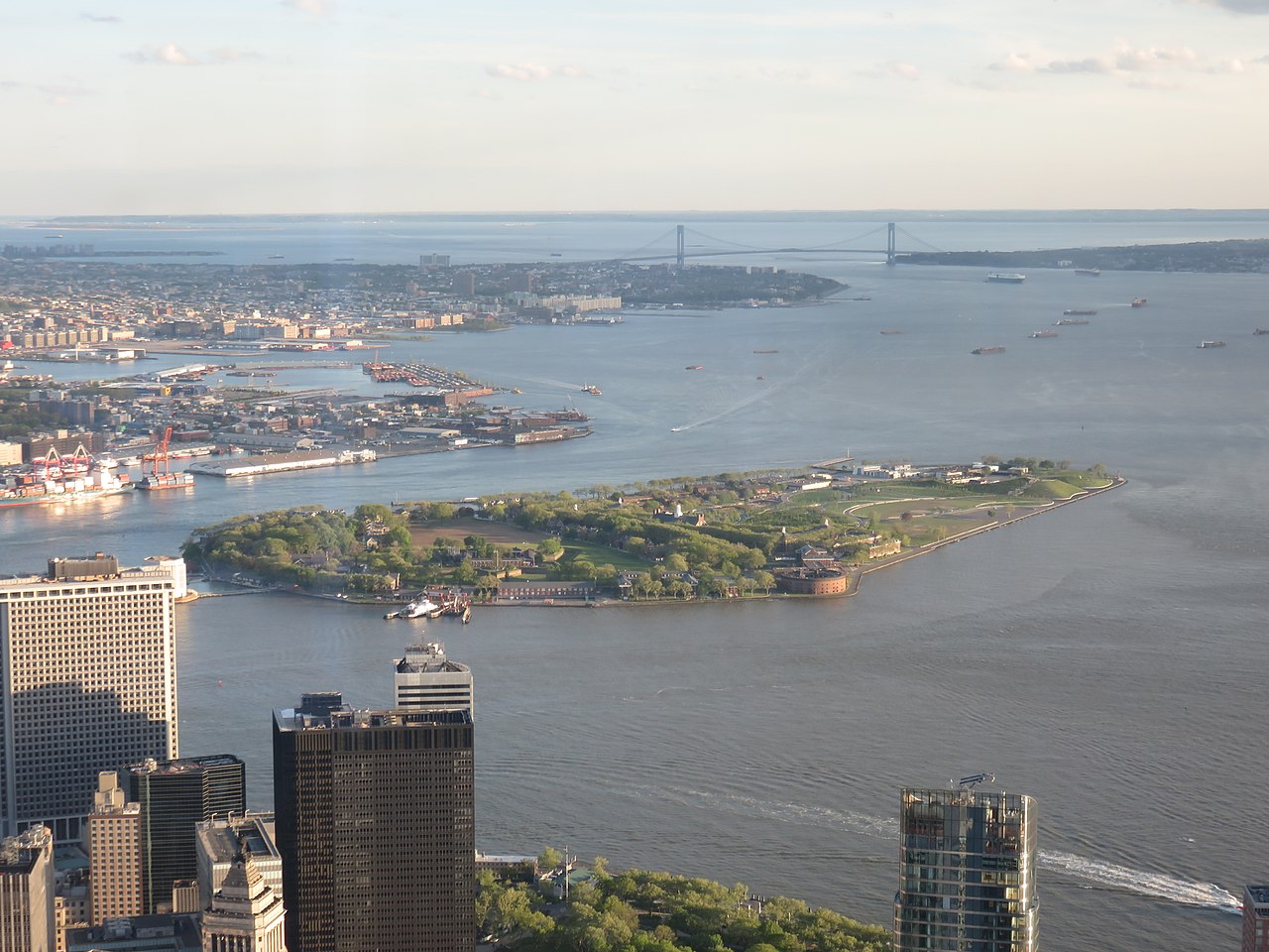
The island sits at the southern edge of the city, separated from New Jersey by the Kill Van Kull and the Arthur Kill. Road connections to New Jersey include three major crossings: the Bayonne Bridge, the Goethals Bridge and the Outerbridge Crossing; each is a principal route to and from the island. The Verrazzano-Narrows Bridge (to Brooklyn) links Staten Island to Brooklyn and the rest of Long Island.
- Ferry: The free Staten Island Ferry operates between Saint George and Manhattan and is a hallmark of local transit. The service has carried around 21 million passengers per year in busy periods and remains one of the most heavily used commuter ferry routes in the United States. Staten Island Ferry crossings traverse New York Harbor and land at terminals near Manhattan and Saint George.
- Rail: The Staten Island Railway runs along the island’s eastern and southern shorelines, terminating at the Saint George terminal where the ferry docks.
- Roads and buses: Local and express bus routes connect neighborhoods to the ferry and bridges; arterial highways provide freight and passenger links to New Jersey and the rest of the region.
History
The island was part of the Dutch colony of New Netherland until the English took control in the 17th century during the events known broadly as the Second Anglo-Dutch War. After that transition it was incorporated into the English-controlled province of New York. Over subsequent centuries Staten Island developed a mix of farming, military sites and small towns before gradually becoming more suburban after the construction of major bridges and improved transit links.
Culture, parks and notable places
Staten Island retains a large amount of open space compared with other New York boroughs. It has numerous parks, historic homes and museums, and several waterfront and bayfront areas popular with residents. Examples of notable sites include long-established neighborhoods around Saint George and historic Richmond Town, as well as coastal parks and former military installations that have been repurposed for public use.
Importance and distinctions
Although sometimes described as quiet or suburban relative to the rest of the city, Staten Island plays an important role in the metropolitan region: it is a residential base for thousands of commuters, a node for regional freight and vehicle traffic across its bridges, and the location of one of the nation’s busiest commuter ferry services. Transit, coastal geography and its borough-county status (borough and county) make Staten Island distinct within New York City governance and infrastructure.
For more detail on local government, transportation schedules and historic sites, consult municipal resources and transit providers: New Jersey connections, Brooklyn links, and historical references for the early colonial period and ferry operations (ridership figures, colonial history, 17th-century conflicts).
Related articles
Author
AlegsaOnline.com Staten Island: Overview, Geography, History and Transportation Leandro Alegsa
URL: https://en.alegsaonline.com/art/93532
Sources
- siferry.com : "Staten Island Ferry"