
Mount Tongariro
Active volcanic massif in New Zealand's central North Island, noted for its multiple volcanic cones, crater lakes, Māori cultural significance and the popular Tongariro Alpine Crossing day hike.
Overview
Mount Tongariro is a volcanic massif in the central North Island of New Zealand. The highest parts of the complex reach about 1,978 m in elevation. The summit zone is rugged and contains roughly a dozen volcanic cones and craters formed by repeated eruptions and subsequent erosion. The mountain lies at the heart of Tongariro National Park, a protected landscape valued for its distinctive geology and cultural importance; for maps and visitor information consult location resources.
Image gallery
4 Images


Geology and volcanic activity
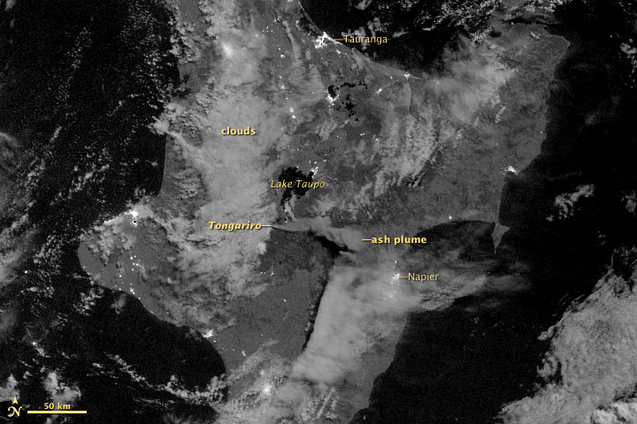
Tongariro is part of the Taupo Volcanic Zone, a region of active volcanism in the North Island. It is a complex of andesitic cones and vents rather than a single simple cone. The area includes several crater lakes, notably the Emerald Lakes and the Blue Lake. Tongariro has erupted repeatedly during the Holocene, with both small steam-and-ash explosions and larger explosive events recorded in modern times. Short-lived eruptions occurred in 2012 and 2016; because even brief eruptions can produce ash, gas and ballistic fragments the volcano is continuously monitored—see current advisories at volcanic activity reports.
Cultural significance and history
The mountain and surrounding lands have long importance in Māori tradition and identity. The area that became Tongariro National Park was protected in the late 19th century when local Māori gifted land to preserve its spiritual and environmental values, an action often associated with Ngāti Tūwharetoa leadership. The park is recognized for its combined natural and cultural heritage and is managed with attention to both conservation and Māori values.
Recreation, safety and access
Tongariro is best known to many visitors for the Tongariro Alpine Crossing, a one-day trek that traverses volcanic terrain, colorful crater lakes and dramatic crater rims. The crossing is frequently listed among New Zealand's most popular day hikes. Weather can change rapidly and volcanic hazards are possible, so walkers are advised to be well prepared and to check volcanic alerts and local advice before setting out; monitoring information and alerts are available through official channels such as volcanic activity reports and local visitor services.
Notable facts
- The Tongariro massif is geologically linked to nearby volcanic centres such as Mount Ngauruhoe and Mount Ruapehu.
- It contains multiple named vents, craters and lakes that illustrate a range of volcanic processes.
- Combines scientific interest with strong cultural associations, attracting geologists, hikers and those interested in Māori heritage.
Visitors and researchers alike are reminded to respect both natural hazards and the cultural significance of the landscape when exploring the Tongariro area.
Related articles
Author
AlegsaOnline.com Mount Tongariro Leandro Alegsa
URL: https://en.alegsaonline.com/art/67104