Mount Aragats — Armenia’s highest peak and volcanic massif
Mount Aragats is an extinct stratovolcano and Armenia’s highest mountain, a four-peaked massif above Aragatsotn. It combines alpine terrain, historic sites, observatories and popular hiking routes.
Overview
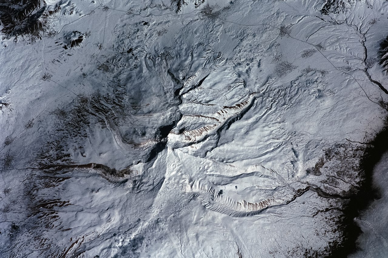
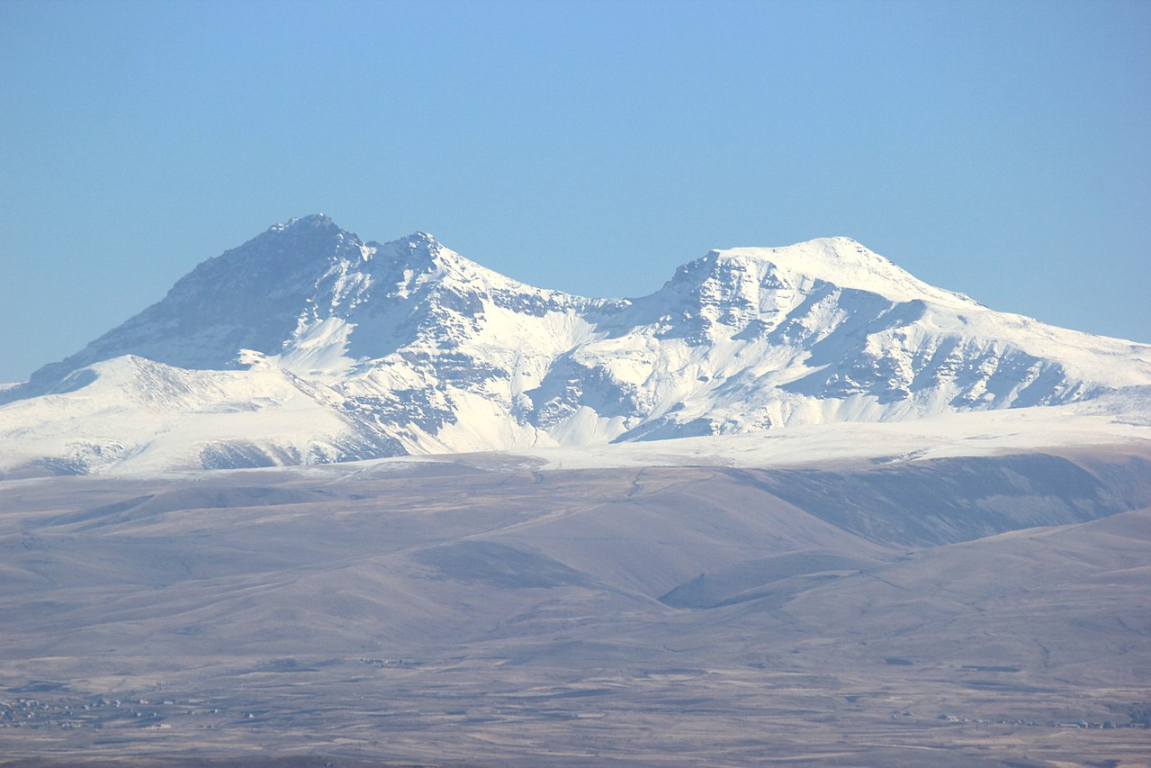
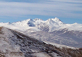
Mount Aragats (Armenian: Արագած) is the highest mountain in Armenia. This broad, largely isolated volcanic massif rises above the surrounding plain in the Aragatsotn province and is visible from much of western and central Armenia. The summit area is notable for a rim with four principal high points; the northern summit is the tallest. Aragats is a cultural and geographic landmark, long important to nearby communities and a favored destination for hikers and climbers.
Image gallery
10 Images


Geography and geology
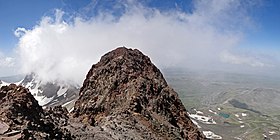
Aragats is an extinct stratovolcano built by repeated lava flows and pyroclastic deposits. Its summit forms a wide crater-like area with distinct northern, eastern, southern and western summits. The highest point reaches about 4,090 metres above sea level, giving the massif alpine character: seasonal snowfields cover its upper slopes and lingering snow may persist into summer. The edifice shows signs of long-term erosion and past volcanic activity that shaped the surrounding topography.
Climate, flora and fauna
The mountain has an alpine climate near the summits with colder temperatures and stronger winds than the surrounding lowlands. Vegetation changes with elevation: lower slopes support steppe and shrubland, mid-elevations host grasslands and summer pastures, and the highest belts are characterized by sparse alpine meadows and hardy plants adapted to short growing seasons. Wildlife includes species typical of highlands in the southern Caucasus, and birdlife is rich along ridges and cliffs.
History, culture and science
Human use of Aragats dates back centuries. Fortresses, medieval churches and monasteries cling to its flanks, and the area has long been used for seasonal grazing. Notable historic sites and villages provide cultural context for visits. In the 20th century the mountain also became important for scientific work: observatories and research stations lie on or near its slopes, taking advantage of elevation and clear skies for astronomy and cosmic-ray research.
Recreation and access
Aragats is popular with day-hikers, trekkers and mountaineers. Routes vary from moderate walks on lower ridges to demanding ascents of the northern summit. Summer offers the most accessible conditions, while winter climbs require mountaineering experience and equipment because of snow and rapidly changing weather. Trailheads are reached from nearby villages and roads that connect the massif to regional centers; local guides and established base camps support organized trips.
Conservation and visitor guidance
- Visitors should respect grazing areas and cultural sites and follow local regulations intended to protect mountain ecosystems.
- Preparation for high-altitude conditions, appropriate clothing and awareness of weather are essential for safe travel.
- The mountain remains both a practical resource for nearby communities and an emblem of Armenian natural heritage.
For those planning visits, regional visitor centers and local guides can provide up-to-date information on trails, access and safety. Aragats continues to draw interest for its geological significance, scenic vistas and combination of nature and history.
Images
· 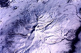
Aerial view with the four peaks
· 
· 
Questions and answers
Q: What is Mount Aragats?
A: Mount Aragats is the highest point in Armenia and is a standalone extinct stratovolcano.
Q: Where is Mount Aragats located?
A: Mount Aragats is located in the province of Aragatsotn, northwest from Yerevan.
Q: How many peaks are there on Mount Aragats?
A: There are four main peaks forming the rim of the crater on Mount Aragats.
Q: What is the main activity for locals on Mount Aragats?
A: Local alpinists find Mount Aragats to be a popular destination.
Q: Is Mount Aragats an active volcano?
A: No, Mount Aragats is an extinct stratovolcano, meaning it is no longer active.
Q: What is the significance of Mount Aragats in Armenia?
A: Mount Aragats is the highest point in Armenia and is a significant national landmark.
Q: Can tourists visit Mount Aragats?
A: Yes, tourists can visit Mount Aragats and are encouraged to participate in outdoor activities such as hiking and mountaineering.
Related articles
Author
AlegsaOnline.com Mount Aragats — Armenia’s highest peak and volcanic massif Leandro Alegsa
URL: https://en.alegsaonline.com/art/66994