Mount Ashitaka: volcanic complex southeast of Mount Fuji
Mount Ashitaka is a volcanic complex in Shizuoka Prefecture, Japan, notable for its eroded peaks including Mount Echizen-dake (1504 m) and Ashitaka-yama (1188 m) and for views toward Mount Fuji.
Overview
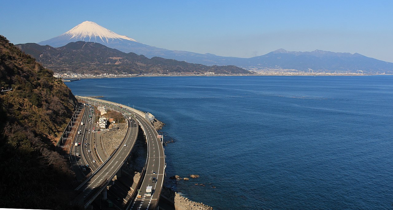
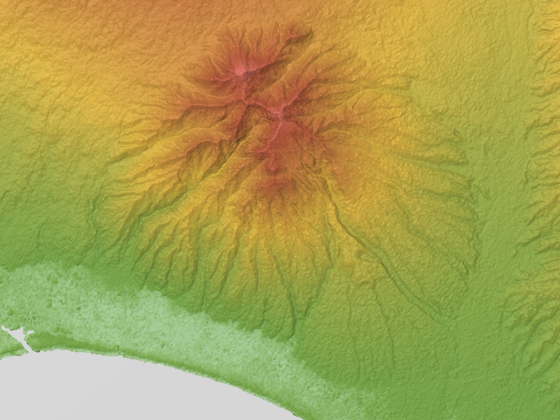
Mount Ashitaka (愛鷹山, Ashitakayama) is a volcanic mountain complex located to the southeast of Mount Fuji in central Japan. It rises above the coastal plain of Shizuoka Prefecture and forms a distinct group of eroded summits and ridges. The complex is commonly described as a volcanic massif rather than a single cone, reflecting multiple vents and flows that built the present landscape.
Image gallery
10 Images


Geology and characteristics
Ashitaka is classified as a volcanic complex with the typical features of an older, heavily eroded volcanic center: remnant domes, ridgelines, and valleys carved by weathering and streams. Rock types include andesitic to dacitic lavas and pyroclastic deposits that record repeated eruptive episodes in the geologic past. The structure shows radial drainage and steep slopes in places where lava flowed and cooled against older terrain.
Principal peaks
- Mount Echizen-dake — the highest summit in the complex at 1504 meters.
- Ashitaka-yama — the peak after which the range is commonly named, at 1188 meters.
History and development
The volcanic activity that built Mount Ashitaka occurred in the geologic past and produced a complex of overlapping eruptions and lava domes. Over time, erosion reduced the original relief and exposed internal volcanic structures. Because there has been no recorded historical activity in recent centuries, the complex is generally regarded as long dormant or extinct, though its volcanic origins remain apparent in the landscape.
Ecology, recreation and human importance
The slopes of Ashitaka support mixed montane forests and alpine plant communities at higher elevations, with seasonal changes that attract nature observers. The area is popular with hikers and day visitors who come for trails, ridge walks and panoramic views that include Mount Fuji and the Suruga Bay coast. Local conservation efforts and parks help protect the mountain's natural habitats and cultural sites.
Notable facts and distinctions
Mount Ashitaka is often mentioned in regional guides because its profile provides a complementary foreground to the iconic silhouette of Mount Fuji. It is also a useful example of a multi-peaked volcanic complex where the named summit (Ashitaka-yama) is not the highest point in the group. Hikers and geologists use the range to observe erosion of volcanic structures and to study how former eruptive centers evolve into rugged, forested landscapes.
For further geological context or hiking information consult regional resources and maps before visiting; local trail conditions and access can change seasonally.
Related articles
Author
AlegsaOnline.com Mount Ashitaka: volcanic complex southeast of Mount Fuji Leandro Alegsa
URL: https://en.alegsaonline.com/art/66998
Sources
- books.google.com : A Handbook for Travellers in Japan, p. 170
- tef.elte.hu : "Erosion calderas: origins, processes, structural and climatic control,"
- eri.u-tokyo.ac.jp : "Geology of Fuji Volcano"
- wwwsoc.nii.ac.jp : "Pyroclastic cone on southwestern flank of Ashikita Volcano,"
- shizuoka-guide.com : "Overview of Mt Fuji