M2 motorway (Great Britain)
A primary motorway in Kent, England, linking Strood and Faversham. It provides an alternate corridor to the M20 for traffic toward Dover and serves Medway towns, freight routes and commuter traffic.
Overview
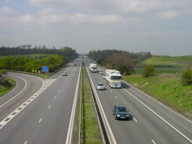
The M2 is a motorway in Kent, England, running between Strood and Faversham. It forms part of the strategic road network in southeast England and offers an alternative route for traffic heading for the Channel ports, notably providing another option alongside the M20 for journeys toward Dover. The motorway lies within England and serves both long-distance and local journeys.
Image gallery
4 Images


Route and characteristics
The M2 generally follows a corridor parallel to the older A2 trunk road, linking urban areas around the Medway towns with eastern parts of Kent. It typically carries two or more lanes per direction and connects with several major trunk roads and local routes. The motorway is used by a mix of passenger vehicles, commuter traffic and heavy goods vehicles transporting freight to and from the ports.
Major connections
- Urban approaches to the Medway towns and Strood (Strood)
- Links toward the Kent coast and crossings that serve Faversham (Faversham)
- Interchanges with routes that give access to the Channel ports, including options via the M20 and routes to Dover
History and development
The motorway was built in stages during the mid-20th century as part of a broader expansion of Britain's motorway network. Its alignment and junctions reflect attempts to balance long-distance traffic needs with local access to towns and industrial areas in north Kent. Over time the M2 has seen maintenance, improvements and targeted upgrades to cater for changing traffic volumes.
Uses and importance
The M2 is important for regional connectivity: it supports commuter travel into employment centres, carries freight bound for southeastern ports and provides resilience by offering an alternative to the more direct coast-bound routes. When incidents or congestion occur on parallel corridors such as the M20, the M2 often absorbs re-routed traffic to help keep cross-Channel movements flowing.
Notable facts and distinctions
The M2 runs through a landscape with historic transport corridors nearby—the modern motorway often parallels older roads shaped by centuries of travel. Its role is as much local as regional, linking smaller urban areas while forming part of longer-distance routes to the Channel. For maps, traffic updates and official guidance about closures or works, consult local transport authorities or published road information pages linked by regional agencies (Strood, Faversham, England).
Related articles
Author
AlegsaOnline.com M2 motorway (Great Britain) Leandro Alegsa
URL: https://en.alegsaonline.com/art/60214