
Koulikoro Region — administrative and geographic overview
Koulikoro Region is an administrative region in western Mali with its capital at Koulikoro. It spans the Niger River valley and reaches into Sahelian lands, supporting agriculture, transport and diverse communities.
The Koulikoro Region is an administrative region in western Mali whose regional capital is the town of Koulikoro. It covers an area of about 90,120 km2 and occupies a broad zone that includes part of the Niger River valley and drier lands to the north. The region serves as a transition between Sudanian woodland in the south and the more arid Sahel farther north.
Image gallery
2 Images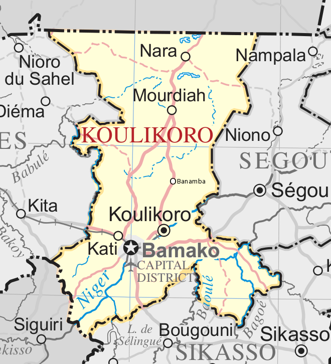

Geography and environment
Koulikoro's landscape includes floodplain and riverine habitats alongside undulating plains and seasonal scrub. The Niger River is the principal hydrological feature, providing irrigation, fishing and seasonal transport. Climate varies from humid or sub-humid in the southern portions to semi‑arid conditions in the north, with the length of the rainy season decreasing from south to north.
Administrative structure
The region is subdivided into several cercles (second‑level administrative districts). Major cercles include:
- Koulikoro (the regional capital)
- Kati
- Kolokani
- Dioïla
- Banamba
- Nara
These cercles contain towns and rural communes that administer local services and customary affairs.
Economy and transport
The regional economy is primarily agricultural. Farmers grow millet, sorghum, maize and rice (notably in irrigated river valleys), and cultivate cotton and groundnuts as cash crops in suitable zones. Livestock rearing and inland fishing along the Niger are important livelihoods. Koulikoro town functions as a river port and transport hub, and road links connect other towns to the national capital and neighbouring regions.
Settlements in Koulikoro reflect Mali's ethnic diversity, with Bambara and Malinké among the principal language groups alongside Fulani pastoral communities and others. The area's history includes use as trade and transport routes along the Niger, and it remains significant for local commerce, agriculture and access to river resources.
Notable facts include the region's role as a corridor between Bamako and northern Mali, its mixed ecological zones that support varied agricultural systems, and its combination of market towns and rural communes that shape social and economic life.
Related articles
Author
AlegsaOnline.com Koulikoro Region — administrative and geographic overview Leandro Alegsa
URL: https://en.alegsaonline.com/art/54368
Sources
- instat.gov.ml : Resultats Provisoires RGPH 2009 (Région de Koulikoro)