Hurricane Boris (1996)
A brief account of Hurricane Boris, an early-season eastern Pacific storm in 1996 that rapidly strengthened before making landfall in southern Mexico, producing heavy rains and deadly flooding.
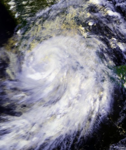
Hurricane Boris was an eastern North Pacific tropical cyclone in late June 1996 that caused deadly flooding after striking the southern coast of Mexico. The system is generally remembered for its swift intensification just prior to landfall and for the damage and loss of life associated with heavy rain. Contemporary summaries and storm reports provide basic details about its development and impacts (official report).
Image gallery
10 Images


Meteorological overview
Boris originated as a tropical depression on June 27, 1996. Within hours it strengthened into Tropical Storm Boris and then underwent relatively rapid intensification, reaching hurricane strength the next day. Observations indicate peak sustained winds near 85 mph (about 140 km/h) as the cyclone approached the Mexican coastline. The storm began to weaken quickly after making landfall and dissipated by July 1. The storm is listed as the fourth cyclone of the 1996 Pacific hurricane season (season summary).
Impacts and aftermath
Boris produced very heavy rainfall over parts of southern Mexico, which triggered flooding and localized landslides. Floodwaters affected communities, agriculture and infrastructure; emergency reports recorded multiple fatalities. At least ten deaths were attributed to the storm, and emergency response and recovery efforts followed in flood-affected areas (rain and flood assessment).
Key facts
- Formation: June 27, 1996 (tropical depression).
- Peak intensity: roughly 85 mph (140 km/h) sustained winds.
- Landfall: southern Mexico (coastal area) with rapid weakening after impact (landfall details).
- Reported fatalities: about ten people.
- Designation: fourth cyclone of the 1996 eastern Pacific season (cyclone listing).
Although not one of the largest or longest-lived Pacific hurricanes, Boris is notable for the short period between tropical storm formation and landfall and for the significant rainfall-related impacts it produced in a concentrated area. Post-storm assessments emphasized flood preparedness and the vulnerability of mountainous coastal regions to fast-moving tropical systems.
For further technical details, track maps and contemporaneous advisories, consult archived summaries and hurricane season reports (storm archive, season overview).
Questions and answers
Q: When did Hurricane Boris form?
A: Hurricane Boris formed on June 27, 1996.
Q: What was Hurricane Boris?
A: Hurricane Boris was a deadly storm and the fourth cyclone of the 1996 Pacific hurricane season.
Q: What happened after the depression became Tropical Storm Boris?
A: Shortly after the depression became Tropical Storm Boris, it rapidly became stronger and eventually turned into a hurricane just as an eye started to form.
Q: Where did Hurricane Boris make landfall?
A: Hurricane Boris made landfall in Mexico.
Q: What were the strongest winds of Hurricane Boris?
A: The strongest winds of Hurricane Boris were 85 mph (140 kn/h).
Q: When did Hurricane Boris end?
A: Hurricane Boris ended on July 1, 1996.
Q: What damage did Hurricane Boris cause?
A: Hurricane Boris caused heavy flooding in southern Mexico and resulted in ten reported deaths.
Related articles
Author
AlegsaOnline.com Hurricane Boris (1996) Leandro Alegsa
URL: https://en.alegsaonline.com/art/45841
Sources
- nhc.noaa.gov : "Hurricane Boris"
- nhc.noaa.gov : "Tropical Storm Warning issued for Mexico"
- hpc.ncep.noaa.gov : "Hurricane Boris"
- nl.newsbank.com : "Hurricane Boris Heads to Sea After Ravaging Mexico"
- nl.newsbank.com : "Hurricane Boris strikes Mexico"
- news.google.com : "Hurricane Boris kills 4, injures 70"
- commons.wikimedia.org : Commons