Chang'an District, Xi'an
Chang'an District is a southern district of Xi'an in Shaanxi, China. It covers about 1,588.5 km², had roughly 1.08 million residents in 2010, and was upgraded from a county to a district in 2002.
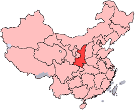
Chang'an District is an administrative district in the southern part of Xi'an, within Shaanxi province in China. Its official Chinese name is 长安区 and the pinyin transcription is Cháng'ān Qū. The district combines urban neighborhoods, suburban towns and rural areas and lies on the southern approaches to Xi'an's urban core.
Image gallery
3 Images

Geography and boundaries
Chang'an District occupies a large area of the municipal region. It measures roughly 55 kilometres (about 34 miles) from north to south and about 52 kilometres (about 32 miles) from east to west, amounting to approximately 1,588.53 square kilometres (about 613.33 sq mi). The terrain tends to rise toward the southeast, producing gentle elevation changes across the district. Neighboring administrative units mentioned in official descriptions include Yanta District and Xianyang Municipality to the north, with Lantian County to the east via Lantian County, and Huyi District to the west via Huyi District.
Population and administration
According to the national census data cited for November 2010, Chang'an District had a population of about 1,083,285. Administratively the area was formerly organized as Chang'an County and on 2 June 2002 it was re-designated as an urban district of Xi'an, a change consistent with the wider urban expansion and municipal governance adjustments in many Chinese cities during that period. The district government oversees a mix of subdistricts and towns that reflect its urbanizing yet still partly rural character.
Economy, institutions and land use
Land use across Chang'an District shows a mixture of agricultural plains, light and heavy industry zones, expanding residential developments and educational institutions. The district benefits from its proximity to Xi'an's city centre, which supports commuter links, local manufacturing, logistics and service industries. Several higher education and research institutions are located in or near the district, contributing students and staff to the local economy. Rural areas within the district continue to support crop cultivation and related agricultural activity.
History, culture and significance
The district's name echoes the ancient name for Xi'an—Chang'an—which was one of the historic capitals of imperial China. While modern Chang'an District is an administrative unit distinct from archaeological and historical sites elsewhere in the city, it participates in the broader cultural landscape of Xi'an, where historic monuments, museums and tourism are important. The administrative upgrade from county to district in 2002 marked Chang'an's closer integration with Xi'an's urban governance and planning efforts.
Notable facts and context
- Area: about 1,588.53 km² (613.33 sq mi).
- Population: roughly 1.08 million as of the 2010 census.
- Formerly Chang'an County; became a district on 2 June 2002.
- Mix of urban, suburban and rural landscapes; rising terrain toward the southeast.
Chang'an District today functions as a transition zone between Xi'an's dense urban core and the more mountainous and agricultural areas beyond, reflecting both the city's long history and rapid contemporary urban development. For further local administrative information consult municipal resources and official district publications.
Related articles
Author
AlegsaOnline.com Chang'an District, Xi'an Leandro Alegsa
URL: https://en.alegsaonline.com/art/18543