Bodrum, Turkey: Aegean resort town with ancient roots and maritime culture
Bodrum is a coastal district on Turkey's Aegean shore, known for beaches, boating, ancient Halicarnassus remains, a Mediterranean climate (Csa), and year-round cultural and tourist activity.
Overview
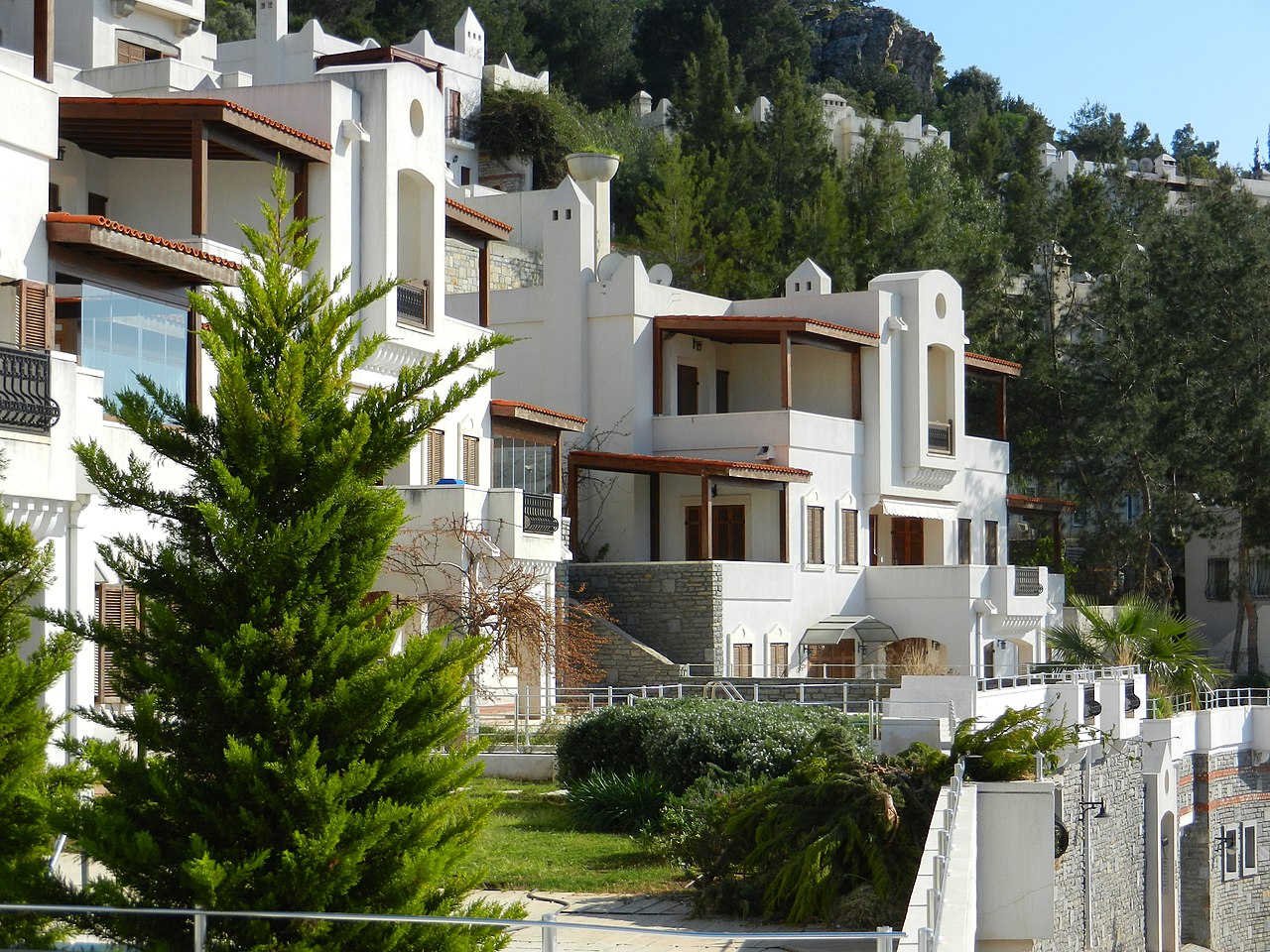
Bodrum is a well-known resort and port town on Turkey's Aegean coast. Located on a peninsula with numerous small bays and inlets, the modern district combines seaside leisure, a lively marina scene and a compact historic center. Its popularity stems from warm summers, clear water and a mix of cultural attractions that draw both domestic and international visitors.
Image gallery
10 Images


Geography and climate
The town lies in western Anatolia along the Aegean Sea and its coastal setting shapes local life and economy. Bodrum experiences a hot-summer Mediterranean climate (Csa in the Köppen classification), with long, dry, hot summers and mild, wetter winters typical of the region. The surrounding landscape includes rocky headlands, pine-covered hills and sheltered coves that are favored by sailors and swimmers.
History and heritage
Bodrum occupies the site of ancient Halicarnassus, a city with a long recorded past. Notable historic landmarks include the Castle of St. Peter, built by the Knights Hospitaller in the medieval period, and the site of the Mausoleum at Halicarnassus, once one of the Seven Wonders of the Ancient World. The town's layered archaeology, from classical remains to Ottoman-era buildings, makes it a focus for visitors interested in history and conservation.
Culture, tourism and activities
Tourism is the principal industry: sunbathing, swimming and yacht-based cruises—often called the "Blue Cruise"—are central attractions. Bodrum has become synonymous with private gulet sailing along the Aegean and Mediterranean coasts. The town also supports museums, galleries, music venues and festivals that extend the season beyond summer. Local markets, seafood restaurants and a compact old town provide a mix of leisure and everyday life.
Notable people and facts
- Antiquity: The historian Herodotus is traditionally associated with Halicarnassus, the ancient predecessor of Bodrum.
- Naval heritage: Famous Ottoman mariners such as Turgut Reis (often called Dragut) have links to the area and its maritime traditions.
- Cultural figures: Prominent Turkish artists and performers, including the beloved singer Zeki Müren, spent time in Bodrum and in some cases died there, contributing to its modern cultural memory.
Practical information and further reading
Visitors often consult official tourism resources or local guides to plan stays, sailing trips and archaeological visits. For official tourism information see local tourism resources. Geographic and climate details are available through regional overviews at Aegean region guides and climate classification references at climate sources. For historical background on Halicarnassus and figures like Herodotus, consult specialist historical materials at historical reference pages.
Geography
Geographical position
The city is located on the Aegean coast, facing away from the inland, in a theater-shaped bulge of land from the foothills of the Taurus Mountains. The coastal landscape near Bodrum is richly indented with islands, peninsulas, bays and capes. In about half an hour you can reach the Greek island of Kos by ship.
The county/municipality is situated on a peninsula bordering Milas to the north and east, otherwise Bodrum is surrounded by the waters of the Aegean Sea. It is the westernmost part of the province/Büyükşehir, has the largest population as well as the highest population density of the province, about three and a half times higher than the provincial value.
Admin
The district (or Kaza as a predecessor) already existed before the foundation of the Turkish Republic in 1923. 15,694 inhabitants (on an area of 690 km²) were counted in the 27 villages and the town of Bodouroum (at that time, spelling based on French; 4290 inhabitants) at the first census, on 28 October 1927.
(Until) the end of 2012, the county consisted of ten municipalities in addition to the county seat (Belediye: Bitez, Göltürkbükü, Gümüşlük, Gündoğan, Konacık, Mumcular, Ortakentyahşi, Turgutreis, Yalı and Yalıkavak) and 20 villages (Köy) in three bucaks (Karaova, Ortakent and Turgutreis), which were transferred to mahalle (districts/localities) during the 2013/2014 administrative reform. The twelve existing mahalle of the district town were retained, while the 26 mahalle of the ten above-mentioned belediye were united and reduced to one mahalle each. By downgrading these belediye and villages to mahalle, their number increased to 42. They are presided over by a muhtar as the chief official.
At the end of 2020, an average of 3,242. people lived in each mahalle, 12,078 inhabitants in the most populous one (Çırkan Mah. ).
Related articles
Author
AlegsaOnline.com Bodrum, Turkey: Aegean resort town with ancient roots and maritime culture Leandro Alegsa
URL: https://en.alegsaonline.com/art/12610