Population density: definition, measurement, factors, and uses
Population density measures how many people occupy a unit of land. This article explains how it is calculated, common types, factors that shape it, practical uses, and limitations with illustrative examples.
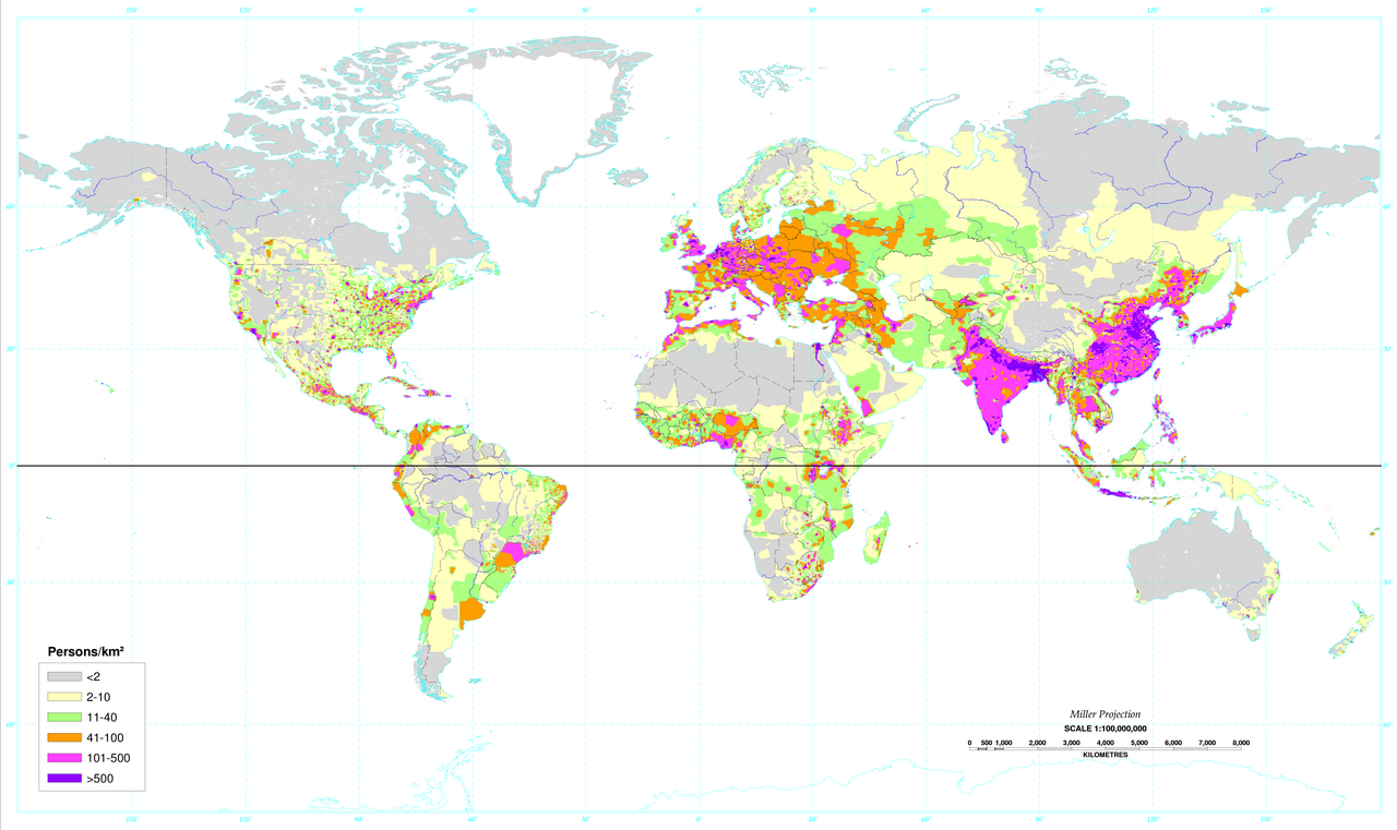
The term population density denotes the number of people living in a specific unit of area, and it is a basic indicator of how crowded a place is. In its simplest form it is calculated by dividing the total population by the total area of the territory, and is commonly expressed as persons per square kilometre or persons per square mile. This arithmetic density gives an overall average but does not show how people are distributed within the area.
Image gallery
10 Images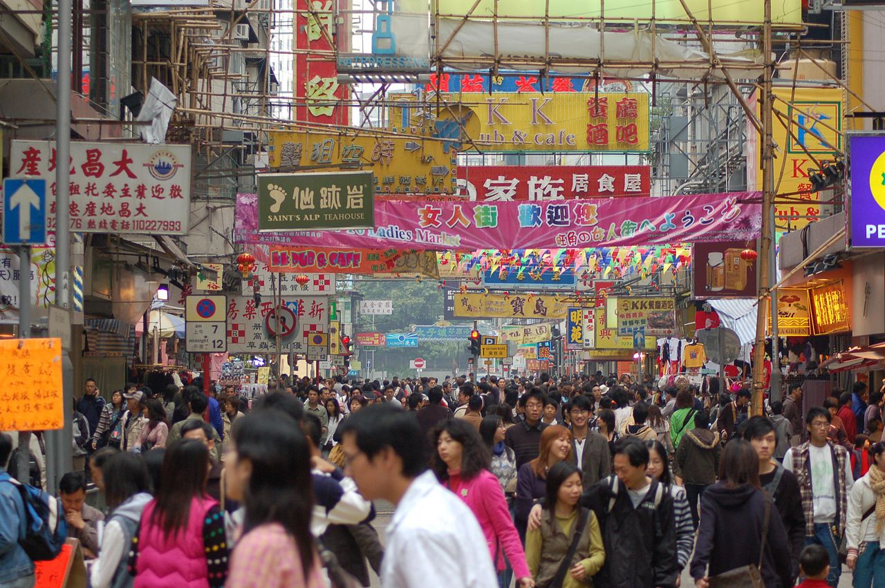


Calculation and simple examples
To calculate density, use the formula: population ÷ area. For example, the number often cited for France can illustrate the method: dividing the number of inhabitants by the land area produces the average number of people per square kilometre. At the other extreme, very large sparsely populated countries have far lower averages. A straightforward city example contrasts a dense urban centre with more empty rural land.
Common types and distinctions
Several measures related to population density are used in different fields. Arithmetic density is the simple average described above. Physiological density compares people to arable land to indicate pressure on productive areas. Residential or urban density measures people within inhabited parts of settlements and often differs markedly from national averages. Ecologists and planners also use densities of households, dwellings or built-up area to capture different aspects of human presence.
Factors that shape population density
Physical environment, history and economy interact to produce observed densities. Climate, soil and water availability limit where people settle: for instance, Greenland has an extremely low average because much of its surface is covered by an ice sheet and uninhabitable terrain such as glaciers (glacier). Rivers, coastlines and fertile plains historically attracted settlers, which is why many older towns and modern cities cluster near waterways. Transport networks, economic opportunities and political boundaries further concentrate or disperse populations.
Uses and practical importance
Population density is a practical tool for urban planning, infrastructure design, environmental assessment and public health. Planners use density figures to estimate demand for housing, schools and transit. Conservationists compare human density with habitat maps to assess pressure on ecosystems. Public agencies analyse density to plan emergency services and to model disease transmission risk in crowded settings.
- Urban planning and zoning decisions
- Estimating service provision and infrastructure needs
- Assessing environmental impact and land-use pressure
- Public-health planning and emergency response
Examples and limitations
Some well-known contrasts highlight the measure's usefulness and its limits. New York City registers very high local densities in many boroughs, while vast countries such as Canada average very low densities because large areas have few inhabitants. Tiny states like Monaco show among the highest national averages. However, averages mask internal differences: urban cores, suburbs and rural zones within the same administrative boundary can differ greatly. Temporal change matters too, as migration, development and policy shift densities over years. Users should pair density figures with maps and finer-grained statistics to understand where people actually live and how that affects resources and services.
Overall, population density is a simple but powerful descriptor when interpreted alongside other data. It helps compare regions, track trends, and inform decisions, provided its limitations and the variety of density measures are kept in mind. For further reading, consult demographic and planning resources that explain measurement choices and spatial analysis methods in detail (country-level data, area definitions).
Questions and answers
Q: What is population density?
A: Population density is the number of people living in a particular place divided by the area of that place.
Q: How is population density calculated?
A: Population density is calculated by dividing the population of an area by the total area of that place.
Q: What are some factors that affect population density?
A: Factors that affect population density include climate, availability of resources, and cultural and economic factors.
Q: Why do many cities develop near rivers?
A: Many cities develop near rivers because early settlers needed a source of water in order to survive and establish a society.
Q: What is the population density of France?
A: The population density of France is approximately 109.8 persons per square kilometre.
Q: What is the population density of Canada?
A: The population density of Canada is only 3.8 persons per square kilometre due to its large size.
Q: Which country has the highest population density in the world?
A: The country with the highest population density in the world is Monaco, with 16,620 persons per square kilometre.
Related articles
Author
AlegsaOnline.com Population density: definition, measurement, factors, and uses Leandro Alegsa
URL: https://en.alegsaonline.com/art/78128