
Van Diemen Gulf (Northern Australia)
A shallow tropical gulf between Arnhem Land, the Cobourg Peninsula and Melville Island; noted for large tides, rivers including the Adelaide, rich wetlands, fisheries and protected coastal reserves.
Overview
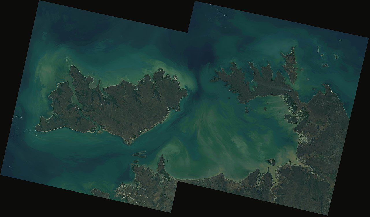
Van Diemen Gulf is a broad, shallow inlet on the northern coast of Australia covering about 14,000 km². It lies between Arnhem Land, the Cobourg Peninsula and Melville Island, forming an ecological and hydrological transition zone between the Timor Sea and the Arafura Sea. The gulf opens toward the west via Clarence Strait, near the city of Darwin, and toward the north by Dundas Strait between Melville Island and the Cobourg Peninsula. The surrounding coastal plains and waterways reflect a tropical monsoon climate with distinct wet and dry seasons.
Image gallery
5 Images


Geography and hydrology
The seabed of the gulf is generally shallow and includes extensive intertidal flats, broad mangrove forests and seagrass meadows. Several major rivers discharge into the gulf, delivering freshwater, sediments and nutrients that sustain estuarine and nearshore productivity. Principal rivers include the Adelaide River, the South Alligator River and the East Alligator River. Strong tidal currents through the connecting straits produce large tidal ranges and frequent changes in water levels across mudflats and channels, influencing navigation, sediment transport and coastal ecology.
Ecology and natural values
The combination of tidal mudflats, mangroves, saltmarsh and seagrass supports diverse communities of fish, crustaceans, molluscs and other invertebrates. These habitats form important nursery grounds for commercial and subsistence fisheries and provide feeding and roosting areas for migratory shorebirds. The region is also home to marine reptiles such as saltwater crocodiles and to populations of dugong in seagrass areas. Seasonal flooding during the wet season drives pulses of productivity and shapes breeding and migration patterns for many species.
History and naming
Indigenous peoples have lived along the coasts and islands bordering Van Diemen Gulf for thousands of years; communities from Arnhem Land and the Tiwi Islands maintain cultural connections to these waters and coastal resources. European mapping of the northern approaches was made by explorers in the 17th century: the Dutch navigator Abel Tasman charted the northern entrance to the gulf (Dundas Strait) in 1644. The name of the gulf commemorates Anthony van Diemen, a Dutch governor associated with early Dutch activity in the region.
Human use, conservation and notable sites
The gulf supports local fisheries, small-scale commercial fishing, recreational activities and tourism focused on wildlife and Indigenous cultural experiences. The Cobourg Peninsula and adjacent coastal waters include protected areas; notably the coastal and marine zones around the peninsula are conserved within Garig Gunak Barlu National Park to safeguard habitats, biodiversity and culturally significant places. Proximity to Darwin and the navigable straits gives the gulf importance for regional transport, access to offshore waters and logistical connections.
Distinguishing features and management issues
Van Diemen Gulf is distinguished by its large tidal ranges, extensive mangrove-fringed estuaries and its role as an ecological interface between the Timor and Arafura seas. Management concerns in the region include sustaining fisheries, protecting migratory bird habitats and cultural sites, and addressing the effects of altered sediment flows or coastal development. Conservation efforts typically combine scientific assessment with the involvement of traditional owners and local communities to balance use and protection.
For regional context and further reading on nearby places and topics see links for Arnhem Land, northern Australia, the Timor Sea, the city of Darwin, the Arafura Sea, the Adelaide River and historical accounts by Abel Tasman.
Related articles
Author
AlegsaOnline.com Van Diemen Gulf (Northern Australia) Leandro Alegsa
URL: https://en.alegsaonline.com/art/104143
Sources
- environment.gov.au : "Kakadu National Park - Explorers"
- nt.gov.au : "Garig Gunak Barlu National Park - Find a Park - Parks - Natural Resources, Environment and the Arts"