Arnhem Land: geography, culture, and history of Australia's northern region
Arnhem Land is a large, mainly Indigenous region in the north-east of the Northern Territory, Australia, known for rich Aboriginal cultures, seasonal landscapes, Kakadu overlap and distinctive biodiversity.
Overview
Arnhem Land occupies the north-eastern corner of the Northern Territory in Australia. It covers a very large area — roughly on the order of 97,000 km² — and lies about 500 km by road from the Territory capital, Darwin. The resident population of the region is small relative to its size and is predominantly Aboriginal: many communities maintain long-established languages, laws and cultural practices.
Image gallery
10 Images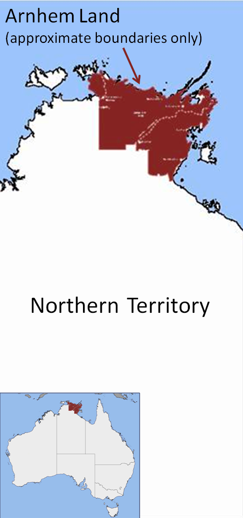


Landscape and environment
Arnhem Land is characterised by a tropical monsoon climate with distinct wet and dry seasons. The terrain ranges from sandy coastlines and islands to extensive savanna, Arnhem Plateau escarpments and seasonally flooded wetlands. Parts of the region interface with Kakadu National Park, and that park — itself a World Heritage site — lies partly within the broader Arnhem Land area Kakadu National Park. The combination of remoteness and large protected areas supports rich birdlife, freshwater and coastal ecosystems, and numerous endemic plants and animals.
People, culture and communities
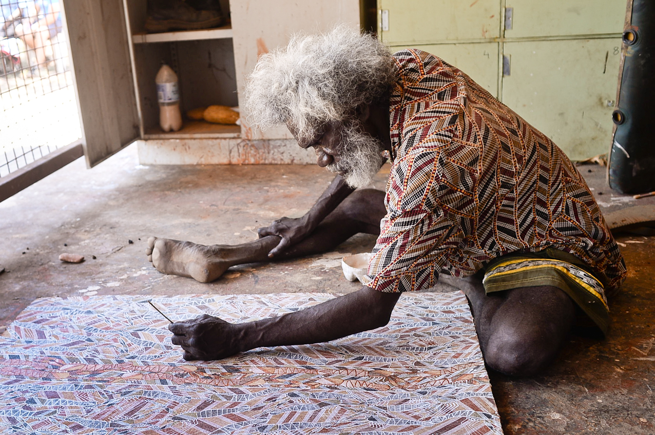
Arnhem Land is internationally recognised for its continuing Aboriginal cultures. Clans such as the Yolŋu and other language groups maintain customary ownership of much of the land under arrangements created after the 1970s. Traditional art forms, bark painting, rock art galleries and ceremonial practices remain central to community life. Major settlements include Nhulunbuy, Yirrkala, Maningrida, Galiwin'ku (Elcho Island), Gunbalanya (Oenpelli) and Ramingining, each serving as regional centres for services, art and local governance.
History and naming
Humans have occupied Arnhem Land for many thousands of years; archaeological and living cultural traditions attest to long continuities. European use of the name dates to the era of exploration: it was named by navigator Matthew Flinders in reference to a 17th‑century Dutch vessel, the ship Arnhem, which had been part of Dutch coastal visits and charting in the early 1600s. The arrival of Europeans led to later periods of mission activity, government administration and, in some parts, mining and pastoralism.
Economy, access and conservation
Local economies combine traditional livelihoods — hunting, fishing and art production — with employment in services, education, and some resource industries such as bauxite mining near the Gove Peninsula around Nhulunbuy. Tourism is important but regulated: much of Arnhem Land is Aboriginal land and visitors commonly require permits to enter; this helps communities manage cultural sites and sensitive environments. Conservation and cultural management occur together in many areas, balancing ecological protection with customary practice.
Notable facts and distinctions
- Significant cultural heritage: Arnhem Land contains extensive rock art and living Indigenous traditions that attract research and cultural interest.
- Part of a mosaic: it sits adjacent to and overlaps environmental reserves such as Kakadu.
- Name origins: the European name commemorates the Dutch voyages of the 1600s and was popularised by Matthew Flinders and other explorers; the Dutch connection is indicated by the original ship name Dutch.
- Regional context: Arnhem Land is one of five administrative regions in the Northern Territory and lies within broader national frameworks of land rights and conservation.
Questions and answers
Q: What is the Arnhem Land Region?
A: The Arnhem Land Region is one of the five regions of the Northern Territory of Australia.
Q: Where is the Arnhem Land Region located?
A: It is in the north east corner of the territory and is about 500km from the territory capital Darwin.
Q: How big is the Arnhem Land Region?
A: It has an area of 97,000 km².
Q: What does the Arnhem Land Region include?
A: This area includes Kakadu National Park.
Q: How many people live in Arnhem Land?
A: About 16,230 people live in Arnhem Land.
Q: How was Arnhem Land named?
A: It was named by Matthew Flinders after the Dutch ship Arnhem, which explored the coast in 1623.
Q: Who explored the coast where Arnhem Land is located?
A: The Dutch ship Arnhem explored the coast in 1623.
Tags
Related articles
Author
AlegsaOnline.com Arnhem Land: geography, culture, and history of Australia's northern region Leandro Alegsa
URL: https://en.alegsaonline.com/art/5778
Sources
- ausstats.abs.gov.au : "Australian Demographic Statistics"